|
The number of interactive mapping sites continually grows. Each issue of ArcNews features but a few of the many new Internet locations powered by Esri software. Send to www.esri.com/imsregistry a description of your mapping site and the URL. Visit www.esri.com/imssites for links to these and other Web sites powered by Esri technology.
Afghanistan Interactive GIS and Satellite Image Visualization Service
www.telemorphic.com/afghan.htm
Esri's ArcIMS and Business Partner Telemorphic's Maplicity power this image map service of Afghanistan. Maplicity is a lightweight Java applet that works with ArcIMS to provide a feature rich user interface for geospatial analysis via the Internet. Available data includes National Aeronautics and Space Administration (NASA) Landsat TM satellite imagery; National Imagery and Mapping Agency's (NIMA) roads, rivers, populated places, and political boundaries; and U.S. Geological Survey (USGS) digital elevation models.
Community GIS
www.southerntierwest.org/st/cgis/html/locgovgis1.htm
The Community GIS project brings interactive GIS to rural municipalities within three counties in south central New York that otherwise might not be able to afford it by using infrastructure and expertise already in place at the regional level. The Southern Tier West Regional Planning and Development Board maintains a regional ArcIMS software-based GIS and has created interactive mapping viewers to meet the needs of each local government.
ICE MAPS
icemaps.des.ucdavis.edu/icemaps2
The Information Center for the Environment (ICE) is a cooperative facility at the University of California, Davis, that supports projects for an interdepartmental faculty including GIS, database, and modeling development and support. ICE developed an easy-to-use, public access Web server that provides users with a variety of environmental information hosting data, maps, and models. Powered by Esri's , ICE MAPS makes available more than 30 data layers for California.
LebanonAtlas
www.lebanonatlas.com
Developed by ArabiaGIS, LebanonAtlas is an ArcIMS software-enabled site where users can explore many features throughout the country of Lebanon including its roads, rivers, railroads, population, and land use.
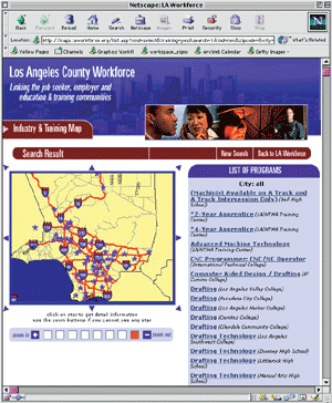 Los Angeles County Workforce Los Angeles County Workforce
maps.laworkforce.org
Employees, training facilities, and Businesses can make connections to each other with this Web site. Unemployed people can find job opportunities and low-wage earners seeking better paying jobs can find training programs. The ArcIMS site helps these people locate jobs and learning centers near their homes because long distances can oftentimes be a barrier to securing jobs and/or training.
NJMC Map Services
Just a few miles from Manhattan, the Meadowlands District is a complex
and ecologically important area. A long history of municipal and industrial
waste discharge has left a legacy of degraded landscapes and contaminated
land and sediment. In 1969, the State of New Jersey created the New Jersey
Meadowlands Commission (NJMC) to protect the area's delicate balance of
nature, ensure orderly development, and provide facilities for the disposal
of solid waste. The Meadowlands Environmental Research Institute (MERI),
a collaboration between the NJMC and Rutgers University's Center for Information
Management, Integration and Connectivity, developed the interactive map
services module, which enables users to view and query maps for land use,
zoning, and parcel information in the District. The basemap identifies
roads, rivers and creeks, schools, and town boundaries. The application
is built with Esri's ArcIMS and ArcIMS Site Starters.
South Bay Cities Traffic Alert
198.179.206.4/traffic/tas.asp
Staff from 16 cities in the South Bay area of Greater Los Angeles use this ArcIMS software-powered Web site to enter the location of construction projects that could create traffic bottlenecks. Users can specify a location and view areas where traffic congestion is anticipated. Streets with projects and events will be highlighted on the map and linked to a detailed report with suggested alternate routes.
|
