Summer 2002
Summer 2002 |
|||||||
|
|
|||||||
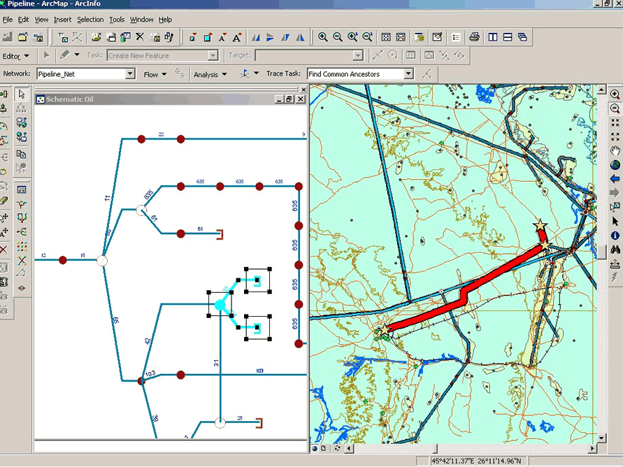
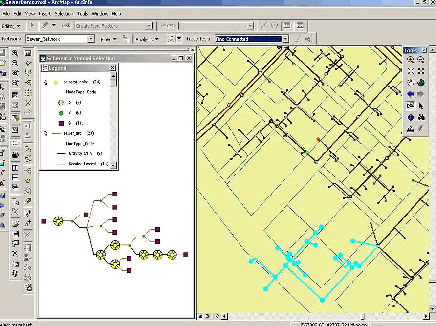
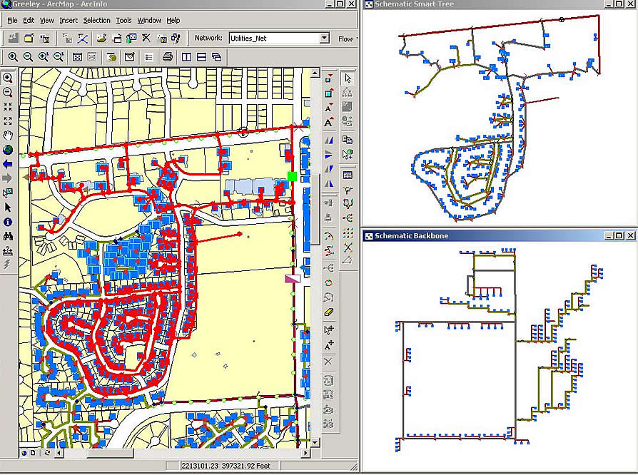
Automatic Schematic Generation Software Creates Logical Networks from GIS Databases
Introducing ArcGIS Schematics |
|||
|
Editor's note: Since ArcNews went to press, the name "NG Spatial" was changed to "ArcGIS Schematics." This Web page has been edited to reflect that change.
In February of 2002, Esri acquired an automatic schematic generation technology called Netgraph and is integrating it with the ArcGIS product line. ArcGIS Schematics automates schematic graphical representations of ArcGIS geodatabases and can be used for electric, gas, telecommunications, and virtually any other linear network. ArcGIS Schematics will provide an advanced solution for network management and visualization of geodatabases. "ArcGIS Schematics is a unique solution for automatically creating and managing data-driven schemas and diagrams," says Jack Dangermond, president, Esri. "The tight integration of Netgraph with ArcGIS will offer multilevel viewing and will help operators rapidly visualize, test, and manage their networks within the ArcGIS geodatabase. ArcGIS is evolving as a standards-based technology platform. As our users' needs change, ArcGIS will provide new tools and functionality to meet these changes." Integrated with ArcGISArcGIS Schematics provides users with the power to operate, manage, and view any network in a wide variety of geographic and schematic representations. ArcGIS Schematics manages all types of graphic representations: geographic, geoschematic, and schematic (diagrams, trees, matrixes, etc.). Its graphic manipulation and network formatting capabilities, combined with advanced cartographic tools, provide Businesses with a robust solution. With ArcGIS Schematics tightly integrated within the geodatabase, users can benefit with no constraints on network modeling. Users can take advantage of a number of functions to manipulate network objects: horizontal or vertical alignment of nodes, modification of symbol and text sizes, intelligent subnetwork movement, and more. In addition, users can easily adapt their own data models and automatically generate schematic representations created and managed within ArcGIS. Rich Features
ArcGIS Schematics automatically creates schematics of networks and manages consistency between cartographic and schematic views. You can retrieve documents produced with ArcGIS and save them as graphic files, and then use them within ArcGIS Schematics to ensure an identical network view regardless of the environment. For more information, visit www.esri.com/schematics or call Esri at 1-800-447-9778, call your Esri regional office, or contact your local reseller. Outside the United States, please contact your local Esri distributor. |