ArcGIS 10.1 Simplifies Sharing of Geographic Information
Changes the Way Users Think About Their Geospatial Content
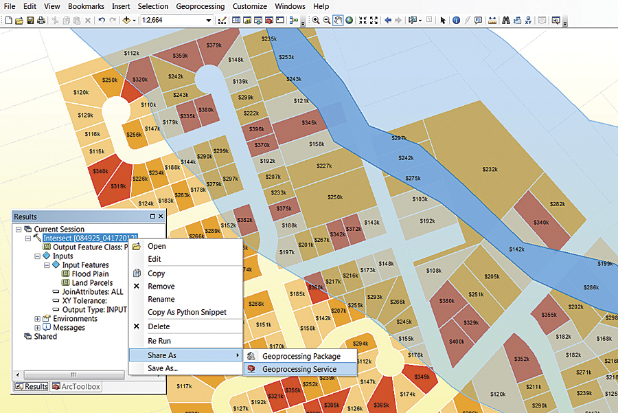
Example of sharing a geoprocessing service from a desktop in ArcGIS 10.1.
Users are already finding that ArcGIS 10.1 makes it simpler to put mapping and geospatial analytics into the hands of more people. GIS professionals can now deliver any GIS resource as a web service. These resources include, but are not limited to, maps; spatial analysis tools; and different file types containing location data, such as shapefiles, and KML, GPX, and CSV files.
This newest release encompasses a host of improvements that will satisfy desktop, server, and mobile users, as well as provide developers with a richer, more accessible environment in which to build, test, and deploy applications and solutions.
Desktop
ArcGIS for Desktop has hundreds of new improvements at 10.1. Many of them make it easier to create and share content, while others improve a user's ability to clearly visualize the patterns and trends in complex data. A user can edit virtually any aspect or component of a map, including feature-level metadata. ArcGIS for Desktop also has dozens of new spatial analysis tools, such as spatial autocorrelation, which allows users to predict and explain things better.
Esri is advancing a new world of 3D GIS. One of the ways this is being done is through the integration of Esri CityEngine into ArcGIS 10.1. CityEngine provides users with a unique conceptual design and modeling solution for the efficient creation of 3D cities and buildings.
In addition, imagery is further integrated into the ArcGIS system. Enhanced tools for analyzing, creating, and editing mosaic datasets simplify all aspects of working with large collections of imagery and raster data in ArcGIS. Imagery is easier to add to ArcGIS with the introduction of raster product support that automates the setup of functions to process traditionally complex data. The imagery also looks better, with many new ways to enhance its appearance; and automated image-to-image georeferencing enables images to be easily georeferenced to each other for better analysis.
ArcGIS 10.1 directly supports lidar. Lidar Log ASCII Standard (LAS) files can be directly viewed as point clouds, surfaces, and rasters, enabling access to a wealth of information, such as ground surface information, tree canopies, or the structure of buildings and electrical lines. Users can take advantage of combining lidar with other features to perform QC of lidar data; change classifications; and view, measure, and perform analysis. Lidar can also be served directly as image services, making lidar data accessible to large numbers of users.
At 10.1, desktops are connected to servers more than ever before. A user can author a beautiful map, a model, or analytics and simply right-click and send it over to a server. The server then caches the data, tiles it, and makes it available as either feature services or visualization services. In other words, a user doesn't have to be an administrator to create services—he or she can take whatever work is done in ArcGIS for Desktop and then deploy it immediately and share it as services. This is also true for imagery.
Server
The primary engine for geospatial infrastructure is ArcGIS for Server, which allows users to turn any location-based resource into a fast, dependable service that can be used in web, desktop, and mobile applications.
At 10.1, ArcGIS for Server is completely rearchitected, making it much easier (and quicker) to install. It is now a native 64-bit application that runs on Windows and Linux. Servers can be deployed on physical, virtualized, and cloud infrastructures or any combinations of these.
Administration tools make ArcGIS for Server more versatile and secure. ArcGIS for Server has a completely new architecture that does away with the previous server object manager/server object container model. Instead, ArcGIS for Server is deployed as a "site." A site can contain one or more GIS server machines; each running ArcGIS for Server. This new architecture makes installation much easier, but more importantly, it simplifies the process of adding and configuring new GIS servers to the site. The Manager application has been redesigned to simplify remote access and provides an improved look and feel for managing services, deploying server object extensions, and monitoring server logs. Sites can be organized into clusters, which can be configured to run dedicated subsets of services. ArcGIS for Server includes an administrative API for scripting complex or repetitive tasks, including setting e-mail alerts when a service is unavailable, querying log files, or granting permissions to services.
In addition to these back-office capabilities, ArcGIS for Server includes a collection of ready-to-use services, such as the geometry service (for an expanded set of geometric calculations), the search service (for creating a searchable index of an organization's GIS content), and the print service (for configuring high-quality printing in web applications).
All editions of ArcGIS for Server (Basic, Standard, and Advanced) include the Spatial Data Server, a separate installation that allows feature-service-only access to geometries, attributes, symbols, and template information for vector data stored in a database or geodatabase. In addition, the ArcGIS Web Adaptor, an optional setup, is included for configuring a custom URL for a site with multiple machines and integrating with an organization's web server security model.
Mobile
The world is becoming increasingly mobile, which is why Esri supports a spectrum of mobile platforms—both with open SDKs that are customizable for developers and with end-user applications that can be downloaded from app stores and marketplaces. These applications can be used to access intelligent web maps and can also be used to share data. In this way, crowdsourced information can be exploited, with every person a sensor. This will affect how people approach science, public service, and citizen engagement. It also affects people's ability to take GIS with them wherever they are and access knowledge in context.
Developer
Esri continues to support multiple platforms and APIs for application development. The new ArcGIS Runtime SDK for WPF and Java allows developers to build applications that are easy to deploy and fast, plus they have a small footprint (read "Build Dynamic Mapping Applications with ArcGIS Runtime SDK" to learn more). In addition, Esri now has two levels of Esri Developer Network (EDN)—Standard and Advanced. EDN Standard includes ArcGIS Runtime SDK and has optional add-ons for ArcGIS Online and ArcGIS for Desktop (Basic, Standard, or Advanced). EDN Advanced also includes ArcGIS Runtime SDK, as well as ArcGIS Online and ArcGIS for Desktop Basic, along with all ArcGIS for Desktop extensions. Developers have the option to add ArcGIS for Desktop Standard or Advanced to EDN Advanced.
Online
Underlying many of the powerful sharing capabilities in ArcGIS 10.1 is ArcGIS Online (read "ArcGIS Online Will Change How You Think About Mapping and GIS" to find out about this important technology that is helping carry ArcGIS into the future).
For more information about ArcGIS 10.1, visit esri.com/whatsnew.