ArcGIS Online Will Change How You Think About Mapping and GIS
Highlights
- GIS professionals can now easily make their maps accessible to others in the organization.
- Organizations can customize their home pages to represent their brand and identity.
- A flexible, annual subscription plan can accommodate organizations or departments of different sizes.
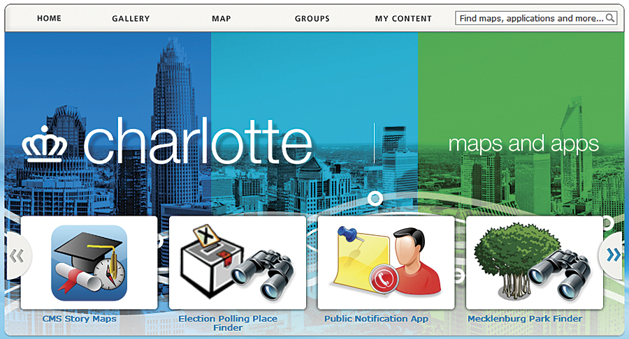
City of Charlotte ArcGIS Online home page to match its own brand.
This month, Esri officially released ArcGIS Online for organizations. Through the purchase of an annual subscription, an organization gets a private instance of Esri's secure, multitenant cloud that's scalable and ready to use. No additional hardware or software has to be purchased or installed. It also gives users in the organization access to tools, basemaps, and other content to make and share maps and applications. Users can catalog and discover maps and applications; set up groups to collaborate; and share items with each other, the entire organization, or publicly. For example, without any programming, any user that's part of an ArcGIS Online organizational account can quickly share maps by embedding them in a website or blog, through social media, or by using a preconfigured web application template.
ArcGIS Online is a totally new technology for mapping and GIS. It provides existing GIS users with a cloud-based content management system for maps, applications, and data. At the same time, it empowers organizations by providing easy access to their authoritative content using web and mobile applications that are easy and freely available. Early adopter organizations have realized immediate benefits by using ArcGIS Online to extend their existing GIS. Enterprise users are discovering how to easily make maps with their tabular data across their organization.
Finally, users are seeing increased collaboration among teams and departments, the ability to provide self-serve mapping, and making geospatial content accessible to anyone. These have created new insights and opportunities for organizations. ArcGIS Online is essentially changing how GIS managers and professionals think about mapping and GIS.
Integration with ArcGIS for Desktop and ArcGIS for Server
Because ArcGIS Online is integrated with ArcGIS for Desktop and ArcGIS for Server, maps created by GIS professionals can now be made accessible to others in the organization using the same system. Everyone in the organization can view and interact with these maps via a browser, smartphone, tablet, or other mobile device. Registering ArcGIS for Server services in ArcGIS Online only takes a few steps and puts the services into the hands of those who need this information to get their work done. In addition, non-GIS professionals, such as knowledge workers who have a need for GIS, now have a way to quickly create maps from the unstructured information they work with in spreadsheets and text files and share these maps with others, who can access them on any device. This type of on-demand and self-serve mapping frees up GIS professionals from having to respond to constant requests for maps and instead allows them to concentrate on making and publishing authoritative information products. An ArcGIS Online subscription also includes access to an API that developers in the organization can use to extend the system or integrate a custom solution with the ArcGIS Online system.
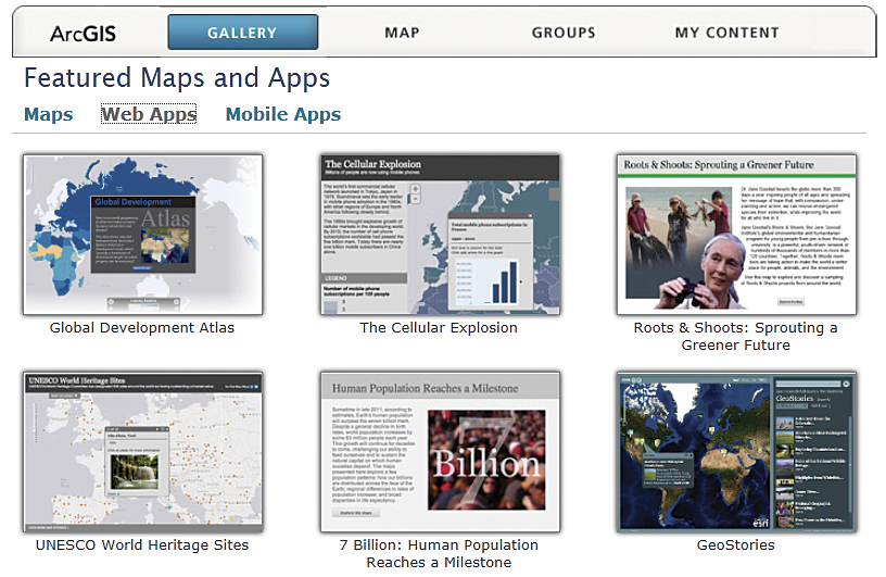
You can feature maps and applications in your organization's web and mobile gallery.
Flexible Subscription Options
A flexible, annual subscription plan structured to accommodate organizations or departments of different sizes is available—from a small workgroup plan to an enterprise-wide implementation. Which plan to purchase depends on the size of an organization and the online resources to be consumed. Separate subscriptions can be purchased for each department or one large subscription for the entire organization. The subscription plans start as small as 5 named users and 2,500 service credits and increase to a multidepartment plan with 1,000 users and 110,000 service credits, or even larger for an enterprise plan. Regardless of the plan an organization chooses, more users and service credits can be added to the plan at any time.
Service credits are the currency of the ArcGIS Online system. Each service credit entitles an organization to consume a set amount of ArcGIS Online services, such as storing feature services or tile services (e.g., map packages and layer packages) in Esri's cloud, and geocoding. Providing a pool of credits gives an organization a lot of flexibility to use the system that best fits its organizational workflows and other needs. Organizations that have an existing enterprise license agreement (ELA) with Esri receive an ArcGIS Online subscription as part of their agreement, with a certain number of service credits allocated and unlimited users.
Managing Your ArcGIS Online Account
There are three roles in ArcGIS Online: administrators, publishers, and users. Administrators of the ArcGIS Online subscription have the ability to publish and use content and also monitor service consumption through a dashboard. If the dashboard indicates that the service credits are at a low level, more credits can be purchased either online or by contacting Esri. Administrators also have the ability to invite and add users, remove users, assign user roles, delete content and groups, and set and manage the security policy. Publishers do not have administrative privileges but can publish and use content published by others, whereas users can only interact with and consume content. It is important to note that organizations retain all the rights and title to and interest in any content they publish in ArcGIS Online.
Administrators also have the ability to customize an organization's ArcGIS Online home page to represent the organization's brand and identity. Customization options include adding a logo and banner, creating a custom URL, and featuring maps and applications important to the organization. As a best practice, organizations should assign more than one person to be an administrator.
For organizations that didn't have the opportunity to participate in the ArcGIS Online beta program or be part of the early adopters program, a 30-day evaluation is available.
To get more details about ArcGIS Online and sign up for the evaluation, visit esri.com/agol.