Winter 2003/2004
Winter 2003/2004 |
|||||||
|
|
|||||||
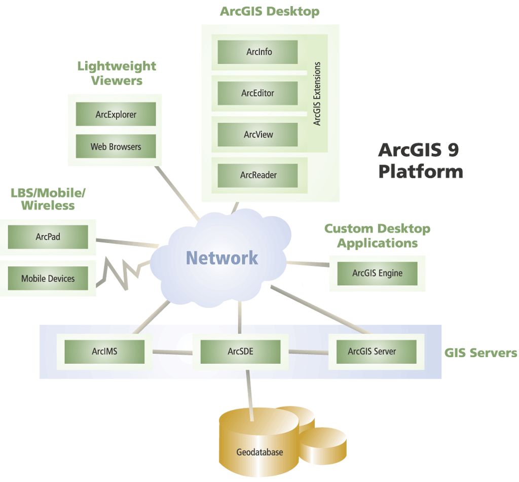
ArcGIS 9 Provides a Complete Platform for GIS |
|||||
ArcGIS 9 is an integrated family of GIS software products for building a complete GIS. The fundamental architecture of ArcGIS 9 enables users to deploy GIS functionality and business logic wherever it is needed in servers, desktops, or custom clients. ArcGIS 9 consists of five key parts:
ArcGIS Desktop 9 (ArcView, ArcEditor, ArcInfo, and ArcGIS Extensions)ArcGIS 9 builds on the strength of previous releases and adds important capabilities not previously offered. ArcGIS Desktop 9 adds a comprehensive geoprocessing framework and toolkit for creating and executing complex GIS procedures. Other highlights include improved annotation, labeling, and geodatabase interoperability. In addition, the ArcGIS extensions grow their offerings with the new ArcGlobe 3D application; ArcReader customization via ArcGIS Publisher; and a new extension, Maplex for ArcGIS. Geoprocessing Framework
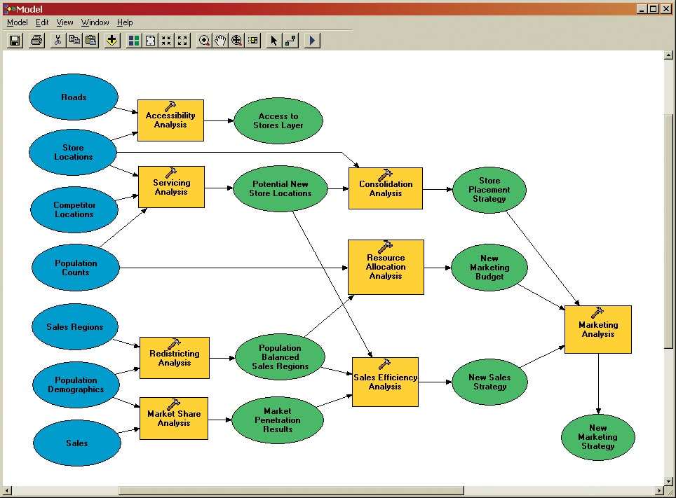
ArcGIS Desktop 9 provides a new framework for creating, using, documenting, and sharing geoprocessing models. Geoprocessing is the creation of derived information through the analysis of existing spatial data and is a critical GIS function. Geoprocessing is used for many crucial interactive and batch GIS activities. Users apply geoprocessing functions to generate high-quality data, undertake quality assurance and quality control checks on data, and perform modeling and analysis. The geoprocessing framework is common, but the tools differ from desktop product to product. ArcView supports a core set of simple data loading and translation tools as well as fundamental analysis tools. ArcEditor adds a number of tools for geodatabase creation and loading. ArcInfo provides a comprehensive set of more than 200 geoprocessing tools for vector analysis, data conversion, and data loading and will work with all supported data formats including geodatabase feature classes. More than 200 additional tools are provided via the ArcGIS extensions such as ArcGIS 3D Analyst and ArcGIS Spatial Analyst. ModelBuilderCommon to ArcView, ArcEditor, and ArcInfo, and new to the ArcGIS environment, is ModelBuilder, a visual modeling application for building geoprocessing work flows and scripts. Models are data flow diagrams that string together tools and data to create advanced procedures and work flows. Users can drag tools and data sets onto a model and connect them in an ordered sequence of steps to perform complex GIS tasks. Models can be created, saved, and rerun using different input data and function parameters, enabling users to readily explore alternative scenarios. ModelBuilder provides not only the framework necessary to construct, execute, and modify spatial models but also an excellent means to document and present models to others. Models can also provide the framework for integrating external applications and processes within the ArcGIS environment. Annotation and LabelingAnother major focus of ArcGIS 9 is on significantly improving the user experience when creating, editing, and managing labels and geodatabase annotation. A new set of tools enables users to centrally manage all labels. In addition, there are new tools for managing geodatabase annotation, allowing users to simply and easily update and create annotation. The geodatabase has also been upgraded to support more advanced text formatting and annotation. GeodatabaseAnother major effort at version 9 is an Extensible Markup Language (XML) representation of the geodatabase. Geodatabase XML represents Esri's open mechanism for information interchange between geodatabases and other external systems. At version 9, Esri will openly publish and maintain the complete geodatabase schema and content as an XML specification and provide example implementations to illustrate how users can share data updates between heterogeneous systems. ArcGIS 3D Analyst
Maplex for ArcGISMaplex for ArcGIS, an optional extension, adds high-quality cartographic text placement, labeling, and conflict resolution to ArcView, ArcEditor, and ArcInfo. A detailed set of rules enables users to control text placement and properties such as abbreviations, stacking, font reduction, overflow, and much more. Maplex for ArcGIS can be used to generate text that is saved as labels in map documents or as in an annotation layer in the geodatabase. Maplex for ArcGIS greatly reduces map production time and enhances cartographic quality. ArcReader and ArcGIS PublisherArcReader and ArcGIS Publisher allow GIS data to be disseminated widely at a very low cost. ArcGIS Publisher enables the creation of a published map file format (PMF) for any map document (MXD). Published map files are viewable with ArcReader and allow users to share their map documents with any number of other users. At version 9, ArcGIS Publisher includes a programmable ArcReader control enabling users to easily build and deploy ArcReader applications. ArcReader customization can be done using Visual Basic, .NET, Java, or C++. Users can also control access to ArcReader maps using security settings in ArcGIS Publisher. ArcGIS EngineArcGIS Engine is a complete library of embeddable mapping and GIS for developers to build custom desktop applications. Using ArcGIS Engine, developers can embed GIS functions into existing applications and build focused custom applications for delivering GIS to many users in their organization. ArcGIS Engine supports all the standard development environments including .NET, COM, Java, and C++. (See "ArcGIS 9 Desktop Development Platform" for more information.) ArcGIS ServerArcGIS Server is a GIS enterprise application server that offers organizations the opportunity to centrally manage GIS services. Mapping, geocoding, spatial queries, editing, tracing, and high-end analysis are all examples of applications that developers can build using ArcGIS Server. These applications can be utilized by browser-based clients, custom applications built with ArcGIS Engine, and ArcGIS Desktop. ArcGIS Server supports key standards, such as Java and .NET, for building local and wide area network enterprise applications and XML/Simple Object Access Protocol (SOAP) for messaging and data transfer over Web (HTTP) network connections. The Fall 2003 issue of ArcNews featured ArcGIS Server; see the article at www.esri.com/arcgisserver. ArcIMS 9ArcIMS 9 will ship in conjunction with ArcGIS 9. This release features support for the ArcIMS ArcMap Server on Linux and UNIX operating systems, synchronizing ArcIMS platform support with ArcGIS. The ArcIMS ArcMap Server allows users to take advantage of the advanced data access and cartographic capabilities offered in ArcMap by publishing ArcMap documents (MXD files) on the Internet. ArcSDE 9Highlights of ArcSDE 9 include improved image data management and raster handling, new administrator tools, direct connect for IBM DB2 and Informix, enhanced Java application program interface, and support for additional platforms for DB2 (Red Hat Linux, HP-UX, and Sun Solaris). For more information on the ArcGIS 9 release, visit www.esri.com/arcgis9, call Esri at 1-800-447-9778, call your Esri regional office, or contact your local reseller. Outside the United States, contact your local Esri distributor. |