Winter 2006/2007
Winter 2006/2007 |
|||||||
|
|
|||||||
GIS Helps Determine and Forecast Causal Correlations
Minimizing Avian Mortality in Siting Wind Turbines |
|||||
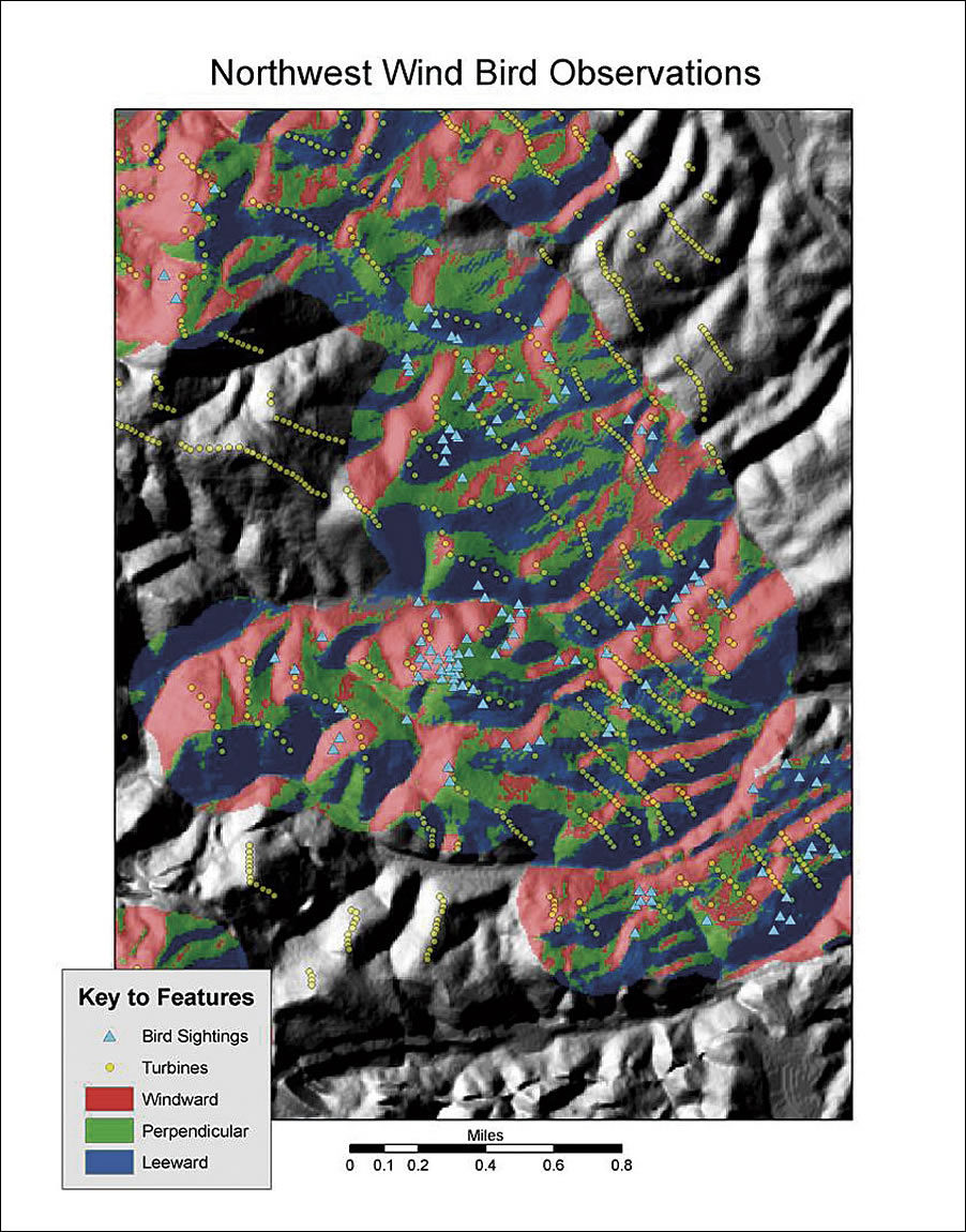
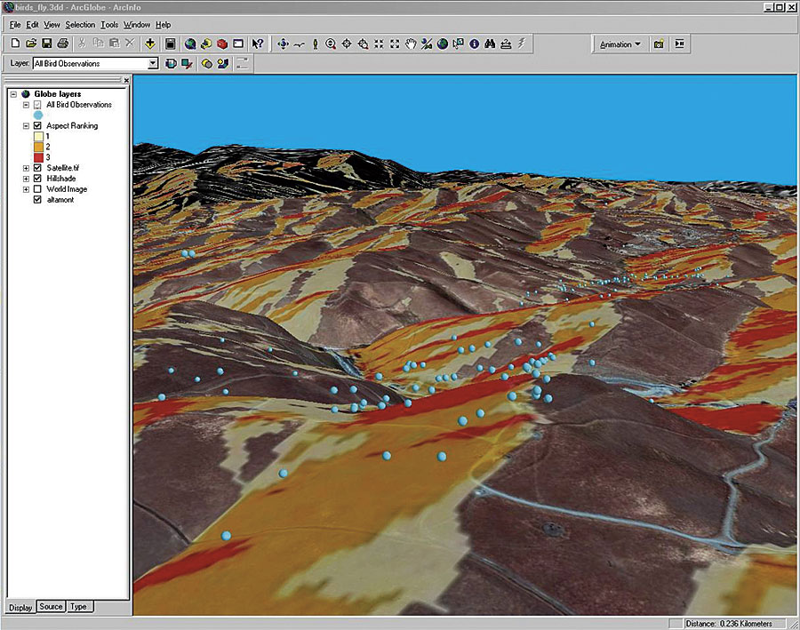
Wind power is a popular energy source because it saves resources, is an inexhaustible supply, and reduces pollution. On the downside, wind turbines kill a large number of birds, including those protected by various state and federal protection acts. To study the effects of wind turbines on bird populations and to find solutions that reduce avian mortality, the California Energy Commission funded a project to determine what measures could be used to reduce bird collisions with wind turbines within northern California's Altamont Pass Wind Resource Area (APWRA). Research studies by BioResource Consultants and Lawrence Livermore National Laboratory (LLNL) determined that various causal correlations exist between wind turbines and bird mortality in the APWRA. The study also analyzed relationships of bird behavior, wind velocity and direction, tower height, topography, and other factors. GIS has been useful in determining these correlations and creating maps that indicate bird behaviors and wind turbine impact on populations. Shawn Smallwood, Ph.D., and Lee Neher of the LLNL GIS team designed GIS project applications using ArcGIS ModelBuilder and ArcGIS Server. These maps were useful for analyzing raptor behavior data collected during 2003�2004. Attribute labels were attached to one-minute observations of bird behavior (activity, elevation, etc.) with corresponding terrain slope, aspect, elevation, and relationship to wind direction. Also added were results of a curvature analysis of the 10-meter digital elevation model, defining areas of convex, concave, and flat terrain under each bird observation. GIS analysts used the ArcGIS 3D Analyst and ArcGIS Spatial Analyst extensions to create a series of maps for the study.
Findings indicate that site location and rotor plane height contribute significantly to raptor morbidity. The taller the tower is, the greater the reduction in morbidity. These reduction rates were also impacted by wind turbine placement and species type. Behavior observation studies and studies of bird activity levels should precede the installation of wind turbines at new wind farms. Understanding bird flight patterns could help guide the design of the wind farm, including the appropriate heights, spatial arrangements, and specific locations of wind turbines relative to the topography and land-use practices. Additionally, preproject behavior observation studies enable the measurement of the contributions of species susceptibility and project-induced vulnerability leading to impacts after the wind farm is installed and operating. More InformationResults of the statistical analysis are presented on the Web site eed.llnl.gov/renewable. For more information, contact Lee Neher, Lawrence Livermore National Laboratory (e-mail: neher1@llnl.gov or lee@neherconsulting.com), or Shawn Smallwood, Ph.D. (e-mail: Puma@davis.com). |