Winter 2006/2007
Winter 2006/2007 |
|||||||
|
|
|||||||
New Esri Press Book Maps Techniques to Analyze Land Use
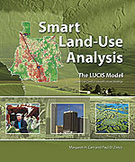
Smart Land-Use Analysis: The LUCIS Model |
|
|
Authors Paul Zwick and Margaret Carr, both University of Florida professors, say that it's often difficult to visualize, over time, what small, incremental changes in land use today will lead to tomorrow. To stem hodgepodge development and sprawl or just do better planning in general, an analysis technique is needed that reveals the spatial reality of incremental land-use change over time, they said. Smart Land-Use Analysis outlines that technique, which employs GIS technology's mapping, modeling, and analysis capabilities and a process called Land-Use Conflict Identification Strategy (LUCIS). The book comes with a DVD that includes data and data models. Zwick and Carr write in their book's introduction, "We contend the public will be best served when the cumulative effect of land-use policies can be translated into comprehensible visualizations of the future, in other words, when 'what if' scenarios can be simplified to the point where they may be easily and satisfactorily understood." That's where GIS comes in. Complex land-use models can be easily developed—without understanding a programming language—using the ModelBuilder window embedded in Esri ArcGIS software. The software supports cell-based suitability analysis. "If the spatial reality of 3,000 new residential units per year for the next 10 years can be clearly mapped," Zwick and Carr write, "then the lost agricultural and conservation opportunities will be more easily understood. And the need for additional public infrastructure in the form of roads, sewage treatment systems, and schools will be more obvious." Esri president Jack Dangermond lauds Zwick and Carr for writing Smart Land-Use Analysis and hopes planners and other key decision makers will take the lessons to heart. "While the process described . . . will take some work to adopt and apply, it is well worth doing, [and will lead] to educated decision making when it comes to how our precious land is used and allocated for the future," Dangermond writes in the book's foreword. "It epitomizes the potential of the computer, of GIS, and of creativity in software application." Zwick is a professor and chair of the University of Florida's Department of Urban and Regional Planning and director of the university's GeoPlan Center. Carr is a professor in the Department of Landscape Architecture and the GeoPlan Center's codirector. The GeoPlan Center, short for the GeoFacilities Planning and Information Research Center, was started in 1984 and serves as a GIS laboratory for researchers and faculty from various departments, including planning and landscape architecture. Smart Land-Use Analysis: The LUCIS Model (ISBN-13: 978-1-58948-174-9 or ISBN-10: 1-58948-174-7, 264 pages, $49.95) is anticipated to be published in February 2007. More InformationVisit www.esri.com/esripress/smart to preorder your copy today. |
 Urban planners, elected officials, and others who make land-use decisions face some tough choices ahead. Smart Land-Use Analysis: The LUCIS Model, a new book from Esri Press, will help them tackle the job.