Going Beyond the Physical Community
By Parris Lyew-Ayee Jr., Mona GeoInformaticS Ltd. and the University of the West Indies at Mona, Jamaica
Jamaican GIS projects yield practical benefits.
Over the last decade, GIS has made huge strides in providing spatial information for national and local governments, companies, universities, and individuals worldwide and has guided much decision making. In Jamaica, GIS has been used to map land parcels, roads, terrain, vegetation  cover, and other important data used to manage the island's natural and man-made resources. Different government departments have adopted GIS, which now forms an integral part of many of their operations. cover, and other important data used to manage the island's natural and man-made resources. Different government departments have adopted GIS, which now forms an integral part of many of their operations.
However, with few exceptions, GIS has not had much impact on the wider society outside government sectors in Jamaica. This is due mostly to the cost of large scale GIS implementation by smaller firms and the relatively high skill level required to operate such a system, especially in a developing country such as Jamaica. The University of the West Indies, Mona, in Kingston has developed and expanded its GIS services beyond providing training for geography and geology undergraduates. It is working on projects that serve the wider community on issues such as crime, environmental modeling, natural hazards, and corporate mapping, while also focusing on applied GIS research and development.
Two specific projects have expanded traditional community GIS use in Jamaica beyond mapping physical infrastructure. Community mapping, in its most literal sense, refers to mapping assets in a region such as manholes, telephone poles, and the locations of stores and schools. For these two projects, however, GIS was used to map communities of people who are related not by geography but by religious and ethnic backgrounds.
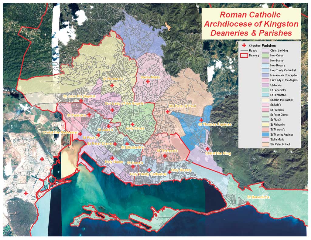
The Roman Catholic Archdiocese of Kingston
The entire Roman Catholic population of Jamaica comprises only about 4 percent of Jamaica's 2.7 million people. The country is divided into two dioceses headed by bishops in western Jamaica and an archdiocese, led by an archbishop, in the capital of Kingston and surrounding areas.
Established in 1967, the archdiocese is divided into six deaneries. These administrative subunits of the archdiocese total 3,815 square kilometers or about 35 percent of the entire land area of the island. The archdiocese region accounts for more than half the entire population of
 |
| This map shows the Kingston parishes within the archdiocese. |
Jamaica and has a total population of 1.4 million. This region consists of 46 churches and missions in 32 church parishes. An estimated 56,000 Catholics live within the archdiocese, significantly fewer than the roughly 140,000 Catholics that lived there during the early 1970s.
The city of Kingston accounts for four and one-half deaneries, 20 church parishes, and 23 churches. However, while church building locations are generally known, the full extent of many parish boundaries is not. Also, the archdiocese does not know the full geographic range and distribution of these churches. The absence of this information affects the ability of individual churches to plan and coordinate activities, such as feeding the poor and other social programs, as well as the archdiocese's overall planning and management of the region.
ArcGIS 9.1 was used to conduct this project, which benefited from its advanced digitizing and cartographic capabilities. The original documents that describe the extent of each parish at its formation exist in text format. This hampers their immediate transfer to a digital format. These documents, circa 1966, also lack true geographic or survey descriptions and use general descriptive terminology such as "near the water supply installation." The descriptions may refer to features that no longer exist.
A comprehensive survey of the entire archdiocese is currently under way. It will collect detailed information on the entire region, such as the total number of churchgoing Catholics, the male-female ratio, age distribution, income characteristics, and the number of ministry programs. At an administrative level, information on the weekly, monthly, and annual income for each church parish has already been collected.
This information has been correlated with the total number of parishioners and socioeconomic conditions of the wider parish. Wealthy parishes tend to have both the greatest number of social welfare programs and the greatest overall expenditure. Poor parishes, both in terms of church income and househould income compared with the wider community, have fewer programs. When compared with national socioeconomic data, these poor parishes also have higher levels of crime and illiteracy. There is also a relatively high concentration of churches in the poor areas of Kingston. This knowledge can now empower the archdiocese to identify priority areas for intervention. However, as a percentage of individual income, those who contribute money in poor parishes give more to the church than those in wealthy church communities.
The four Catholic churches in the Kingston suburb of Portmore, where nearly 250,000 people reside, collectively draw roughly 700 people to Mass each Sunday. This clearly indicates that the archdiocese needs to become more involved in this area. GIS provides location information to
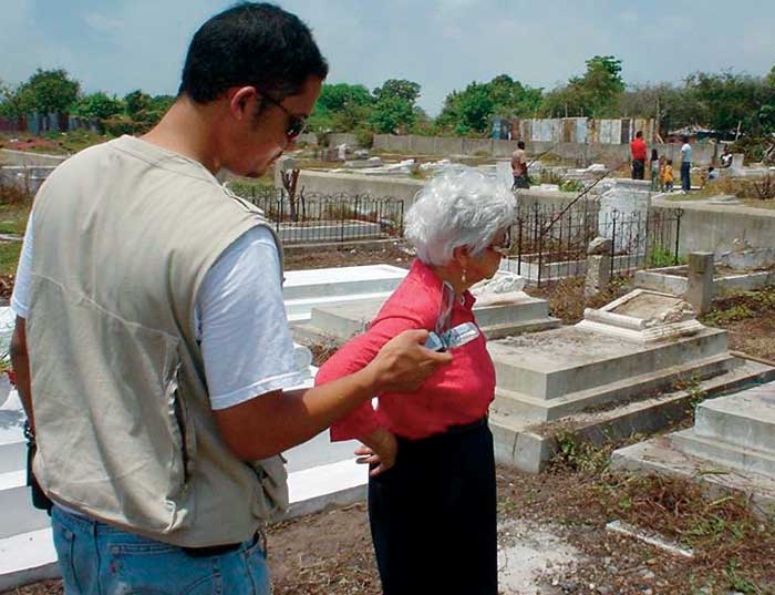
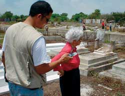 |
| An ArcPad-equipped PDA was used to find graves in the field at Gah San in 2005. |
accompany the financial information that comes into the archdiocese's offices from these churches. The correlation of national GIS data on community populations, socioeconomic data, and roads with church information provides explanations for observed patterns and trends.
Individual church locations, mapped using GPS, contain attribute information on the priest and associate priests, church phone numbers, and Mass times. Mapping of schools, convents, skills training centers, and other Catholic properties is also under way.
Continued on page 2
|