GIS Enters the Design Space
By Matt Artz, Esri
"Imagine if your initial design concept, scribbled on the back of a cocktail napkin, has the full power of GIS behind it. The sketch goes into the database, becoming a layer that can be compared to all the other layers in the database."
With that simple yet powerful statement, Esri president Jack Dangermond launches into a discussion of the convergence of GIS and design. And Dangermond is truly excited about the possibilities of bringing GIS into the design process. That's why he chose GIS: Designing Our Future as the theme for the 2009 Esri International User Conference, to be held July 13-17 in San Diego, California.
A GIS is a collection of hardware, software, and data for managing, visualizing, and analyzing geographic information. But what exactly is design? That depends on whom you ask. A formal definition might be the process of planning or sketching the structure or form of something. Other definitions from renowned designers and architects are more esoteric, yet much more descriptive. Charles Eames called design "a plan for arranging elements in such a way as to best accomplish a particular purpose," while Glen Lowery described it as "a bridge between the abstraction of research and the tangible requirement of real life." Gavin Heaton defined design simply as "applied imagination."
Designing Our Future
So how does GIS play into the design space? Dangermond believes that to develop a true understanding of our complex and dynamic earth, we must create a framework that takes many different pieces of past and future data from a variety of sources and merges them in a single system. GIS is a sophisticated technological tool already in widespread use by planners, engineers, and scientists for displaying and analyzing all forms of location-referenced data about the health, status, and history of our planet.
GIS enables a GeoDesign framework for analyzing, managing, and ultimately directing earth systems issues by allowing users to inventory and display large, complex spatial datasets. They can also analyze the potential interplay between various factors and design alternative futures, getting us closer to a true understanding of how our dynamic earth systems may change in the coming decades and centuries-and how we may thoughtfully and intelligently direct that change.
It's not a stretch to say that development of GIS and the entire industry around the technology was profoundly influenced by the foundational work of landscape architect Ian McHarg. Primarily through his revolutionary book Design with Nature, McHarg popularized the overlay concept and laid the groundwork for what was to become GIS, influencing a number of budding young landscape architects and geographers-including Dangermond-and changing their lives forever. "McHarg and I clearly shared the vision of using geographic analysis techniques to design a better world," says Dangermond. "Although we've made a lot of progress in building the technological infrastructure to help us accomplish this monumental task, we still have work to do."
Design is art within the framework of limitations-limitations that arise as a result of function, world view, bias, and other factors, but also those that arise as a result of place. "Design considering place was at the core of McHarg's beliefs, and it is the basis for our research and development efforts in the emerging field of GeoDesign," says Dangermond. GeoDesign borrows concepts from landscape architecture, environmental studies, geography, planning, sustainability, and integrative studies. Much like GIS and environmental planning before it, GeoDesign takes an interdisciplinary, synergistic approach to solving critical problems and optimizing location, orientation, and features of projects both local and global in scale.
GeoDesign may be a new term to some people, but GIS and design have a long history together. Whether they realize it or not, over the last 40 years, many GIS professionals have been involved in GeoDesign projects primarily in the fields of environmental, regional, and urban planning.
"To a certain extent, this is already done today by numerous GIS practitioners in fields like urban and regional planning and environmental management," says Dangermond. "But GeoDesign makes this easier by making it an integral part of the workflow, both shortening the cycle time of the design process and improving the quality of the results." Dangermond sees with great clarity a new focus on this synergistic approach, primarily spurred by such pressing issues as environmental degradation and climate change.
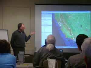 Esri president Jack Dangermond discusses the evolving field of GeoDesign at the Specialist Meeting on Spatial Concepts in GIS and Design, held December 15-16, 2008, in Santa Barbara, California. (Photo by Jake Sopher) |
Basics of GeoDesign
GeoDesign brings geographic analysis into the design process, where initial design sketches are instantly vetted for suitability against a myriad of data on the physical and social geography of the project. This on-the-fly suitability analysis provides a framework for design, giving land-use planners, engineers, transportation planners, and others involved with design the tools to directly leverage geographic information within their design workflows.
"Taking full advantage of geography during the design process results in designs that emulate the best features and functions of natural systems, benefiting both humans and nature through a more peaceful and synergistic coexistence," Dangermond says.
GeoDesign involves three activities: the work environment (where designers do their work), design tools (the tools designers use to do their work), and supportive workflows (how designers do their work). Having one of these out of sync with either of the others can impede the design process.
- Work environment-The work environment used by GeoDesign professionals involves the field, the desktop, connection to enterprise servers and databases, the use of document management systems, collaborative environments (both inside and outside the enterprise), and interaction with outside agencies and organizations.
- Design tools-GeoDesigners use a variety of tools to assist them as they create their designs. The most frequently used type of tool is the drawing tool. The particular type of drawing tool depends on the designer's domain and whether the designer is working in 2D or 3D space.
- Supportive workflows-Most GeoDesign workflows are domain specific. However, three workflows pertaining to the use of geographic information stand out as being predominantly related to land-use change; one to the design, construction, and management of built facilities; and one to the use of 2D CAD.
Meeting the Challenge
The first geographic design system was ArcCAD, Esri's earliest attempt to build a dedicated GeoDesign tool. ArcCAD was followed by other Esri applications (including SDE CAD Client and ArcGIS for AutoCAD), which allowed designers and others within the CAD environment to leverage the full power of GIS functionality and GIS databases. ArcGIS for AutoCAD, a free downloadable tool that offers seamless interoperability between AutoCAD and the ArcGIS platform, is used widely today. In 2005, Bill Miller, Esri's engineer/architect, led a small team to develop a free sample ArcGIS extension called ArcSketch that was the first step toward true GIS-based GeoDesign tools. Released in 2006, the extension allows users to quickly create features in the ArcGIS Desktop ArcMap application with easy-to-use sketch tools. Functionality similar to ArcSketch will be further enhanced and integrated into the core software system at the ArcGIS 9.4 software release, and subsequent releases of ArcGIS promise even more support for the use of GIS for design.
Integration of design tools with existing GIS functionality is important, but it's only the first step. Dangermond's vision expands the utility of GIS to the point where it is a foundational design system. As we come to grips with our overwhelming impact on the world around us, we are also gaining a much better appreciation for our inextricable link to nature and how technology can help us make where we live a better place. And with that, of course, comes an enormous responsibility-a responsibility made all the more gargantuan by the fact that we still have a long way to go toward fully understanding the dynamics of the various systems and developing a robust suite of comprehensive models and other tools to support the design of alternative futures.
"A better world is the common goal all of us-geographers, planners, scientists, and others-have been striving for," says Dangermond. "We should be using our dominance of the earth and advanced technologies such as GIS to help evolve the natural world and make it better, not to conquer it. Powerful anthropogenic influence over earth systems represents not just a huge challenge but an equally huge opportunity-not humans versus nature, but humans with nature."
Learn More
Dangermond will talk about his vision for GeoDesign at the 2009 Esri International User Conference, so register today. Also, look for his article, "GIS: Designing Our Future," in the Summer 2009 issue of ArcNews.