Spatially represent your data
Given that 80 percent of all data contains location as a variable, you can use the ArcGIS Python libraries to represent and visualize your data on a map, giving it context and making it relative to space and time.


Python for spatial data science
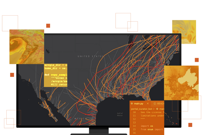
Given that 80 percent of all data contains location as a variable, you can use the ArcGIS Python libraries to represent and visualize your data on a map, giving it context and making it relative to space and time.
Access your organization's spatial data via Python and enrich it with curated datasets compiled by an expert team of cartographers, statisticians, and demographers. Read spatial data from file and enterprise geodatabases as well as web layers (feature services and map services) across the entire ArcGIS ecosystem.

Use the ArcGIS Python libraries to go beyond the proximity of points on a map and tell meaningful stories with your data. Find clusters, quantify data relationships, and create information products to share your insights with others.

Build models with high spatial precision by using spatial machine learning and deep learning methods that incorporate geography directly into their computation. This includes the shape, density, contiguity, distribution, and proximity of your data.

Take advantage of the robust projection capabilities and the intuitive geometry engine and services made available via the ArcGIS Python libraries. These capabilities let you accurately represent and analyze your spatial datasets in any coordinate system.

Automate repetitive spatial workflows by writing Python-based scripts to save time and find efficiencies. Use ArcPy or ArcGIS API for Python to administer your portal, users, and servers and manage your local and web content. Productize and share your analytical outputs.

With its widespread use and popularity, Python is the preferred language within ArcGIS and continues to evolve. It is prevalent throughout the ArcGIS platform and encompasses a broad analytical framework that interoperates with the larger open-source ecosystem.

The ArcGIS Python libraries drive the ArcGIS Enterprise platform as well as run within the servers that compose it, including ArcGIS Notebook Server. Perform administration and content management tasks, access spatial analysis and big data analysis tools, and much more.

Within the desktop environment, the ArcGIS Python libraries can be leveraged via ArcGIS Notebooks, an integrated Jupyter environment that seamlessly lives within ArcGIS Pro.

Within ArcGIS Online, Python is made available for spatial analysis, data management, and system administration via ArcGIS Notebooks, enabling you to combine ArcPy, ArcGIS API for Python, and open-source Python libraries.

Python is also made available through ArcGIS APIs and SDKs that developers can tap into to start their work. You can create robust visualizations and maps and perform spatial analyses by starting for free and then paying as you go with flexible pricing options.

Learn about ArcPy, a comprehensive and powerful library for spatial analysis, data management, and data conversion.
Get startedStart using ArcGIS API for Python, a simple and lightweight library for analyzing spatial data, managing your Web GIS, and performing spatial data science.
Get startedBegin a conversation online.
Speak with a representative.