ArcNews Online
 

Fall 2004
Search ArcNews
 

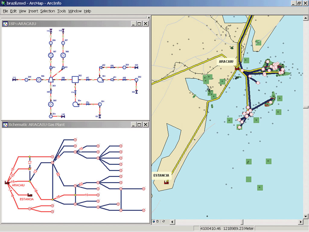
ArcGIS Schematics 2.3 Expands Graphic Representation of Network Features

  click to enlarge
ArcGIS Schematics enables users to create schematics representations of their spatial and nonspatial data.

With the release of ArcGIS Schematics 2.3, Esri expands the ability of ArcGIS users to generate, visualize, and manipulate diagrams from network data in a geodatabase. The ArcGIS Schematics 2.3 extension is designed to improve the efficiency of creating and working with schematic diagrams using ArcGIS 8.3 and 9 Desktop software.

ArcGIS Schematics provides the tools to operate, manage, and view any network in a wide variety of geographic and schematic representations. ArcGIS Schematics automates the generation of schematic diagrams from geographic data, and changes to the data are reflected in the schematic diagrams. Schematics users in the electric, gas, water/wastewater, transportation, pipeline, and telecommunications industries will find ArcGIS Schematics a time-saving tool for creating and managing representations of their linear network data.

ArcGIS Schematics features include

  • On-the-fly diagram generation—Generate diagrams automatically from a selection set or tracing result, limiting the number of operations and saving time.
  • Logical and physical representation—Display the logical connectivity of services in addition to the physical representation of the network.
  • Interaction between the geographic data view and the schematic view—Dynamically interact with the geographic data view (distinguishing topological relationships) and the schematic view (displaying the network architecture).
  • Inside plant representation—Display inside plant diagrams directly from an outside plant map or schematic.
  • Node reduction—Graphically remove selected nodes and reconnect incident links with a superspan (e.g., for an electric network, poles can be removed to display active network features only).
  • Connection to multiple data sources—Manage both spatial and nonspatial data and interact with a geodatabase or other network-related databases within a single session.
  • Overlapping link separation algorithm—Separate selected lines connected to the same junction.
  • Custom symbol alignment—Specify an angle to automatically arrange symbols along an imaginary axis.

For more information or to evaluate ArcGIS Schematics, visit www.esri.com/schematics, call Esri at 1-800-447-9778, or call your Esri regional office. Outside the United States, contact your local Esri distributor.

Contact Us | Privacy | Legal | Site Map