ArcWatch: GIS News, Views, and Insights
June 2012
A Capital Idea: Green Up DC
By Jessica Wyland
Esri Writer
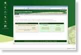
People can now take an active role in protecting the environmental health of the Chesapeake Bay and lower their utility bills by using a new interactive web mapping application, Green Up DC, provided by the District Department of the Environment (DDOE). Green Up DC offers Washington, DC, residents tools to plan new improvement projects for their homes and businesses, including green roofs, pervious pavement, and rain barrels. They can also access information about financial subsidies and rebates, register installed projects, and view maps of other property owners' projects. Green Up DC features an intuitive mapcentric interface in an application that was created with Esri's ArcGIS API for JavaScript and runs on the web via Esri's ArcGIS technology. Read the article.

People can design projects using the interactive drawing tools in the Green Up DC application.
Tip of the Month
Learn to Use Image Analysis Functions to Display Layer Tints on Hillshades
Using transparency to overlay colored rasters on hillshades or other grayscale rasters results in a washed-out, less detailed image. Read this tip to learn how to use the No Alteration of Grayscale or Intensity (NAGI) fusion method to create an image that instead retains the original colors and details.
Connect with ArcWatch
ArcWatch is published monthly by Esri and contains GIS news, practical advice, and updates about the company's software and events. To submit article ideas, e-mail editor Carla Wheeler at arcwatch_editor@esri.com.
Join the Conversation
Celebrate the Power of Where
 Where's the best place in the world to celebrate the power of where? San Diego, California, home to the Esri International User Conference (Esri UC). More than 15,000 people from all corners of the GIS world will converge here for one week this July to celebrate geographic understanding and hear about the latest geospatial tools and solutions. Read this article to find out what's in store at the largest GIS conference of the year.
Esri UC Forecast: Clouds
 Given that cloud is now one of the most used technology buzzwords of the decade, it's no surprise that the upcoming Esri International User Conference will offer an impressive number of cloud sessions. Esri's technical staff will equip you with the know-how to successfully implement cloud solutions. Read the article.
Esri Demographic Data Ranked Most Accurate
To make sure you continue to receive the industry's best data, Esri commissioned a blind study to test the accuracy of its demographic projections. The study was conducted by four independent researchers, experts in small-area forecasts and forecast accuracy measures. They benchmarked variables from Esri and each of the four other major data vendors against results from Census 2010. The study encompassed the entire United States at four geography levels. The findings? Esri ranked No. 1 overall. Read the study and call 1-800-447-9778 for more information.
Envision the Future of GIS Education
With game-changing advances in cloud computing and mobile technologies, more access to authoritative data, and the release of Esri's ArcGIS 10.1, this is the year to definitely book your trip to the Esri Education GIS Conference. Find out what the organizers have planned for you. Read the article.
Ambassador Speaks about GIS
 US Ambassador Betty King spoke in Geneva, Switzerland, about the importance of using technologies such as GIS to address global problems. "Through the use of science and technology, including innovative uses of GIS applications, we can become more effective and efficient in this endeavor and stretch the power of limited resources," she said. Read the full transcript of her remarks.
Arby's Uses GIS to Grow the Restaurant Chain
Arby's Restaurant Group, Inc., uses Esri Business Analyst software and business data to help with corporate decision making. Read the article.
Build Dynamic Mapping Applications with ArcGIS Runtime
Using ArcGIS Runtime, a new developer technology from Esri, developers can create powerful, lightweight GIS applications that display quickly, deploy easily, and work with the entire ArcGIS system. Read the article.
Businesses Steer toward Location-Based Decision Making
This year's Esri Business Summit will bring together business leaders to talk about how location-based decision making helps them compete in today's global economy. Keynote speakers will include representatives from General Motors, 3M, and Kohler. Read the article.
Producing Maps for First Responders
Dr. Terance L. Winemiller, an associate professor of anthropology and geography at Auburn University, used his remote-sensing expertise and ArcGIS software to produce maps for the first responders sent to assist after the 2011 earthquake and tsunami in Japan. Read the article.
Mapping Election Results
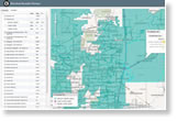 Sangamon County, Illinois, used Esri's election results viewer template to create an interactive mapping application that provides a real-time, spatial view of election results from the web or a mobile device. How did officials there do it? Read the article.
Follow the Flame
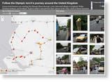 Follow the route of the Olympic torch as it crisscrosses the United Kingdom over the next few weeks using this map created using Esri ArcGIS. The torch's 8,000-mile trek will end when it arrives at the Olympic Stadium in London on July 27, 2012.
A New Guide to Public Data
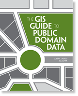 New from Esri Press, The GIS Guide to Public Domain Data gives GIS users relevant information about the sources and quality of available public domain spatial data. Students, researchers, and professionals will find this book useful as they find, evaluate, and analyze data to solve location-based problems. Buy the book.
Try Out the Geoportal Server
 Test Esri Geoportal Server on your own computer using this LiveDVD. Geoportal Server helps organizations manage and publish metadata for their geospatial resources and lets users discover and connect to those resources. The geoportal on the LiveDVD's self-contained operating system is preinstalled and preconfigured. Just boot up and go.
For Developers Only
A heads-up to developers: The Esri International User Conference in San Diego, California, will host four new activities geared specifically for you. Go Speed Geeking and then head to the Hackers' Sandbox, a Dev Meet Up, and the User Interface Design Showcase. Get the details.
Newsroom
Technical Talk
Is Your Raster So Bright, You Have to Wear Shades?
Have you ever added a raster to an MXD and noticed that it looked different? Or created a mosaic dataset or raster catalog and suddenly, the rasters become so bright, you think, "What did ArcMap do to my raster?!" Learn to solve the problem.
Five Great Reasons to Use ArcGIS for SharePoint
Esri developed a way for you to easily add GIS mapping functionality onto SharePoint pages, giving your employees the power to use geographic information. Read this article.
On the GIS Bookshelf
A Python Primer for ArcGIS is one of three new books worth adding to your bookshelf.
What's New in ArcGIS API for Flex 2.5?
Better web editing, for one thing. Read the article.
Using Alternative Thematic Basemaps with Map Viewer in ArcGIS Online
Creating a Multimedia Trail Web Map
Spatial Roundtable
 What's the Cost of a Power Failure?
Most utilities know how much it costs them to restore customers' power after a disaster like a blizzard, hurricane, or tornado knocks the electricity out. Bill Meehan, director of utility solutions for Esri, wonders if geospatial technology can be used to determine just how much a power outage actually costs a community in spoiled food and lost business and opportunities. Join the discussion at the Spatial Roundtable.GIS to the Rescue
 Emergency managers have only minutes to respond to critical situations and coordinate across jurisdictions. That's why the City of Laurel, Maryland, developed the Tandem Emergency Response Platform (TERP), a real-time situational awareness solution built on the ArcGIS system. Watch the video. TERP was made possible through a Small Public Safety Agencies enterprise license agreement (ELA) from Esri.
San Diego: Curated, Mapped
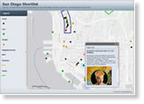 From a maritime museum to a hip French bistro, the San Diego Shortlist map guides you to some of the coolest places for you to visit in your free time during the week of the Esri International User Conference. "This kind of map is easy to make," says Rupert Essinger, the Esri employee who created it. "It is simply a small set of shapefiles uploaded into a web map and shared using one of the built-in ArcGIS Online templates." The map can also be viewed as a full-screen presentation in ArcGIS Explorer Online. (This requires Silverlight.)
Bridging the Gap between IT and OT
Esri public works industry manager David Totman examines the implementation issues and consequences of using GIS as the common platform to bridge information technology (IT) and operational technology (OT) services. Join the discussion at the Spatial Roundtable.
GIS for Health
Are you a hospital executive, planner, clinician, researcher, or social worker interested in attending this year's Esri International User Conference? Browse the agenda for the dozens of sessions devoted to health and human services, including paper presentations, technical workshops, and Special Interest Group meetings. Esri will also host the Esri Health GIS Conference in Scottsdale, Arizona, August 20–22, 2012.
Register for ArcGIS 10.1 Foundational Training
Reserve a spot in one of Esri's instructor-led foundational courses. You will master critical GIS skills, learn to apply recommended workflows, and immediately be productive using ArcGIS 10.1. The courses are available online and at Esri Learning Centers nationwide.
Training Seminar Focuses on Location Analytics Solutions
Missed the Esri Maps for Microsoft Office, SharePoint, and IBM Cognos live training seminar when it aired? The recording is now available.
Esri Offers Free Story Map Templates
These templates will give you an easy way to publish your own story map. No coding is required! Choose from among several templates such as basic storytelling, side panel, and swipe.
Download Historic Conservation and Preservation Map Templates
Two new map templates available in ArcGIS Online support creating services and web maps designed to feature historic preservation and conservation content. You can find these templates in Historic Conservation and Preservation ArcGIS Resources in ArcGIS Online.
Light Gray Canvas Map Updates
Contribute to the Ocean Basemap
New E-book: Essays on Geography and GIS, Volume 4
Hardware Offers
Technical Talk
Web Resources and More
 Esri offers US customers the Data Appliance for ArcGIS for Windows and Linux, manufactured by Cutting Edge for Esri. Data Appliance for ArcGIS provides terabytes of prerendered and precached maps for the world, including imagery, street maps, topographic maps, shaded relief, elevation maps, and much more, so you can set up and serve your own map and task services in the secure environment behind your firewall. Learn more about all the Esri and Cutting Edge offers.
Visit the Esri Store to find more software and extensions, upgrades, data, books, and hardware bundles.