Organizations around the world are turning to 3D GIS workflows and models for asset monitoring, mission planning, and risk analysis. Supporting these efforts are advances such as reality capture and feature extraction from point clouds, which generate extensive and distributed 3D datasets.
Open data standards such as Indexed 3D Scene Layer and 3D Tiles help optimize the distribution of massive 3D datasets on mobile and web applications, enabling tile set integration with advanced 3D workflows. Users can access integrated mesh and 3D object elements of a 3D Tiles tile set from local directories or public services in ArcGIS Pro 3.2. Combined with data and analysis tools, these tile sets provide additional context to help make data-driven decisions with greater accuracy and speed.
The ArcGIS system enables multidimensional databases by integrating unstructured information, geospatial features, BIM, imagery, point cloud, reality mapping, and real-time data. This facilitates the creation of digital twins. These practical, efficient, and sustainable 3D virtual representations of real-world operating environments can improve collaboration, awareness, and understanding.

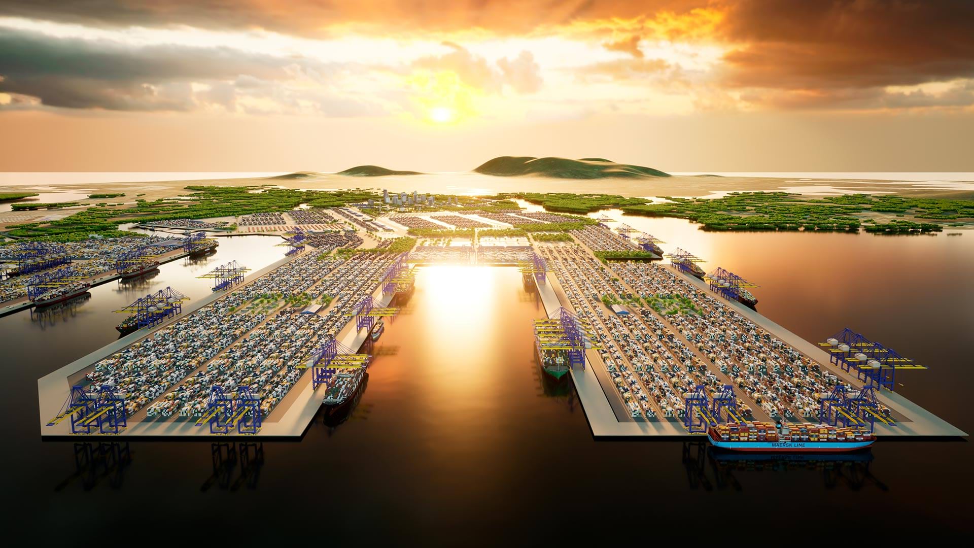
A Vietnam Port’s Digital Twin
Located at the mouth of the Thi Vai and Cai Mep rivers in Vietnam, the Cai Mep–Thi Vai port system is near several major shipping routes, including for the Americas and Europe.
With a naturally deep ship channel depth, the port has the potential to become an even more important maritime gateway to Southeast Asia. But development of the port, which has been operational since only 2009, has been stalled by factors such as dredging needs and the lack of a logistics center. To solve these problems, the government of Vietnam requested a comprehensive study for the port’s navigational channel and primary plan.
To conduct this study, Vietnam-based port and coastal consultancy Portcoast Consultant Corporation developed a digital twin of the port system. Khoi Tran, Portcoast Digital Transformation Centre vice director, said this has helped boost port capacity, reduce environmental impact, and reduce the number of collisions and other accidents. In addition to ArcGIS Pro and ArcGIS Online, Portcoast used ArcGIS Earth, Scene Viewer, and ArcGIS Maps SDKs for Unity for the project.

Tran said Portcoast is also using data from GPS, terrestrial laser scanners, unmanned aerial systems with lidar and photogrammetric sensors, mobile mapping systems, unmanned surface vehicles with wideband multibeam and side-scan sonar, and subbottom profilers with drilling geotechnical boreholes for data collection. This data is processed and integrated using GIS and BIM to construct 3D assets such as reality mesh, 3D point clouds, 3D objects, and BIM models. The survey, BIM, and GIS data is used to create an accurate representation of the port’s physical environment.
With immersive 3D content across desktop and mobile devices, the web, and game engines, this enables stakeholders to explore and interact with a virtual representation of the port system, providing details about underground technical infrastructure—subsurface structures, riverbeds, and geological layers—and other information needed for effective management, maintenance, and operation.
Tran said it also enables analysis and simulations of various scenarios to evaluate the impact of proposed changes or expansions and optimizes the design and operation of the port. This fosters better decision-making processes, heightens efficiency, and mitigates risks and costs associated with infrastructure development and management. Overall, Tran said, it shows how a digital model of infrastructure and urban areas can meet modernization requirements and address global trends.