ArcGIS technology has advanced over the past decade to more fully meet the needs and requirements of organizations that perform field operations. Whether those mobile activities lie at the center of a company’s business model or are ancillary to an organization’s goals, the results of their execution can significantly influence outcomes.
In the last five years, Esri’s field operations offerings have evolved, too. They’ve progressed from initially focusing on map viewing and data collection to encompassing optimized routing, work management, and location tracking. Now, the way users employ these mobile apps is evolving, too.

While having a flexible framework that allowed the separate use of one or more field apps at a time was valuable, customers have experienced some pain points around deploying and maintaining multiple apps. Mobile users were also challenged by having to individually sign in to all the different apps, deploy offline maps on a per-app basis, and switch from app to app when completing workflows that required using more than one.
To resolve these issues and provide app users with a better experience, Esri’s field apps team created a single app that incorporates the full range of field operations capabilities: planning and managing work, navigation, data capture, and monitoring projects and personnel.
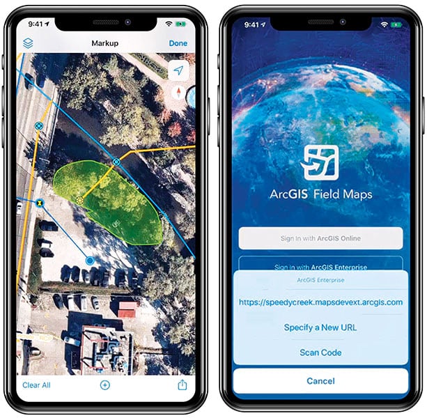
The new ArcGIS Field Maps app, introduced to customers in the early adopter beta program in July and now available to everyone, brings together the functionality of ArcGIS Collector, ArcGIS Explorer, and ArcGIS Tracker to give users the ability to collect data, view maps, and track locations all within a single mobile app.
Field Maps has two components, a mobile app and a web app. The mobile app is powered by maps created with ArcGIS and configured using the Field Maps web app. The web app streamlines map configuration and deployment by bringing together the experiences throughout ArcGIS that support offline capabilities—including configuring feature templates, form capabilities for data capture, and editing in the field—in one place.
In addition, with Field Maps, a single map can support all field workflows, meaning it’s no longer necessary to have separate maps for data collection, map exploration and markup, navigation, and work management. This minimizes device storage consumption that often results in reduced app performance.
Mobile personnel who use Field Maps benefit from map-centric workflows that make it easy to explore a map of a work area, search within the map to find assets or places of interest, and record location tracks. Data that they edit or capture feeds directly into the organization’s ArcGIS system, where it’s available for others to use in near real time. Field Maps works seamlessly in disconnected environments, too. It retains collected data on the mobile device until connectivity is available, and then it syncs with the organization’s ArcGIS platform.

For GIS administrators who manage an organization’s mobile devices, having all these field apps available via one app makes it easier to assign apps to mobile personnel. There’s only one app to manage and update—Field Maps—rather than having to do all this work separately in Collector, Explorer, and Tracker. In future releases, Field Maps will also include the work management capabilities of ArcGIS Workforce and the navigation functionalities of ArcGIS Navigator.
Existing customers that currently use Collector and Explorer either as stand-alone apps or through the Field Worker user type license get the same data collection and map viewing capabilities with Field Maps. Those that also use Tracker experience the same location tracking capabilities they currently have. And all the capabilities that have previously required the use of three separate apps are now available within the Field Maps app.
For users who are only now getting ready to digitally transform their mobile operations, Field Maps is the best place to start. It’s where all future development and new capabilities will be delivered.
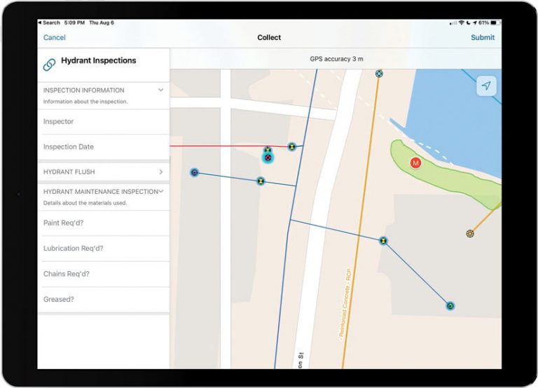
The use cases for Field Maps vary widely. For organizations that manage significant infrastructure, such as utilities or pipeline owners, Field Maps provides a streamlined experience for inspection and maintenance workflows. An inspector, for example, can use Field Maps to find assets that need service; follow a built-in inspection form to document any findings; and if necessary, confirm through location tracks that the correct asset was inspected.
Home health workers, as another example, can use Field Maps and its smart form capabilities to complete built-in health surveys for their patients. They can also employ app-based location tracks to show supervisors that they’ve covered their areas of responsibility.
With Field Maps, decision-makers can stay aware of how work is progressing and where their crews are by viewing location tracks. If an associate in the field doesn’t report in when expected, managers can see that person’s last known location, making it easier to provide help if needed.
For anyone involved in field operations—from GIS administrators to crews and supervisors—it’s game changing to be able to deploy, use, and manage all the robust GIS capabilities that are so critical to field activities from one app.
Learn more about ArcGIS Field Maps.

