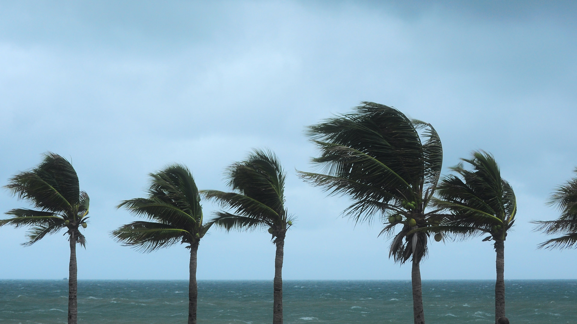
The volcanic eruption that covered Saint Vincent and the Grenadines in ash in April, the numerous hurricanes and tropical storms that have swept through the region this season, and the magnitude 7.2 earthquake that hit Haiti in August are reminders of the threats people in the Caribbean face all too often.
Amid these crises, a group of organizations has begun to improve regional GIS capabilities, increase GIS capacity and geographic thinking, and foster an environment for information sharing and collaboration. The aim is twofold: to better support work across the region, especially during responses to natural hazards, and to prepare for a more resilient and sustainable future.

They are doing this via the new Caribbean GeoPortal, a comprehensive, cloud-based platform from Esri that combines GIS technology with geospatial data to build local capacity. Launched in collaboration with the United Nations Regional Committee on Global Geospatial Information Management for the Americas (UN-GGIM: Americas), the Caribbean Geospatial Development Initiative (CARIGEO), the UN’s Economic Commission for Latin America and the Caribbean (ECLAC), and others, the Caribbean GeoPortal is focused on advancing the following three goals for the region:
- Increasing organizations’ GIS capacity through training and education
- Improving collaboration and information sharing among organizations
- Providing organizations with the necessary GIS capabilities to support their work
“The geoportal’s data and solutions are local to the Caribbean community,” explained Sean McGinnis, Esri’s geoportal program manager. “Everyone who signs up gets credits to use Esri content and services to help them address the situations they are dealing with, whether that’s responding to a disaster or crowdsourcing information about economic development and opportunities.”
Connecting Technology, Authoritative Data, and People
In recent years, the availability of and access to geospatial, statistical, and earth observation data in the Caribbean has grown. Yet there is still a need to organize, discover, share, and analyze this data to more effectively support decision-making. Many organizations in the region have embarked on this journey individually, but they could have a much greater impact if they are able to work together more easily.

“There are many geospatial portals across the Caribbean that provide a variety of datasets and services. This…means that there are a commensurate number of groups and initiatives having similar objectives, which are often under-resourced with few technical experts,” explained Cecille Blake of the UN-GGIM Secretariat in the UN Statistics Division, who joined the organization after 18 years of leading Jamaica’s National Spatial Data Management Division. “The challenge we need to address is how these shared datasets and experts can best support the people and processes within each country to make better decisions.”
In a nutshell, that’s what the Caribbean GeoPortal aims to do. For those who have lacked access to GIS technology and location data, they can now work within the geoportal to build their skills and knowledge by using ArcGIS technology along with data from agencies such as the National Aeronautics and Space Administration (NASA) and the National Oceanic and Atmospheric Administration (NOAA).

The geoportal enables users to quickly search and discover various geospatial resources, including data about the region, imagery, raster datasets, and readily usable web services. Because the Caribbean GeoPortal is federated and managed by authoritative organizations across the region, users can validate and ensure the quality, timeliness, and availability of registered resources to support their work.
All this is made possible by employing three key components of the ArcGIS system. First, the core technology and capabilities of the Caribbean GeoPortal are built on ArcGIS Online and ArcGIS Hub. Together, these allow users to display, analyze, and share data. Next, ArcGIS Living Atlas of the World gives users a curated collection of authoritative data from providers around the world. The Caribbean GeoPortal also has a selection of ArcGIS Living Atlas data that is specific to the region so users can access open and authoritative data from providers and producers in the Caribbean. And finally, Learn ArcGIS lessons that are available on the Caribbean GeoPortal enable users to expand their general GIS skills, increase their geographic literacy, and learn how to make better use of the new capabilities and data shared within the geoportal.
Contributing to Natural Hazard Planning and Response Efforts
The Caribbean GeoPortal has already served as a significant resource in preparing for, responding to, and providing relief efforts for several crises that have occurred in the region in recent months.
When La Soufrière erupted in Saint Vincent and the Grenadines, one of the first questions asked was, What is the impact? Given the magnitude of the eruption, the effects were not limited to the immediate area and seismic activity; they extended to neighboring islands as well, as ash from the eruption scattered far.

By employing data from NASA made available through the Caribbean GeoPortal, users were able to quickly understand how the eruption affected the rest of the region. For instance, they ran plume models to get a better idea of how the volcanic ash was moving through the air and anticipate where response and recovery efforts would be needed.
Users in the Caribbean community are also beginning to use the geoportal to get ready for and better discern the impacts of potential storms.
“The Caribbean GeoPortal has now become an important go-to resource for me in tracking Atlantic storms,” said Lavern Rogers-Ryan, GIS manager for the Government of Montserrat’s Ministry of Agriculture, Land, Housing and the Environment. “I am able to view the associated NOAA layer, which provides real-time data on hurricane watches, warnings, and tracks. In the 3D scene viewer, I am able to zoom in, zoom out, and pan around the map to see which islands will potentially be affected.”
Rogers-Ryan finds the information on wind speed particularly useful to give her an idea of how severe a storm may be.
“[Because I live] in the Caribbean, this dynamic mapping gives me a better understanding of the potential risks faced by my island and neighboring islands, especially during the active hurricane seasons,” she said.

When a powerful earthquake struck Haiti on August 14, the Caribbean GeoPortal team was able to act quickly. With the technology’s infrastructure already in place, the group was able to stand up a new geoportal for Haiti straight away to get vital information to residents, responders, and decision-makers who were mobilizing to help the community.
The Caribbean GeoPortal allowed the team to rapidly configure the country-specific site and federate key data sources that were critical to the event, such as NASA’s data on soil moisture and landslide susceptibility and the UN Satellite Centre’s damage assessment imagery. The geoportal also enabled organizations to easily share their authoritative data among its users, including data scientists, emergency response professionals, teachers and students, and the public. This was crucial for decision-makers, who could trust that they were using the appropriate data when determining plans of action.
Initiating a More Collaborative and Sustainable Future
Building geospatial infrastructure and geographic knowledge across the Caribbean region is a critical and shared goal for the Caribbean GeoPortal team—one that has immediate ramifications as hurricane season wraps up, as well as larger, long-term gains.
“I was really inspired by [Esri president Jack Dangermond’s] vision for collaboration,” said Paloma Merodio Gómez, vice president of Mexico’s National Institute of Statistics and Geography (known by its Spanish acronym INEGI) and chair of UN-GGIM: Americas. “Thanks to the help of Esri, this CARIGEO project is really the start of something bigger.”
As more partners join the Caribbean GeoPortal and begin to collaborate, and as more people learn how to use GIS technology to better understand risk and vulnerability in the region, a more sustainable and resilient future will begin to take form.