A Digital Twin of Istanbul Now, a 3D Cadastre of Türkiye Next
As the country maps every building, parcel, and property boundary in 3D, it is transforming how property rights are managed.
As the country maps every building, parcel, and property boundary in 3D, it is transforming how property rights are managed.
To account for unique geography and elevation variation, the city used an ArcGIS Pro script tool to model streetlight distribution in 3D.
To try to identify victims of the 1921 Tulsa race massacre, investigators are using GIS to make a 3D model of Oaklawn Cemetery’s Section 20.
Esri provides a large collection of 2D and 3D basemaps built with data from Esri, OpenStreetMap, and soon the Overture Maps Foundation.
Crisfield, Maryland, has high flooding risk. A digital twin, built with ArcGIS technology, is helping to assess flood adaptation strategies.
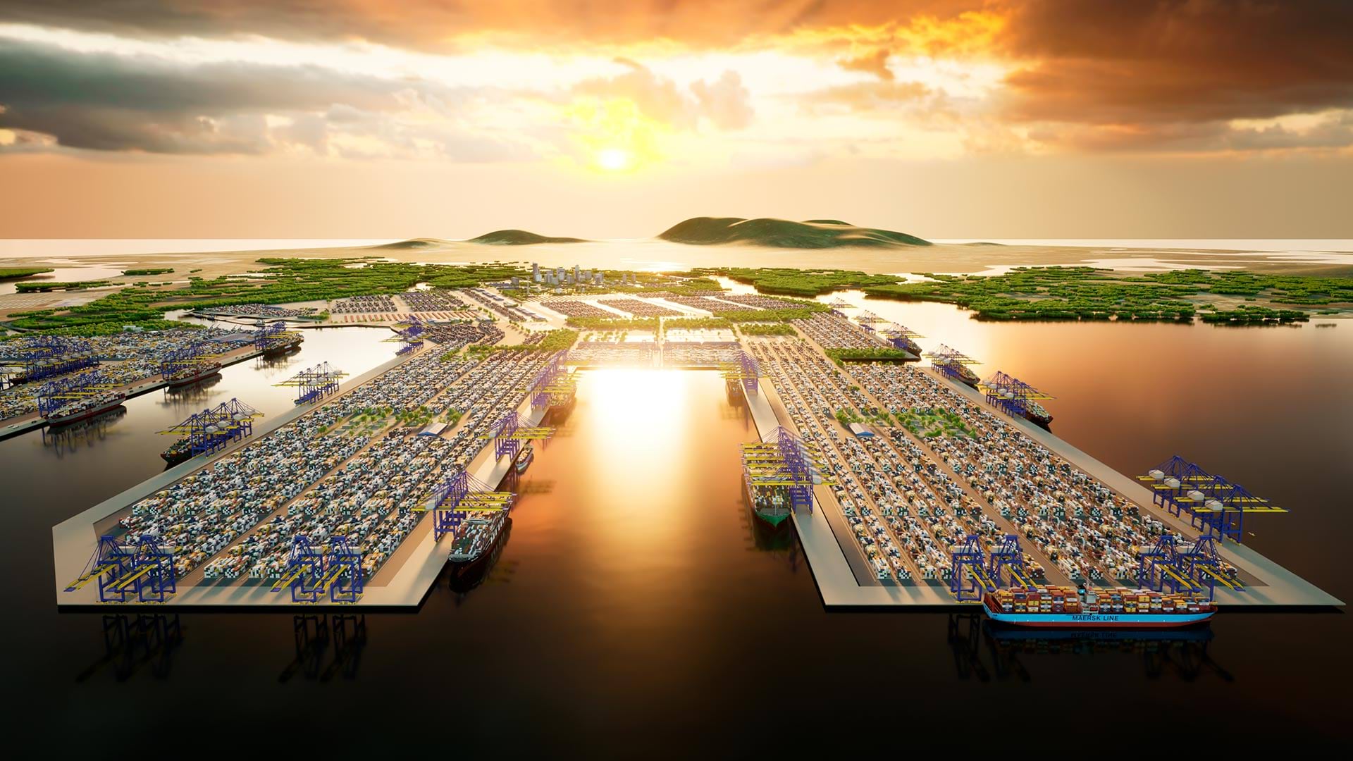
3D GIS workflows and models have created a digital twin to help guide development of port facilities in Vietnam.
Launched in November 2023, ArcGIS Enterprise 11.2 includes a variety of new and improved analysis and data management tools.
ArcGIS Image provides flexible data management, extensive sensor support, imagery processing and analysis capabilities, and secure sharing.
For a team of archaeologists, GIS offers an effective way to collect data and quickly disseminate project findings in compelling formats.
In addition to reducing errors and mitigating risk, the workflow allows for the complete interoperability of BIM and GIS data.
Erie Water Works saves hundreds of thousands of dollars with its GIS-based implementation.
Airflow Analyst uses 3D urban models and meteorological data to predict ventilation in places like stadiums and public transit stations.