Spatial Data Is the Key to Community Conservation
Native pollinator habitats are under threat. Learn how John Ball Zoo is revitalizing them and engaging communities in conservation efforts.
Native pollinator habitats are under threat. Learn how John Ball Zoo is revitalizing them and engaging communities in conservation efforts.
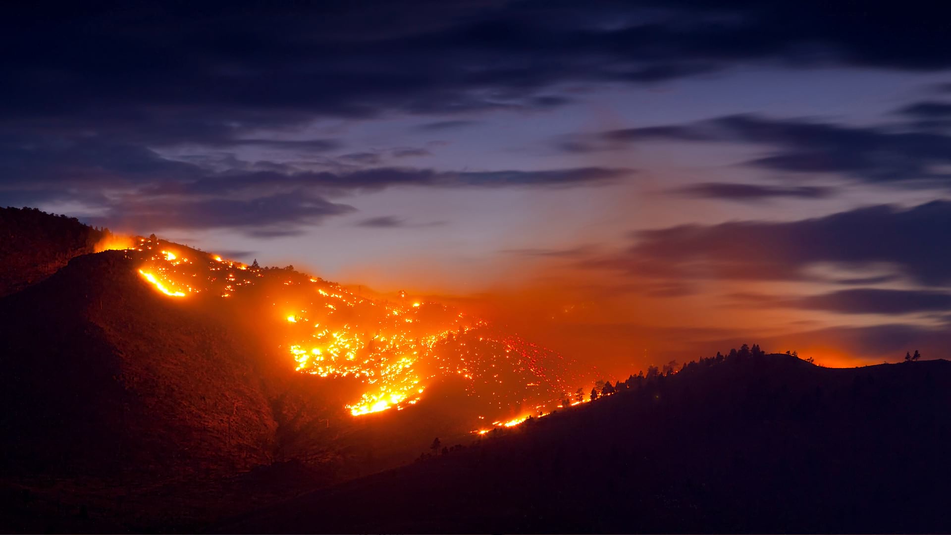
With ArcGIS technology, Fire Neural Network maps high-risk lightning strikes to help firefighters and communities allocate resources.
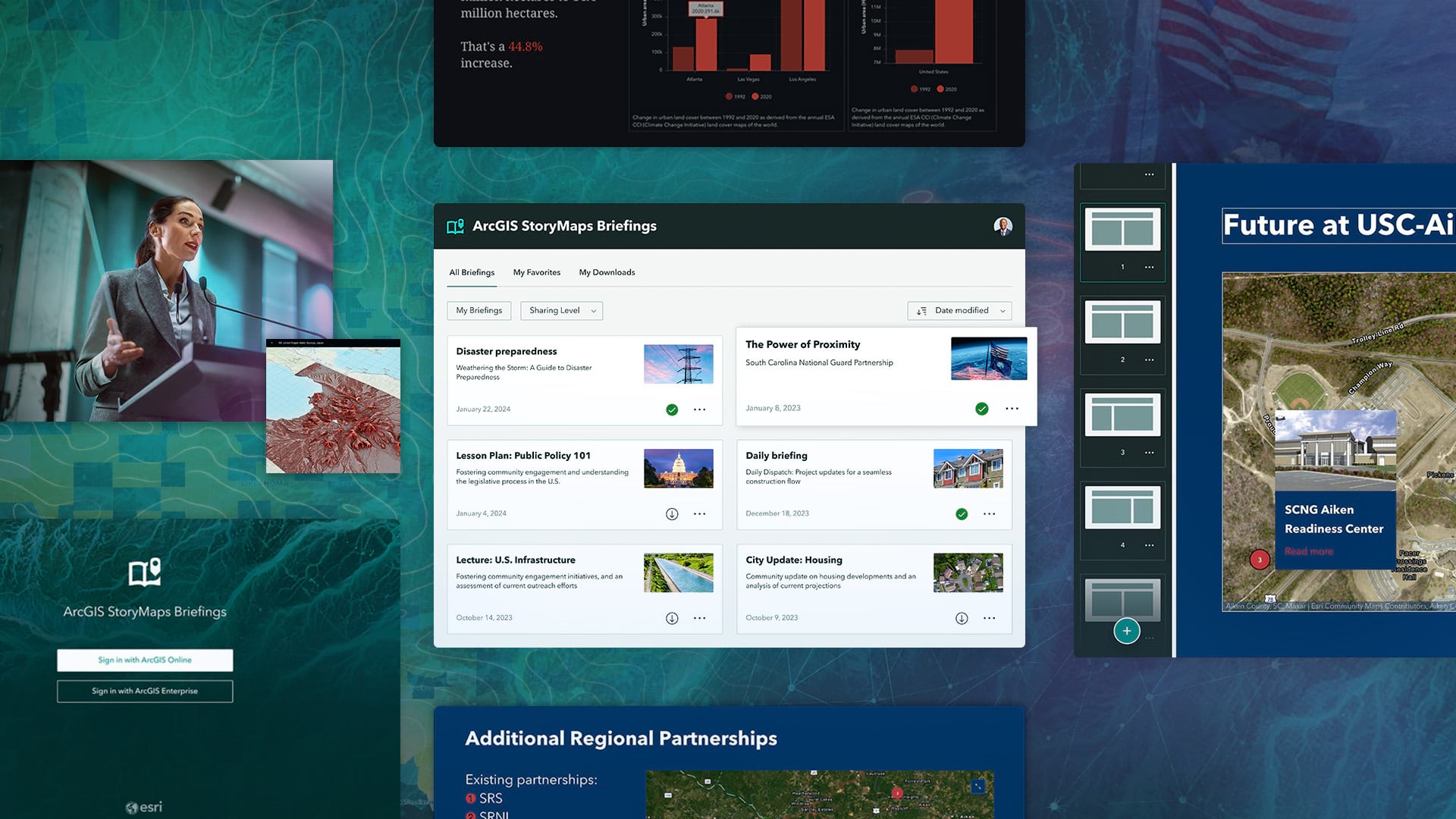
A new StoryMaps output type called briefings helps users create accessible, brand-specific slide-based presentations.
The City of Rochester Hills, Michigan, uses ArcGIS Survey123 to track community education and safety device installation.
DashFLUboard allows users to monitor wild bird migrations and connect outbreaks of Highly Pathogenic Avian Influenza (HPAI) around the world.
Truck drivers now have easier access to map-based information about commercial vehicle restrictions, such as height and weight limitations.
A new version of ArcGIS Dashboards that provides better performance, enhanced features, and refreshed designs is available for general use.
Scientists at the Stimson Center monitor the impact of hydroelectric power projects on the Mekong River in Asia.
As the new coronavirus began to spread in early 2020, many Esri users built maps and dashboards to share critical data about the virus.
The new ArcGIS Dashboards beta lets users test-drive several new features, including improved usability and new data sources.
To better identify sections that need maintenance or could become commerce choke points, Esri partner SymGEO implemented ArcGIS Dashboards.
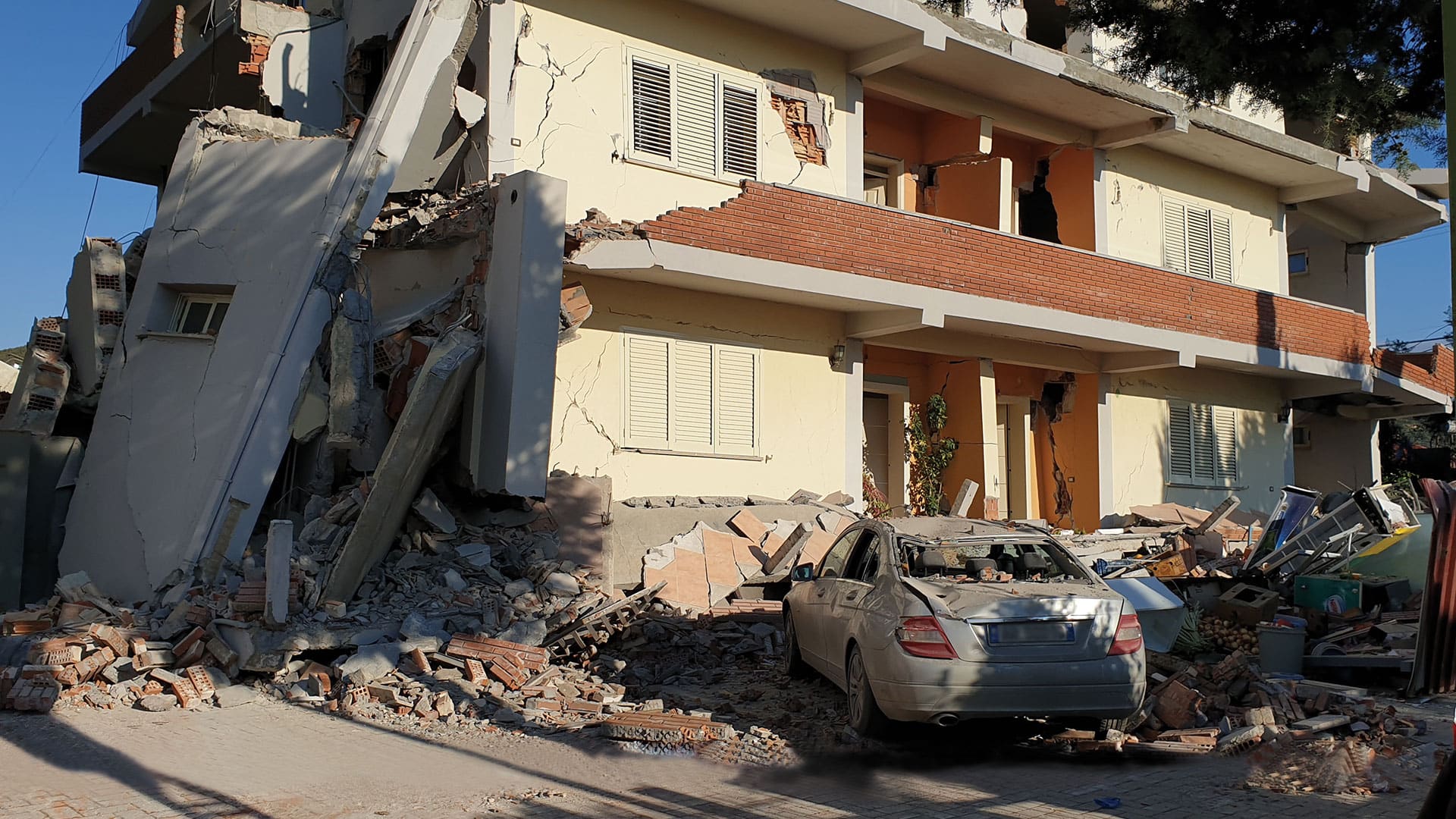
Location-based surveys and dashboards helped citizens, local agencies, and international organizations work together.