Empowering Conservation Through Community and Collaboration
ProtectedSeas, a pioneering project that maps and shares global ocean protection data, is now part of ArcGIS Living Atlas of the World.
ProtectedSeas, a pioneering project that maps and shares global ocean protection data, is now part of ArcGIS Living Atlas of the World.
For disaster-prone nations, spatial analysis and effective data sharing are crucial for climate mitigation, adaptation, and resilience.
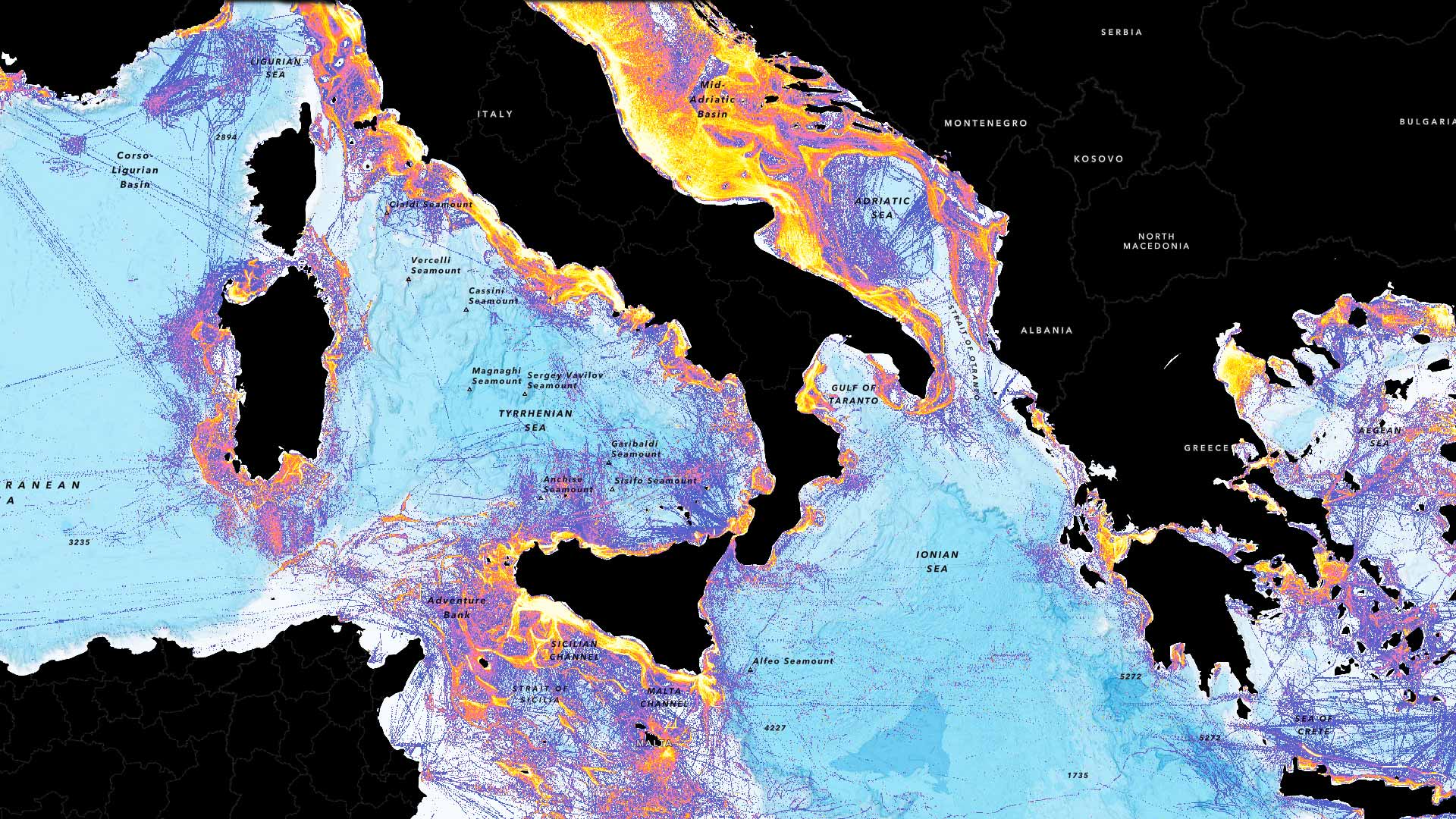
New fishing layers in ArcGIS Living Atlas of the World let users gauge the intensity of fishing operations around the globe.
The Fisheries and Climate Toolkit brings together data sources and employs ArcGIS Hub to foster collaboration among various stakeholders.
ArcGIS Living Atlas has up-to-date ACS data, Esri and NOAA are creating a hub for ocean data, and Autodesk Forma is getting geospatial data.
ArcGIS Maritime now integrates with ArcGIS Field Maps, taking Electronic Navigation Chart production out of the office and onto the water.
A dynamic and interactive web app now educates visitors on critical issues and best practices.
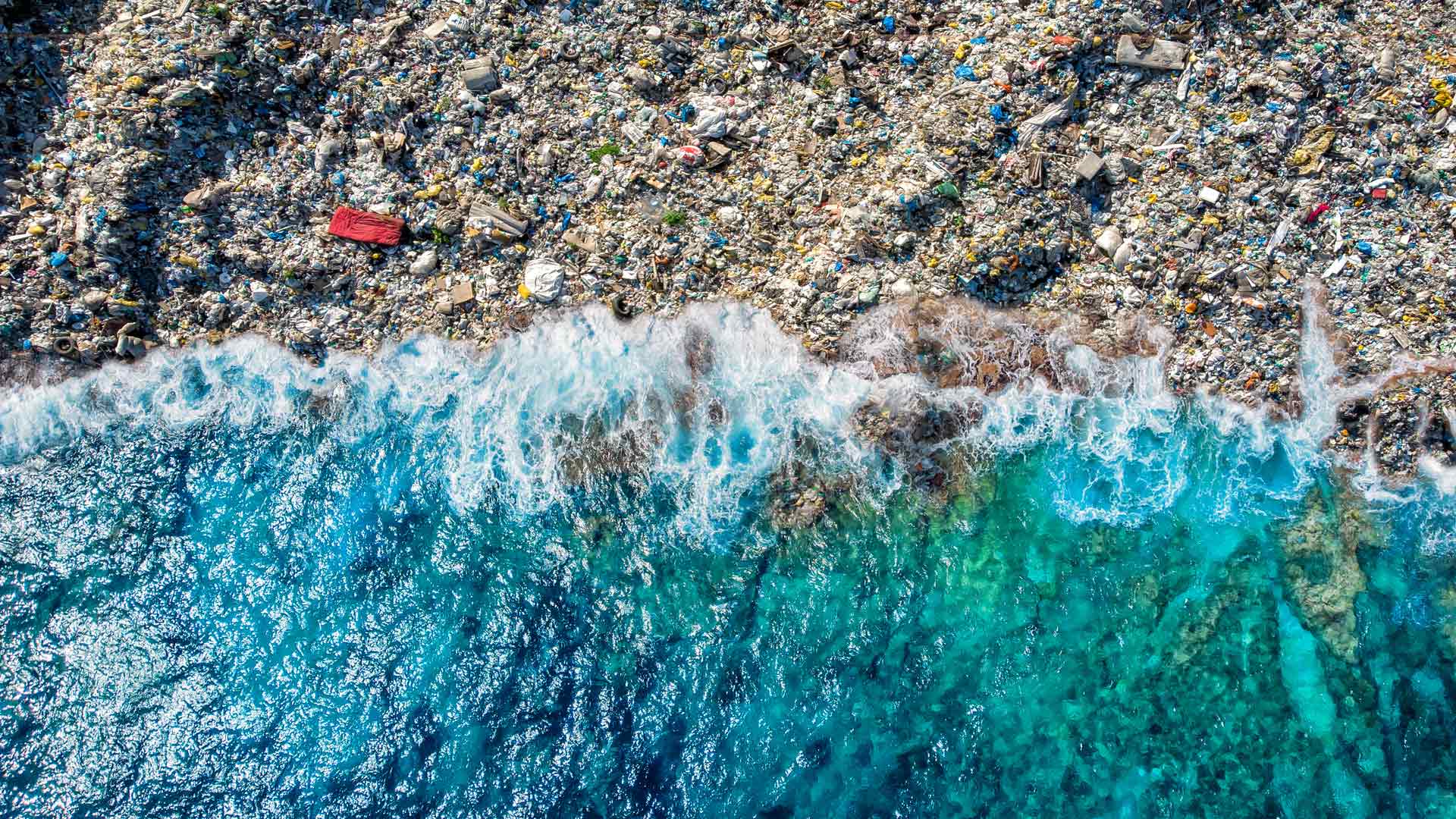
The GIS user community is key to figuring out which beaches around the world are consistently fouled by plastic and how to clean them up.
Esri’s chief scientist became the first person of African descent to dive to Challenger Deep, where she surveyed its Western Pool.
Scientists know more about the dark side of the moon than they do about Earth’s ocean depths. Seabed 2030 seeks to change that.
One way to cope with climate change on a global scale is by continuous, near real-time mapping and monitoring of the face of the Earth.
Miami Beach, Florida, is one of the most vulnerable areas for sea level rise in the United States.