Technology Transformed
In this Q&A, Esri director of software products Clint Brown reflects on how GIS grew from a niche field into a vital industry.
In this Q&A, Esri director of software products Clint Brown reflects on how GIS grew from a niche field into a vital industry.
Some claim that Easter Island suffered from ecological and societal collapse. A digital twin disproves this theory.
The drone industry has been through highs and lows—and it is now at a crucial point that’s intertwined with mapping and GIS technology.
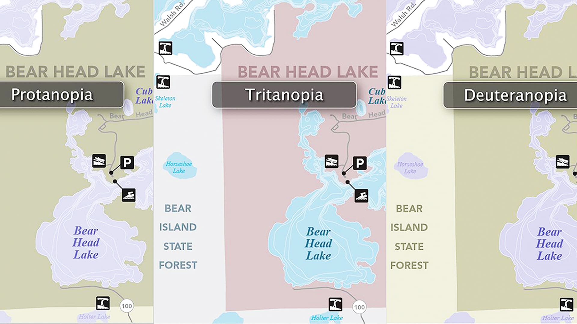
A statewide team ramped up digital accessibility efforts created an online resource center that can help anyone make accessible maps.
Esri partner Epistemix helped the Riverview School District in Pennsylvania make better-informed policy decisions.
In 2014, the French government launched Nouveau Programme National de Renouvellement Urbain (NPNRU), its national program for urban renewal.
Clay County Utility Authority used ArcGIS Data Reviewer to improve quality assurance and quality control processes.
The latest release of the Land Administration Information System in Rwanda is transforming the way the country manages its land.
The Census Bureau collaborated with Esri, weaving geospatial capabilities into every operational component of its 2020 Census.
The new Agri-GIS app is bridging the spatial analytics gap in Indian farming communities.
Zibumi will help advance 3D visualization and simulation in Esri software and expand the integration of game engine technologies into ArcGIS.
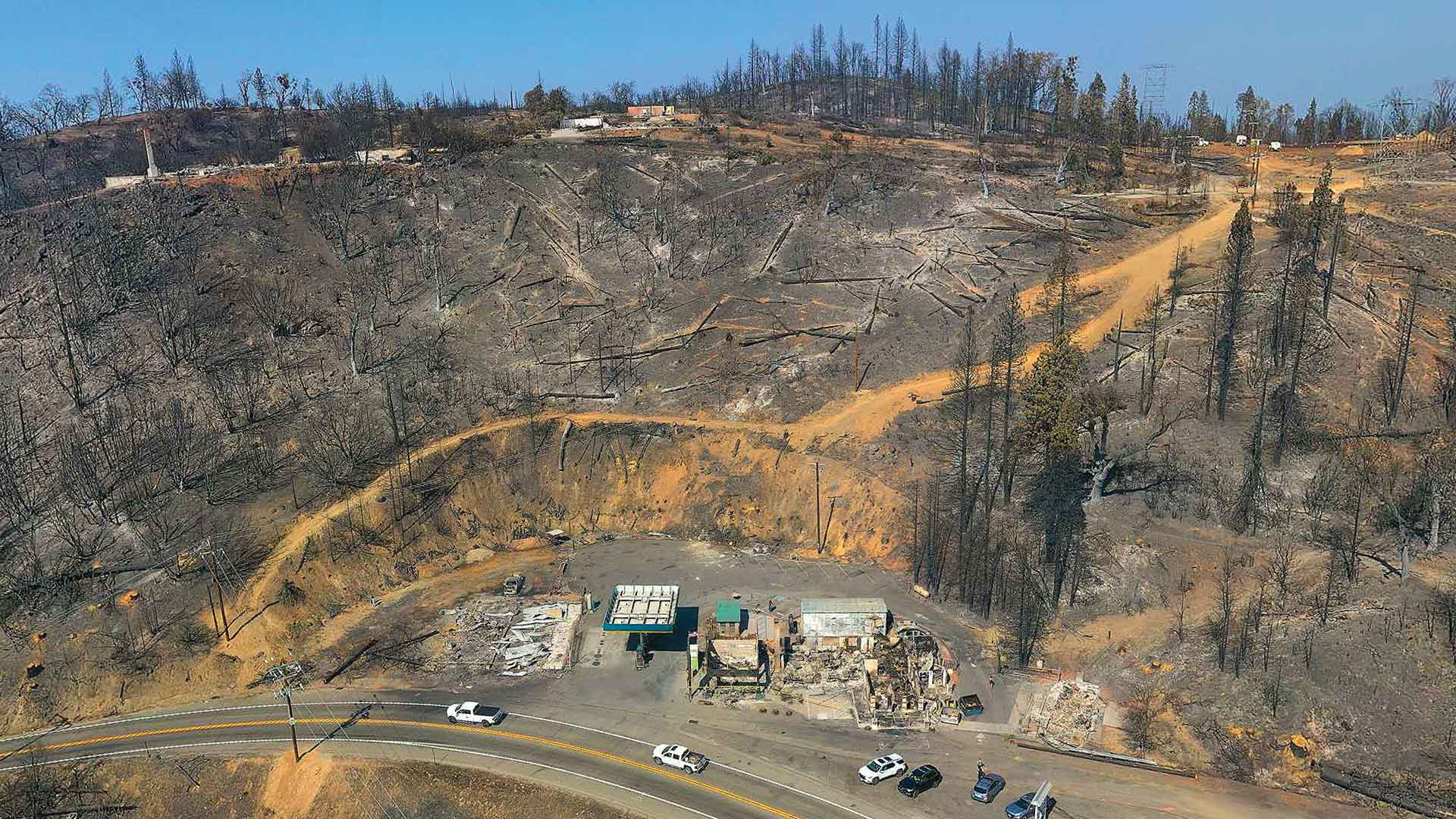
Law enforcement working on California wildfires tasked Esri partner and geospatial consulting firm GeoAcuity with obtaining aerial images.