Balancing human livelihoods with wildlife conservation requires precision and patience. African People & Wildlife (APW), a US-based nonprofit operating in Tanzania, initially set out to help Maasai pastoralists protect their herds from big cats.
Two decades later, the nonprofit has expanded its mission into an even more complicated balancing act, using GIS as foundational technology. Working closely with the Maasai people and leaning into their deep, historical knowledge of the land, APW is helping them document phenomena across the Maasai Steppe, from the changing plant heights and heavy rains to invasive plants and insect habitats.
But the point is not to change traditional ways. Rather, it is to connect the knowledge that’s already being gathered and demonstrate to others how the Maasai have sustained their land for so long.
-
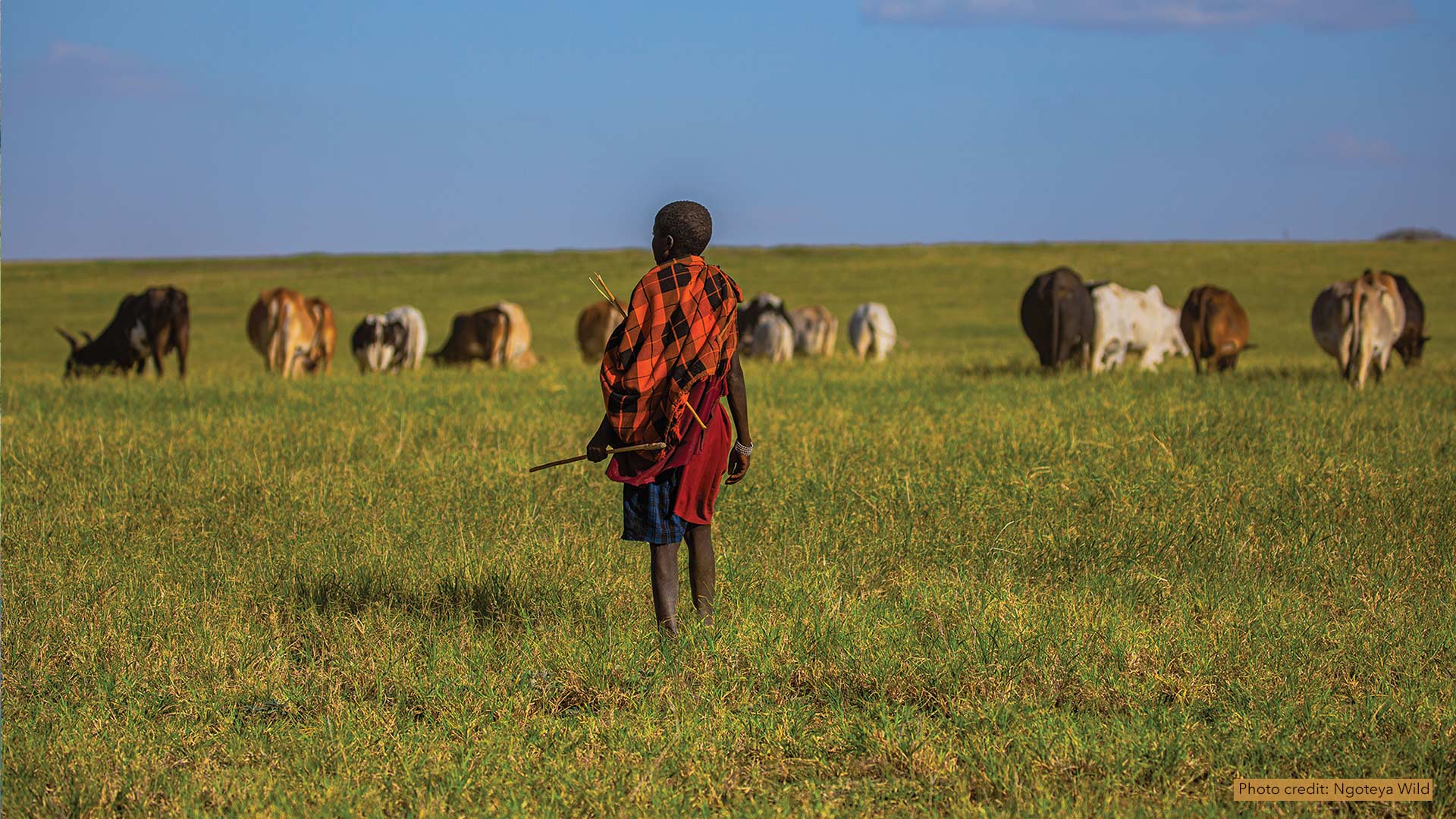
The Massai Steppe spans over 15,000 square miles of wetlands, rangelands, and savannahs. (Photo credit: Ngoteya Wild.)
Lions at the Gates
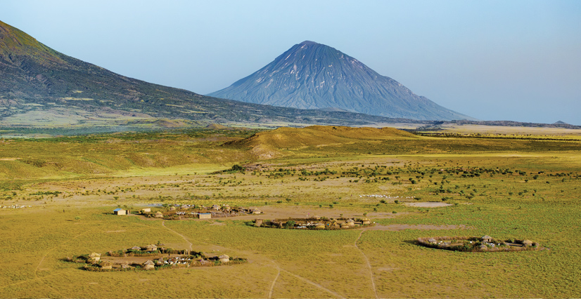
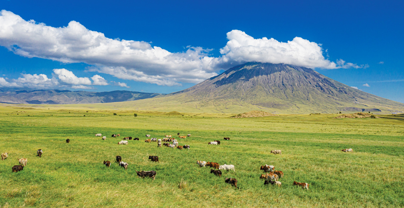
APW’s Sustainable Rangeland Initiative helps Maasai pastoralists preserve their traditional way of life in the heart of the Tarangire-Manyara ecosystem. Also called the Maasai Steppe, the region spans over 15,000 square miles of wetlands, rangelands, and savannahs.
Around 600,000 ethnically Maasai people live in the area, tending to millions of cattle, sheep, and goats. Around half of the villages APW partners with lie between two national parks, Tarangire and Lake Manyara.
Under a legal framework created in the 1990s, the Maasai manage the rangelands between the parks while practicing certain conservation approaches, such as rotating fields to provide passage for migratory animals. Migration heightens the potential for conflict with wildlife—through predation or grass trampling—but herders are prohibited from harming the animals.
APW’s original mission was to work with villages via its partner organization, Tanzania People & Wildlife (TPW), to reduce conflict caused by big cats—mostly lions—moving between protected areas and communal lands, where livestock are vulnerable to carnivores.
The Maasai had long used nighttime corrals, called bomas, surrounded by thornbushes to deter wildlife. These bomas tended to decay rapidly, giving lions access. Their attacks on livestock often led to killing the protected animals.
APW helped the herders design sturdier bomas called Living Walls, which have thick groves of trees reinforced by chain-link fences. They were a success, but there were larger, more holistic issues.
“You couldn’t just solve the problem of lions eating cows,” said Katy Teson, APW’s communications and outreach manager. “What about poverty? What about the land?”
Old Ways, New Methods
When TPW launched the Sustainable Rangeland Initiative nearly a decade ago, the organization worked with three villages. They used open-source software to gather and process the data, along with ArcGIS Desktop. The results were presented to villagers through slideshow presentations.
“The process was very cumbersome for the team,” said Elizabeth Naro, TPW’s director of monitoring, evaluation, learning, and adaptation. “The program couldn’t expand drastically until we received ArcGIS Online.”

Around 2019, TPW began working with ArcGIS Solutions for Protected Area Management—now called the Conservation Land Management toolset.
“That was a real game changer,” Naro said.
TPW transferred data collection workflows to ArcGIS Survey123 and adopted ArcGIS Dashboards for visualization.
“That let us grow the program quickly to meet the demand of villages requesting support,” Naro said.
TPW loads Survey123 on smartphones used by the pastoralists. Once a month, herders survey each plot of land by walking it and entering data every five meters. TPW staff then use ArcGIS Online to add the data to a dashboard for that village.
The data for all plots in a village goes into a larger dashboard, which pastoralists can view at small technology centers that TPW helped build. Some of the dashboard data is shared with other villages via sites built with ArcGIS Hub.
Naro stressed that the initiative is more about reframing old ways than introducing new ones, with GIS being used to help quantify and explain Maasai pastoralist methods.
“These herders are still using indigenous methods,” she said. “We’re just providing the opportunity to integrate this knowledge with modern technology.”

Grass height, for example, has always been a carefully watched metric of a field’s health. Herders would make scratches on their legs to mark the height. Over time, a herder’s scarred legs would become a living record of several years of herding on a plot.
“Older generations can have scars that provide amazing datasets, going back 50 years,” Naro said.
These methods were the Maasai’s version of the penciled-in data that field observers worldwide make while collecting data. One might argue that scarred legs are a more practical way of storing and accessing data than filing cabinets filled with years of spreadsheets. The drawback of both methods is that they make it hard to visualize data and discuss it with others.
For the Maasai, GIS also gives them in-creased visibility of official sources of knowledge and funding.
“Unfortunately, we’ve noticed there’s often not a lot of credence in the scientific community given to indigenous methods,” Naro said.
Plant Invaders
Naro recently demonstrated how the dashboards organize information. On her monitor, she zoomed in on a village called Ngoley (pronounced n-go-LAY). The screen was populated with the various plots used by Ngoley’s herders.
Graphics on the dashboard showed the last few years of grass height, vegetation cover, and “perceptions of the state of the rangeland,” she said. “That one is very important to me because I’m not a pastoralist, so I care what the other community members think.”

Another graph measured the presence of invasive plants, which also tracked closely with rainfall. Naro focused on the rainy season months of 2023, when an especially strong El Niño season produced record-setting torrential rains.
The rains had been a welcome respite from a two-year drought. But for the herders, they also represented the kind of imbalance the Sustainable Rangeland Initiative tries to rectify.
A pink line revealed the proliferation of the Sphaeranthus plant on the fields. Like other invasive plants, it had increased after the El Niño rains. But it can also survive dry periods, so even as the rains receded, the plants remained.
The only livestock that will eat the plant are goats—and even they soon tire of it.
“It’s thorny and nasty,” Naro said. “It makes a pasture useless.”
As Sphaeranthus takes over the land, wildlife is forced to find different routes to healthy grasses, which can lead to more conflict with humans and livestock.
Herders didn’t need a dashboard to tell them about the problem—they could see the plant spreading across the rangelands. The dashboard made it easier for the village to apply for funds to mount a massive eradication effort. The data also provided a good baseline to monitor the aftermath of the project.
From Cats to Bees
APW continues to find new ways to help people on the Maasai Steppe and in other regions of Tanzania address problems of imbalance. A women’s beekeeping program, though separate from the rangeland initiative, has similar habitat benefits.

The honey that bees produce offers economic advantages to the villages. The pollination helps the continued proliferation of native plants. Tanzanian law also protects trees with beehives and the land around active hives, extending conservation benefits even further.
“One of the reasons we cocreated the beekeeping project with communities is to help women have a sustainable income in a way that ties closely to the rangelands,” Teson said. “We have the same data-driven GIS approach for conflict, rangeland, and beehive data—there are now so many different layers to our map.”
“We want to keep formalizing the data collection process in a way that lets the outside world truly appreciate what the Maasai people do and give them financial support for programs like the invasive species uprooting,” Naro added. “And also, ideally, make it so they don’t have to cut their legs every year.”