AI Needs Geography—and You
While AI can process information at unprecedented scale, geography gives that information meaning. GIS professionals know this intuitively.
While AI can process information at unprecedented scale, geography gives that information meaning. GIS professionals know this intuitively.
Find out about a new ArcGIS StoryMaps format, tune in to the Esri & The Science of Where podcast, and get prepared for the Esri UC!
In the US, the technology is there to transition to fully digital addressing networks that use live GIS data to route emergency calls.
When mapping with communities, cartographers and geographic information scientists can rethink their processes to better fit a new purpose.
This collection of programs and resources supports organizations that seek to create a more sustainable future.
Learn more about AI in ArcGIS, check out ArcGIS Pro Shorts for quick tutorials on key tools, and see what innovation award Esri won.
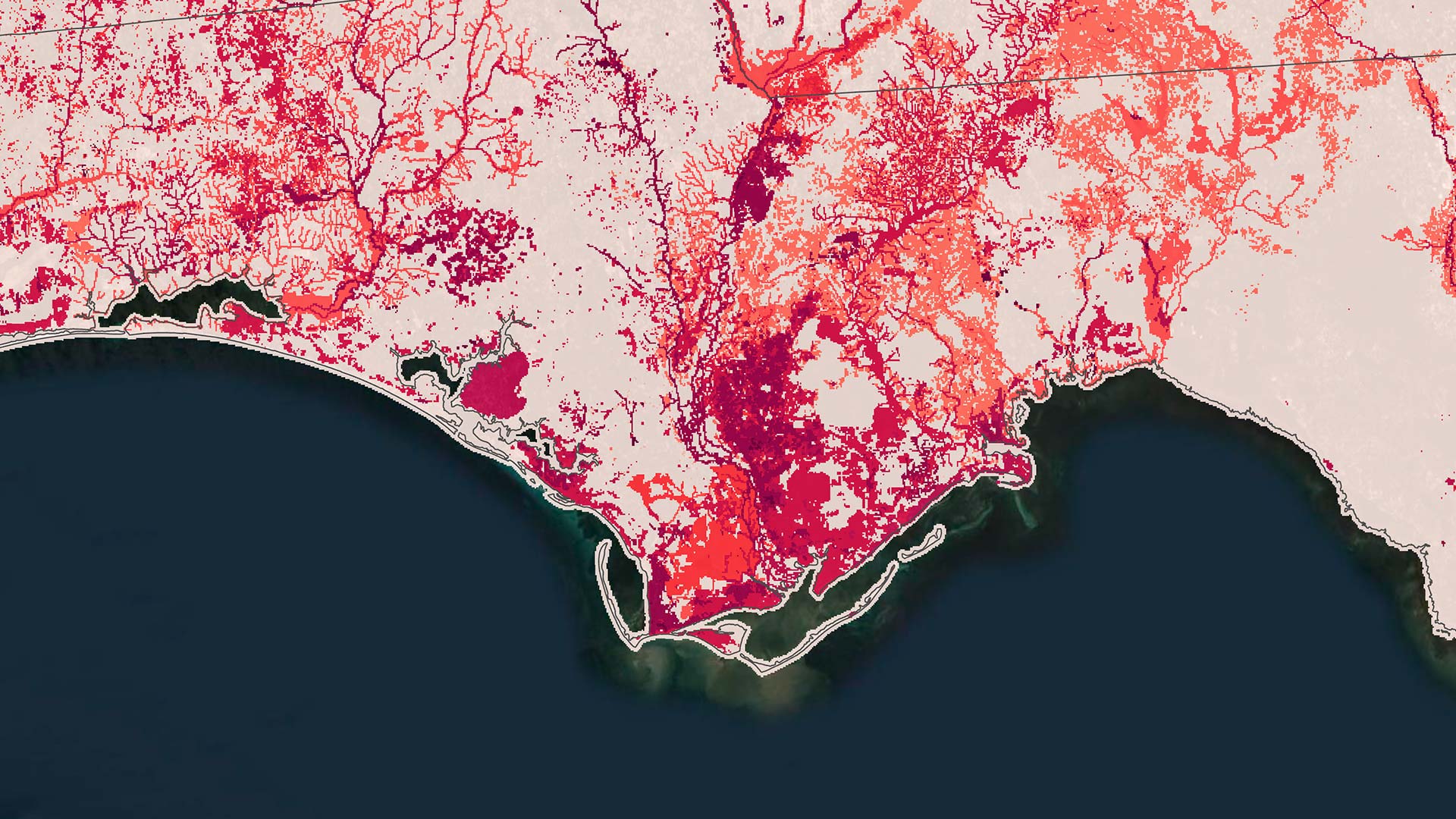
Using GIS and predictive modeling, NatureServe shows where conservation efforts matter most.
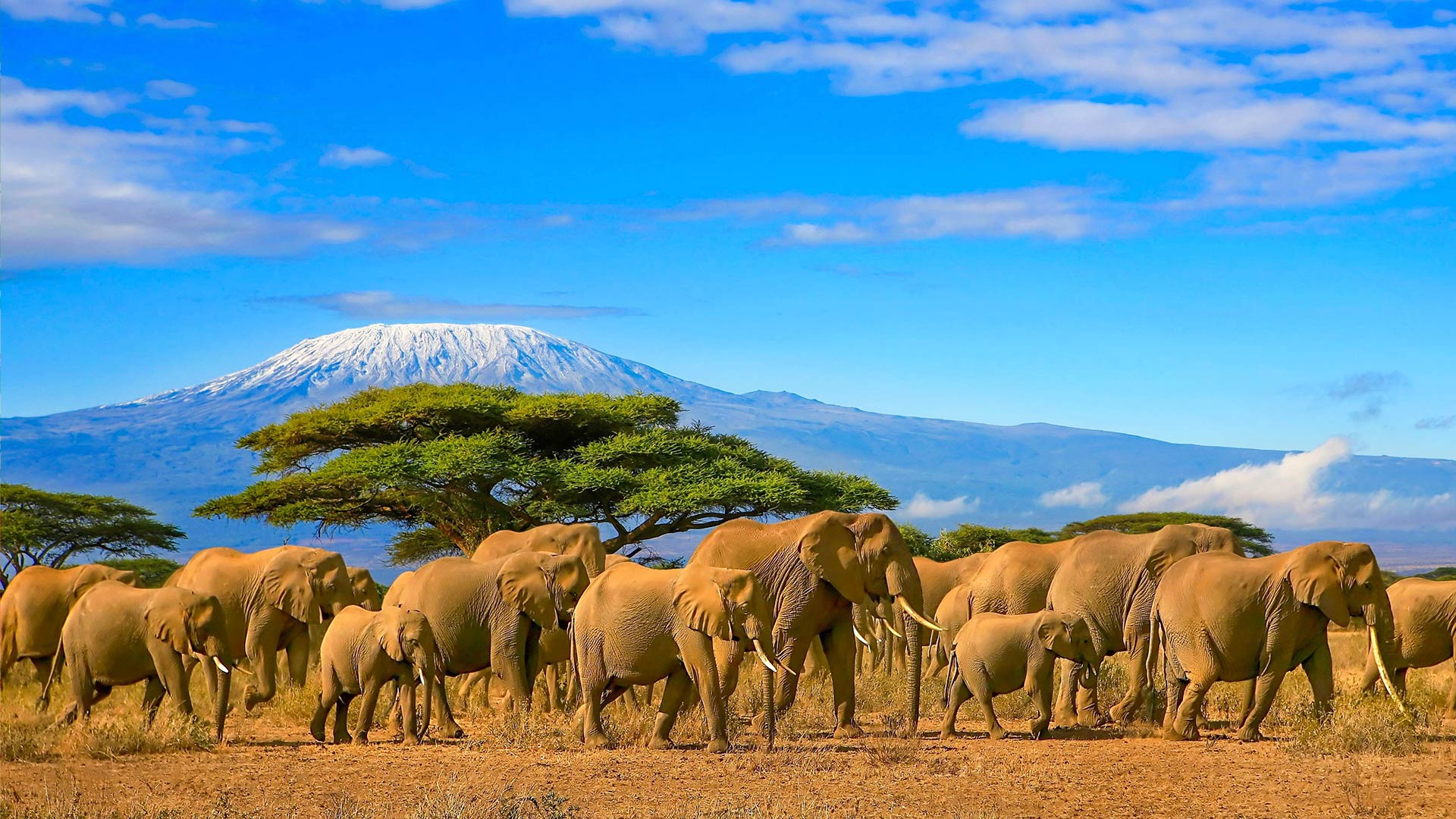
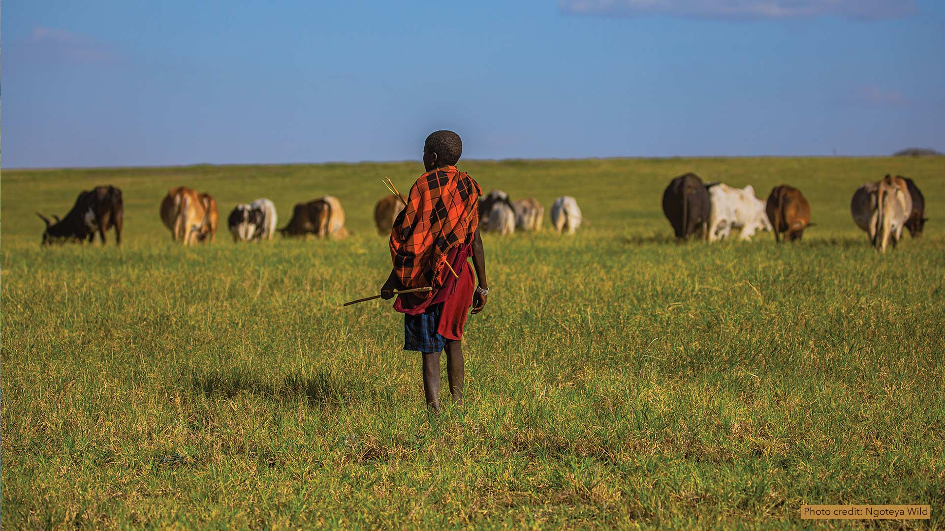
African People & Wildlife works with Maasai pastoralists in Tanzania to use GIS to document phenomena and share their knowledge of the land.
Discover how four partners collaborated with customers of varying sizes to ensure everyone has the geographic context they need.
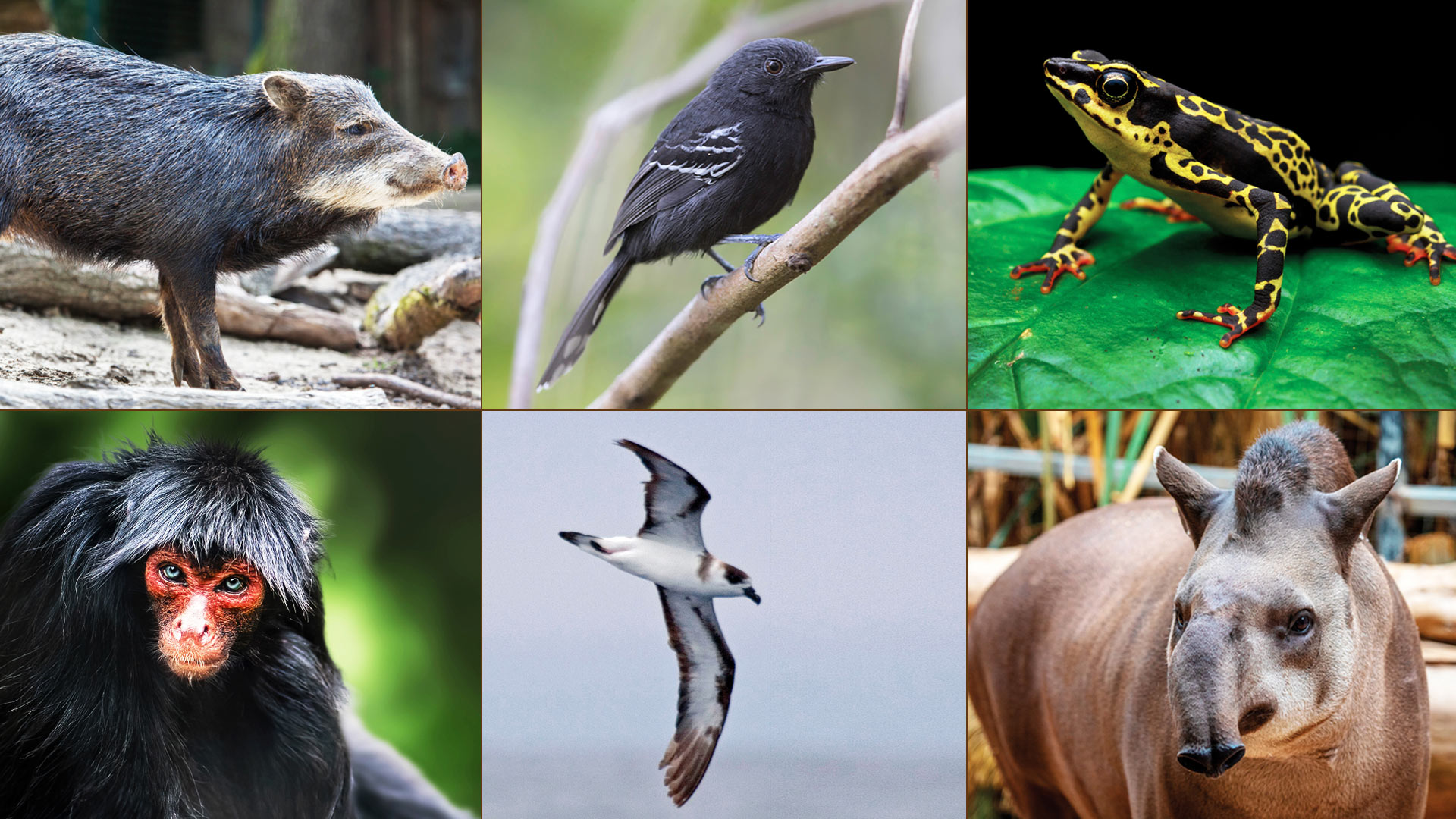
To document and monitor thousands of species across regions, it’s imperative to have tailored GIS to integrate and harmonize the data.
With enterprise GIS and the power of location intelligence, the Adams County Health Department responds rapidly to community-specific needs.
Now, humanitarian workers can use the same authoritative data in the same geodatabase to collaborate during critical, fast-moving events.