When managing extensive construction projects with hundreds of workers spread across multiple teams and expansive project sites, traditional documentation approaches break down fast. Esri partner Aegean Energy Group is no stranger to leveling up operations on projects like these. Its Maps to Megawatts solution, built on the ArcGIS platform, supports large-scale renewable energy projects through development, on-site analysis, site control, and reporting.
On several recent infrastructure projects that Aegean Energy Group was brought into, a simple innovation transformed not just how teams captured construction progress but also how the entire workforce collaborated. “Pic of the week” started as a basic employee engagement tool and has now evolved into something far more powerful: a next-level collaboration mechanism that fundamentally changed how specialists across disciplines work together.
A Simple Solution with Additional Benefits
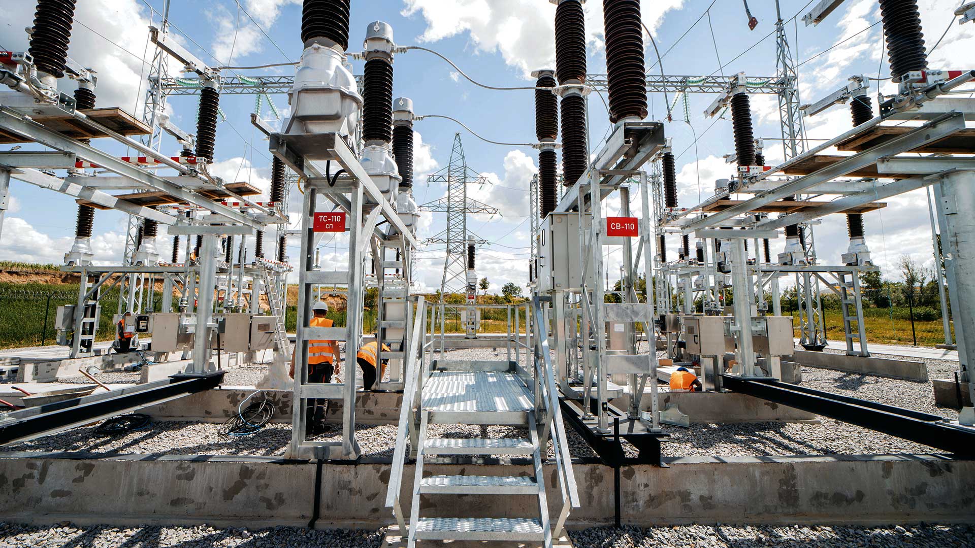
Large-scale construction projects generate massive amounts of visual data. On several of Aegean Energy Group’s recent projects, teams used ArcGIS Survey123 to capture their progress. Each project generated 1,000 to 1,500 observation photos per week across hundreds of miles of active construction. With thousands of unique structures being built—each requiring custom approaches—visual documentation became critical not only for tracking progress but also for meeting regulatory compliance across multiple oversight agencies.
The traditional collaboration approach of holding weekly meetings, filling out paper reports, and keeping scattered photo archives simply couldn’t keep pace. Maps to Megawatts captures each stage of a project with apps that document and guide complex phased workflows. Instead of teams operating in silos, workers and specialists can see the broader picture, while management can maintain oversight across long distances.
“At the end of our weekly calls, on every project, we have traditionally reviewed the best pictures,” said Kenneth “Woody” Duncan, senior vice president of technology for Aegean Energy Group. “It became difficult to coordinate everyone’s schedule, especially the field inspectors…so we had to have [meetings] just with senior management.”
-
A “pic of the week” contest at large-scale construction sites became more than an accountability mechanism—it spurred collaboration across teams, improving safety and regulatory compliance.


But Duncan and his team didn’t want to lose the process of sharing and reviewing workers’ photographed observations, so they developed the “pic of the week” contest with a straightforward concept: Each week, Aegean Energy Group’s technology team reviewed all the photos captured through workflows powered by ArcGIS technology and selected about a dozen of the best shots from each project. The team then compiled these photos into a Survey123 voting form and emailed it to all project workers, who voted for the best shots. Weekly winners received a $25 gift certificate, and monthly winners earned larger prizes.
But the real innovation wasn’t the competition—it was making voting mandatory. Since participation was tracked, managers immediately knew who wasn’t reading weekly email updates that contained critical information about new field maps, apps, survey changes, and operational procedures.
“It became an accountability mechanism, so if someone complained that their field map wasn’t working, we could see if they hadn’t voted, which meant they hadn’t read the email,” said Duncan.
An Unexpected Collaboration Catalyst
Within weeks of starting the “pic of the week” contest, something remarkable happened: Cross-disciplinary review emerged organically. Safety specialists looking at the photos spotted workers without proper safety equipment. Civil engineers flagged environmental concerns like improper berms that could cause erosion issues. Environmental teams caught construction activities that might impact protected areas.
This wasn’t planned—it evolved naturally as specialists examined the same visual data through their professional lenses. In addition to having various teams engage in separate inspection processes, the weekly photo contest created what amounted to continuous peer review across all disciplines.
“It was such a ‘wow’ moment! We had certain simple intentions but ended up with real pearls,” said Duncan. “Anything in construction that enhances a safety culture is embraced, and even the pic of the week plays a part.”
The contest unexpectedly sparked new dialogue about safety and environmental compliance, and everyone began looking out for one another.
Technology Enabling Human Connection
The success of the “pic of the week” contest relied on ArcGIS platform integration. Survey123 captured the observations and photos, and ArcGIS Online hosted all the data, including the weekly voting forms. Technology was simply the enabler; the real power came from engaging human expertise.
The competition drove quality improvements. Teams took better photos, knowing that they might be featured. And over hundreds of weeks of construction, this created an exceptional visual archive of project progress that serves as both historical documentation and an operational resource.
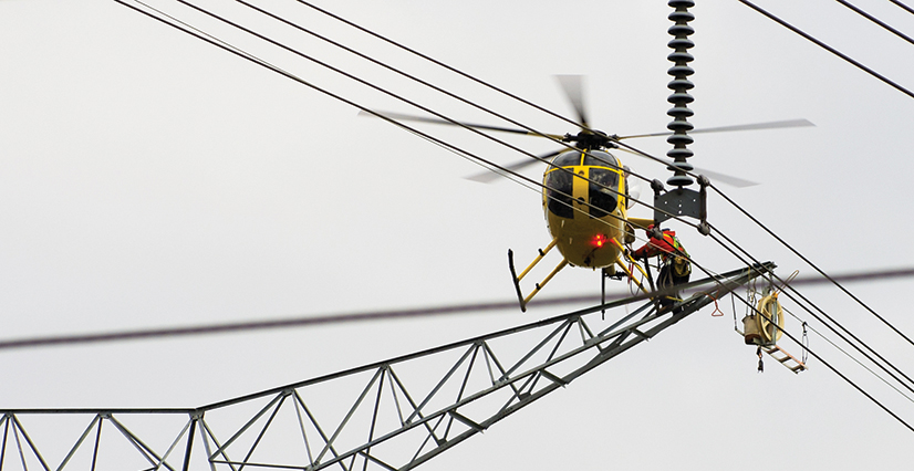
The photos are just one part of the ongoing documentation and feedback that have addressed some fundamental challenges in construction communication. Maps to Megawatts uses Site Scan for ArcGIS to process regular drone imagery of each step in a massive project, adding an eye-in-the-sky view to the on-the-ground documentation—and these photos are included in pic of the week as well. Instead of driving out in trucks for review or sorting through pages and pages of drawings, teams can instantly view current conditions in the drone imagery and collaborate on solutions.
“What is really interesting is that we make general observations all day long, and we have found that 85 percent of the time, there are no issues during construction—most observations and photos are really just capturing progress,” said Duncan. “The drone imagery similarly also allows different audiences to review construction progress and to make sure that everything is going according to plan.”
Compounding Returns
The benefits of the contest multiplied over time. Photos captured crucial details as crews competed for recognition. Documentation became more comprehensive as teams knew their work would be showcased. Issue identification accelerated as multiple disciplines reviewed the same visual data.
Perhaps most significantly, it created cultural change. The traditionally adversarial relationship between contractors and owners—described by one project leader as a “tug of war”—transformed into collaborative problem-solving. Everyone was looking at the same pictures, seeing the same challenges, and working toward the same solutions.
Other construction companies have also adopted the approach. At a recent industry conference, another project manager described implementing the “pic of the week” contest with great success, showing validation from the broader construction community.
What began as employee engagement evolved into operational intelligence. The weekly photo review process became a continuous quality control mechanism, catching issues early, while they were still manageable, rather than after they became expensive problems requiring rework.
For regulatory compliance, the documentation improved collaboration with oversight agencies, streamlining approvals and variance requests. Regulators could see exactly what was happening, enabling them to rely less on written reports.
As the construction industry increasingly embraces digital workflows, the lesson is clear: Technology succeeds when it enhances human expertise rather than replaces it. A simple photo competition powered by GIS became a catalyst for improved documentation and cross-disciplinary collaboration.