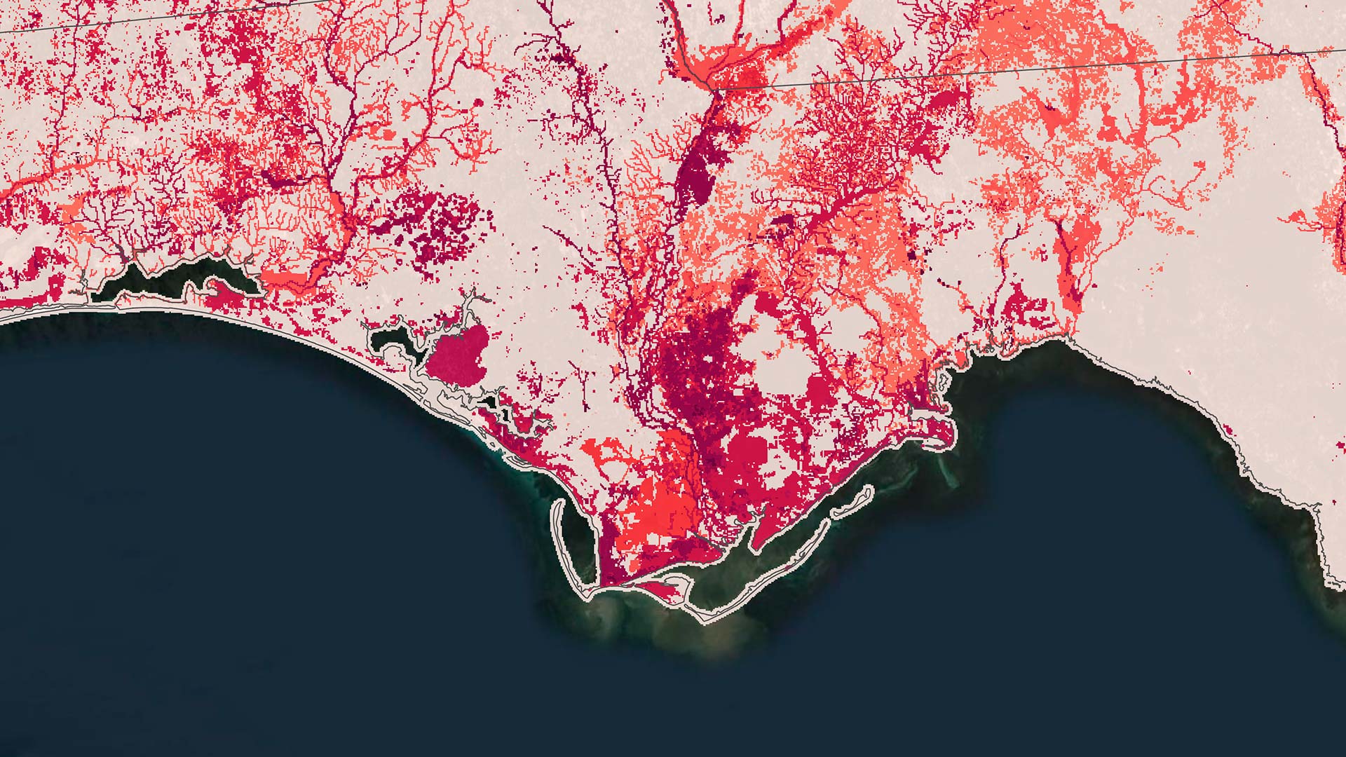
In the arid landscapes of Arizona, Nevada, and Utah, surprising biodiversity hot spots glow red on conservation nonprofit NatureServe’s portfolio of maps, called the Map of Biodiversity Importance (MoBI). The maps’ revelations stem from a landmark collaboration between NatureServe, Esri, The Nature Conservancy, and Microsoft’s AI for Earth program. This partnership has turned 50 years of NatureServe field observations in North America into maps and habitat models that guide land preservation and acquisitions to conserve biodiversity.
Translating Field Data into Actionable Maps
An online tool that launched in 2020, MoBI includes habitat models and maps for over 2,400 at-risk species, with more than 600 added in 2024. Stakeholders and researchers can access MoBI maps and layers in ArcGIS Living Atlas of the World, the NatureServe Explorer Pro application, NatureServe’s open data portal, and Microsoft’s Planetary Computer platform.
MoBI data has been accessed more than 100,000 times in ArcGIS Living Atlas, with users ranging from land trusts to corporate sustainability directors, according to Regan Smyth, a conservation data scientist and NatureServe’s president of strategic partnerships.

“If one of your goals is to save habitat for the plants and animals that are most threatened, then these maps show you where those places are,” Smyth said.
Building on Field Data and Partnerships
Founded in the 1970s and an early GIS adopter, NatureServe has always combined ecological expertise with technological innovation grounded in local field knowledge.
“Good models require expertise both to inform and for scrutinizing,” said Sunny Fleming, Esri’s director of conservation solutions. “People take biodiversity data for granted—they just assume it exists. But in reality, there are very few, if any, other organizations like NatureServe.”
NatureServe’s work depends on a combination of philanthropic support and active collaboration with agencies, corporations, researchers, and other partners. To produce MoBI, Esri provided technical guidance, custom web apps, and outreach support, while The Nature Conservancy’s science team guided the methodology. Microsoft’s AI for Earth program provided the computational power to process thousands of models, and the US Fish and Wildlife Service helped NatureServe apply models to refine the service’s own species range maps, which are the standard tool for evaluating regulatory compliance.
Working with these partners, NatureServe creates predictor sets for terrestrial and aquatic species, then feeds this data alongside documented species locations into machine learning algorithms. After generating initial models, NatureServe sends outputs to specialized biologists for review. The biologists identify which models work and which require alternative approaches, such as using more deductive modeling or only accepting documented locations for extremely rare species.
Some species present particular challenges. For certain pollinators, NatureServe first developed models for host plants, then used those predictions to map pollinator distributions. This approach was used in a recent landmark effort to apply the MoBI modeling methodology to better understand habitat for the western monarch butterfly—a species currently under consideration for listing as threatened under the US Endangered Species Act.
While this work on the monarch butterfly illustrates how NatureServe adapts modeling approaches for complex species, the real impact emerges when agencies partner with NatureServe to translate these models into on-the-ground action. In pilot projects for other species, NatureServe demonstrated that modeling could be used to refine US Fish and Wildlife Service species range maps by almost 70 percent on average. According to Smyth, this significantly improved screening precision while helping agencies and partners focus conservation efforts where they are needed most.
A Network Shaped by Local Knowledge
The models draw on data from the NatureServe Network, a North American biodiversity-focused collaboration that includes field scientists, botanists, and zoologists at more than 60 natural heritage programs and conservation data centers. Using ArcGIS Pro to access and analyze species habitat data, these experts provide species occurrence data that feeds MoBI’s machine learning models.
Some models enable what Smyth called “treasure hunts”—targeted field searches in areas that models identify as likely but undocumented habitat. This approach has resulted in discoveries of new populations of species, such as the pygmy rabbit.
Smyth described NatureServe’s role as “stitching together” this distributed knowledge to produce seamless national coverage, allowing state-level expertise to help create actionable maps and targeted conservation efforts.
Making Real-World Conservation Decisions
There’s an ongoing conservation movement called the 30×30 initiative that aims to protect at least 30 percent of lands and waters worldwide by 2030. But, according to Smyth, this elicits a critical question: “Which 30 percent?”
She emphasized the need to ensure that protected areas represent true biodiversity, including unexpected hot spots such as those in the Nevada and Utah deserts. In places where conservation and streamlined development are goals, Smyth sees MoBI as providing precise information that distinguishes truly important places from less critical areas.
Since the original release of MoBI in 2020, many organizations have used the data to guide land and water management. For example, the National Parks Conservation Association uses MoBI to evaluate landscapes that are next to US national parks. Corporate interest in biodiversity has also risen, particularly among timber companies.
“There’s this big push to demonstrate you’re nature positive,” Smyth said, noting that many standards focus on species extinction risk—one of the factors that MoBI maps.
NatureServe also recently launched InSite by NatureServe, a web-based tool allowing anyone to define a site and receive a biodiversity report that translates MoBI data into metrics frameworks that emerging corporate biodiversity standards require.
What’s Next for Conservation Intelligence
NatureServe plans to continue updating and refining MoBI, adding more species and taxonomic groups as data quality improves. Climate niche modeling represents another frontier.
“We have a couple of exciting projects to take this great technology stack we’ve built and use it to understand not just where species are today, but where they’re likely to be in the future,” Smyth said.
NatureServe increasingly focuses on understanding specific questions stakeholders ask and adapting data to answer them. For example, Smyth envisions MoBI customizations identifying species concentrations associated with old-growth forests or species that are threatened by dams.