Web Map, Created with Esri Technology, Guides People to Colorado’s Great Outdoors
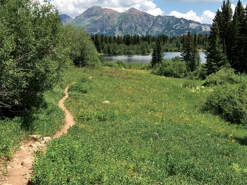
Every day, Colorado’s vast network of wilderness and urban trails beckons hikers, cyclists, horseback riders, runners, and all-terrain vehicle (ATV) riders.
To point Colorado residents and visitors to the trails appropriate for the type of recreational activities they are interested in pursuing, Colorado Parks & Wildlife (CPW) created the new Colorado Trail Explorer (COTREX).
The web app, developed using Web AppBuilder for ArcGIS (Developer Edition), was built to support Colorado governor John Hickenlooper’s Colorado the Beautiful initiative, a plan that’s meant to ensure that within a generation, every Colorado resident will live within 10 minutes of a park, trail, or green space.
“The Colorado Trail Explorer builds on our Colorado the Beautiful initiative by giving people quick and easy access to recreational opportunities and more readily connects people with the outdoors,” Hickenlooper said in a press release. “Consolidating trail information that traditionally exists in dozens or hundreds of places into a single application makes it easier for Coloradans to find the trail options that might be just beyond their back door or near a favorite destination.”
Eighty-one contributors—including the United States Forest Service; the National Park Service; and cities such as Lakewood, Fort Collins, and Denver—provided data on more than 39,000 miles of roads and trails for COTREX, which has both desktop and mobile-friendly versions.
“This is an amazing tool,” said Lauren Truitt, CPW’s public information and website manager. “There are plenty of map books out there, [but] this is the first in digital form, and [it’s] very accessible to everybody.”
While Coloradans live in what Truitt described as “an outdoorsy state” that brims with lakes, streams, mountain trails, and bike paths and lanes, residents may need a nudge to get out into nature. Some people let technology gobble up most of their free time, or they are unaware of the vast networks of trails or cycling routes within a short distance of their homes.
“Technology has inundated our life,” Truitt said. “How can we use technology in a positive way to connect people to the outdoors?”
Truitt hopes the answer lies with COTREX, a web map with a set of interactive tools that people can use to search for and find the perfect trail or route that suits their activity of choice.
About 17,000 trails have been mapped throughout the Centennial State, including West Grouse Creek, which is designated for hikers and horseback riders only; Two Elk, which allows bikes and horses; and Wagon Gulch, which is open to motorized vehicles, horses, pack animals, and bikes.
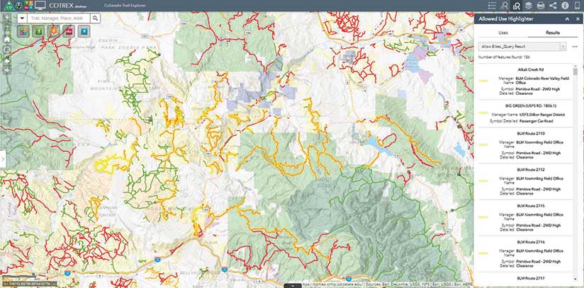
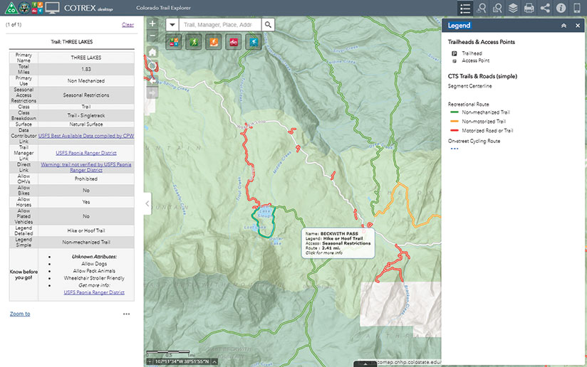
The digital map is intuitive to use. When users click the green, orange, red, or blue buttons on the toolbar, the map displays a corresponding color-coded network of trails and roads—nonmechanized-vehicle trails in green, multiuse trails in orange, motorized trails and roads in red, and cycling routes in blue. When users click a specific trail, a box that contains useful information appears to the left of the map. This includes the name and length of the trail or road; the trail manager (e.g., Bureau of Land Management); a link to the organization’s website; whether horses, pack animals, bikes, and off-highway vehicles (OHVs) are allowed; and whether the trail is wheelchair accessible.
To search for the trails around a specific location—a home, a place of business, or a hotel—users just type its address into a Search box or place a pin on the map. The app then populates the map with nearby trails, generating a list of those trails by name, as well as information such as the length of each trail in miles.
Say a longtime resident of Fort Collins is at a coffee shop near the intersection of West Elizabeth Street and City Park Avenue. She has her computer with her and decides that she wants to go for a hike in a couple of hours. Starting the COTREX app on her computer, she goes to the List Trails Near tool and types the address of the coffee shop into a Search box. A map appears that displays all the trails and cycling routes within a radius of 25 miles. She could also narrow her search to a 2-mile radius and find choices like Mason Trail (1.47 miles away) and West Spring Creek Trail (1 mile away). A list of all the trails by name and the length of each one, along with its primary use (nonmotorized-vehicle trail, for example), will also appear on the right side of the map. If she clicks a segment of the trail on the map, a more detailed, “Know before you go,” description of the trail—including information such as whether dogs or bikes are allowed—will appear to the left of the map.
CPW used Web AppBuilder for ArcGIS (Developer Edition) to build the app, which gave developers the ability to use standard widgets provided by Esri and customized widgets from users collaborating on GeoNet.
They tweaked some of the widgets to create the handy Allowed Use Highlighter on the toolbar. This list includes Allow Bikes, Allow Horses, Allow Pack Animals, and Allow OHVs. If users click Allow Bikes, they can see all the trails, highlighted in yellow, within the map extent that permit bicycles. The names of the trails and the field manager offices are listed to the right of the map, too. When users click the name of one of the trails in the list, the map zooms in to that trail.
There’s another plus: the app is both desktop and mobile friendly. The desktop version comes with a full complement of tools, while the browser-based mobile version contains a map with the color-coded trails, pop-ups that display the names of the trails, a Search box, and a few basic tools.
CPW customized the app to a great extent. Data from Colorado government agencies and nonprofit organizations was mashed up with Esri data to create the basemap. This was made possible by Esri’s allowing developers to customize Esri vector tile basemaps. The app also includes data from the Esri World Hillshade basemap, protected-lands parcel data from COMaP, and roads and trails from Esri vector tile basemaps.
