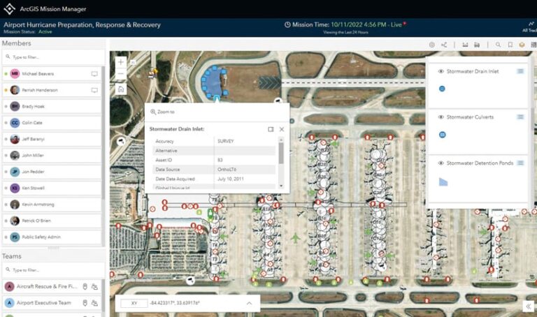
During strategic events and incidents, such as a major sporting tournament or a natural disaster—when command and control of a situation are paramount—ArcGIS Mission provides real-time data visualization and communication between the command post and field personnel. By facilitating situational awareness, Mission helps tactical teams get critical resources where they need to be, when they need to be there. The software also stores mission-critical data behind the scenes so that it is ready to use for analysis and reviews.

Cobb County, Georgia, for example, leveraged ArcGIS Mission when the Atlanta Braves made a Major League Baseball playoffs run in 2021. Before, during, and after the postseason games that were held at the team’s home field, Truist Park, county staff used Mission to visualize critical information, such as the location of every traffic light and camera near the stadium; track resources, including plainclothes officers patrolling the area; and provide real-time communication between the command post, mobile crews, and other agencies working the event. This allowed incident commanders to make tactical, data-driven decisions in the moment and ensure that everyone had an enjoyable and safe experience.
What is perhaps less known about ArcGIS Mission is that it can be just as beneficial when used for daily operations. Security service providers can employ it to keep facilities; schools; and key people, such as business and community leaders, safe. Law enforcement agencies can leverage Mission to enact crime control strategies. And national, state, or local park service organizations can use it to maintain trails and ensure visitor well-being.
Here is how daily use of ArcGIS Mission works.
One Solution for Daily Planning and Operations
With Mission, users benefit from having one solution to plan events, assign resources, share information, communicate with team members, and review incidents. The software dynamically integrates organizational data, such as basemaps and asset details; intelligence from external sources, such as live weather data and maps of landmarks; and new information that comes in during a mission, such as photos and field reports, into a common operating picture. By layering imagery, live weather and traffic data, and other dynamic information feeds onto a mission map, users add context to their operations, enhancing situational awareness and decision support.

The ArcGIS Mission Manager web app allows safety and security managers to build and organize the events that make up a typical day at an organization, such as monitoring campus security patrol routes or briefing private security personnel on where executives will be holding and attending meetings. Within Mission Manager, users generate mission maps, complete with graphics, overlays, and other reference layers; build teams and add members to them; create and leverage mission reports; manage materials such as documents and photos; and oversee the activities of field-based personnel. Once the day’s activities are underway, Mission Manager users can see mobile crews’ past and current locations in relation to the operational picture presented on the mission map. They can also track all teams’ communication to stay abreast of new events and findings.
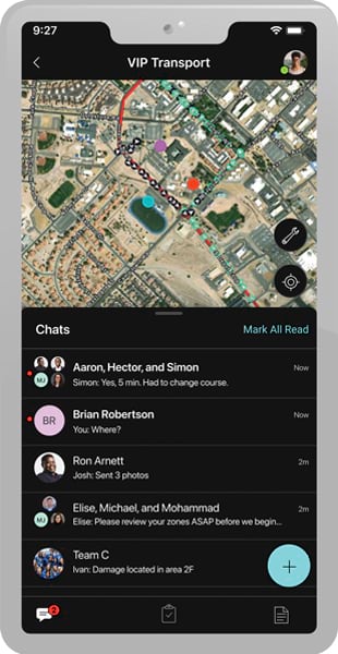
Concurrently, field personnel use the ArcGIS Mission Responder mobile app to conduct their day-to-day duties. For instance, campus security officers can use the app to mark themselves inactive when they take a break, or park rangers who need to close a trailhead can employ the app to report the status of the task and add notes or photos to help with reporting. Within the app, the mission map—which contains dynamic and static layers—helps mobile workers orient and locate themselves in relation to in-progress events and other field-based responders. So law enforcement officers can view traffic data to modify their patrol routes, or those park rangers can monitor weather trajectory to see if they need to close additional trails. The app also enables users to monitor chat feeds and browse any completed mission reports for increased awareness.

Working with Other ArcGIS Technology
One key advantage of deploying ArcGIS Mission for daily operations is that it integrates with other ArcGIS apps and software.
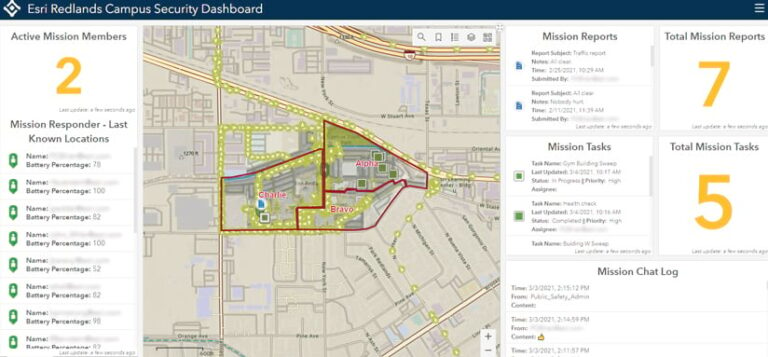
Leveraging ArcGIS Dashboards, for example, to create an interactive, single-screen view of an organization’s day-to-day operations brings the whole picture to life. Dashboard users can see incident reports, field personnel tracks, chat feeds, and other data to pinpoint areas of concern, hold their teams accountable, and replicate mission success in future operations.
Mission is also compatible with ArcGIS StoryMaps, which is useful for compiling narrative-based briefs that combine text, multimedia, and interactive maps. Stories can be used to foster operational transparency by reviewing events that occurred within a specific time frame or at a particular location.
Additionally, ArcGIS Mission can be used in conjunction with ArcGIS Pro and ArcGIS AllSource, Esri’s new intelligence analysis app, to gain a deeper understanding of patterns and trends in an organization’s daily operations. This can help mitigate security vulnerabilities and improve future events and activities.
Get more information about ArcGIS Mission.

