Hydrographic surveyors, cartographers at national mapping agencies, and others who collect and aggregate bathymetric data often end up managing large, overlapping datasets that ultimately get trapped in desktop-based, bathymetric-specific data processing systems. This can make it difficult to perform data analysis and share the results.
The latest release of ArcGIS Bathymetry enables users to catalog vast amounts of bathymetric data and make the data easier to identify, extract, analyze, and visualize and leverage in web and mobile apps.

ArcGIS Bathymetry is an extension for ArcGIS Pro that provides tools and workflows for exploring and modeling bathymetric data and its metadata in a GIS environment. After users collect and process their raw data, ArcGIS Bathymetry catalogs finalized data products in the Bathymetric Information System (BIS) database.
The BIS is an efficient and lightweight database for archiving survey data and its associated metadata. It creates references to where the data products are located, allowing users to access and visualize them on the fly without having to move, copy, or otherwise duplicate the data. Moreover, the BIS framework enables users to create their own metadata and leverage those attributes and values to quickly discover, filter, and sort across vast data archives.
With the release of ArcGIS Pro 3.1, ArcGIS Bathymetry offers a simple, end-to-end workflow that allows users to do the following:
- Create a BIS database
- Add data to the BIS
- Publish the BIS database as an image service
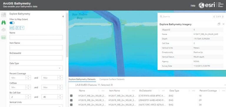
- Sort and filter survey data archives in an intuitive web app
- Create custom mosaic datasets
Different Roles for Different Users
ArcGIS Bathymetry gives a small number of users the ability to enter new survey data into the BIS database via ArcGIS Pro. That data can then be shared across the organization or with a community of specified users via ArcGIS Image Server. Additional users can then access the disseminated data through an intuitive and easy-to-use web app. This gives key stakeholders the ability to sort and filter archived survey data to find what they need.
Metadata Can Be Customized
The BIS that’s delivered with ArcGIS Bathymetry allows users to create their own custom metadata attributes. When the BIS is shared with other users, they use those metadata attributes to sort and filter datasets. For instance, they can filter the data according to the name of the agency or company that captured the survey so that they’re evaluating only those datasets.

Spatial Data Gets Archived Together
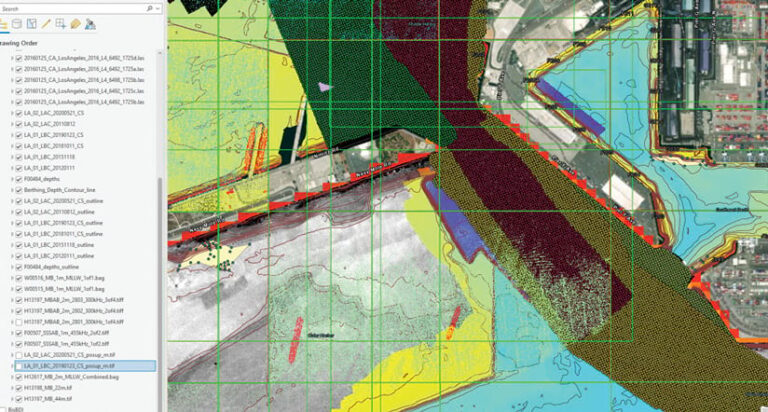
In ArcGIS Pro, ArcGIS Bathymetry allows users to archive bathymetric data together with any other type of spatial data. This makes it easier to collect information and make decisions based on all the spatial data that’s available for a particular area of interest. Hydrographic survey planners, for example, can leverage and visualize the polygons, contours, and lidar data from a survey taken of a harbor to help prioritize additional survey operations when monitoring changing sedimentation.
An Easy Way to Disseminate Data
The Bathymetry web app offers a simple way for users to disseminate their BIS database to a wide audience. The web app is configurable, which enables users to decide which attributes of the BIS to expose and whether to share them publicly or with a select user group. When additional users then employ the filter and sort tools to limit the data to what they want to see, they can generate custom mosaic datasets that can be used in ArcGIS Pro to perform further analysis. For instance, after conducting a survey, staff at a port agency may want to calculate the volumetric difference between the surfaces recorded in a previous survey versus the most recent one to determine how much the port will need to pay a dredging company to keep waterways clear.
Geoenable Your Bathymetric Data
For more information about ArcGIS Bathymetry, visit the ArcGIS Bathymetry web page. Current Esri users can reach out to their Esri representatives.
See an example of the Bathymetry web app and other ArcGIS Maritime maps and apps. A webinar on how to use ArcGIS Bathymetry in ArcGIS Pro 3.1 is also available, as are product demonstration videos.

