
In GIS, imagery and video are foundational data sources that reveal spatial patterns and contextual relationships. They can transform maps into multidimensional tools for exploration and analysis.
Understanding the diverse range of available imagery is crucial for unlocking its full potential in GIS applications.
The Difference Between Imagery Types and Capture Methods
To effectively select and use imagery for GIS projects, it’s helpful to understand the differences between imagery types and how they’re captured.
Imagery can be categorized based on its characteristics and the technology used to capture it. The type of imagery refers to its inherent properties, such as resolution or spectral characteristics, while the capture method refers to the platform or vehicle used to obtain it. These platforms carry various payloads, or sensors, that capture imagery via remote sensing—the process of collecting geospatial data without direct physical contact.
Types of Imagery
With a vast array of imagery options, two key questions emerge: What’s available, and what’s the right fit for your project? Here are the main options.
Panchromatic imagery is captured using sensors on satellites, aircraft, and unpiloted aerial vehicles, or drones. This type of imagery is characterized by its resolution, which is influenced by the camera’s capabilities and the altitude at which images are taken. For example, high-resolution images can reveal small details, such as individual bricks or tree branches, while lower-resolution images may only show larger features like road networks or forest boundaries. The level of detail is described by ground sample distance (GSD), with smaller GSD indicating finer detail.
-
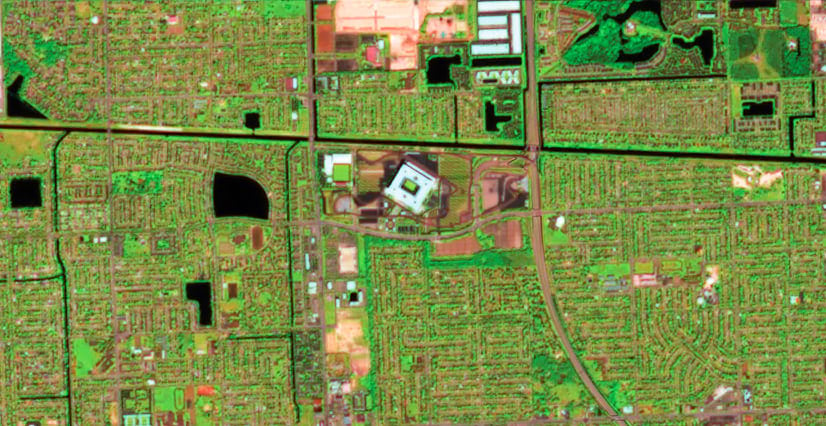
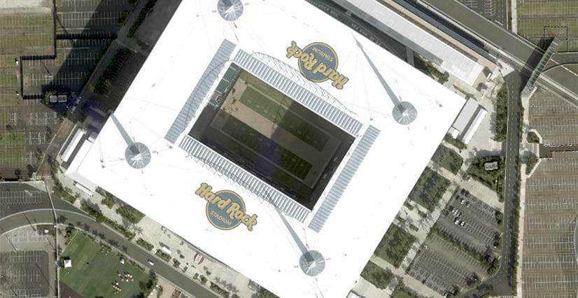
The multispectral Earth observation satellite Sentinel-2 captured this image of Hard Rock Stadium in Miami, Florida. It uses the shortwave infrared bands, one of Sentinel-2’s most powerful spectral channels for environmental analysis. The green tones indicate healthy vegetation.
Spectral imagery captures detailed information about how objects on Earth’s surface reflect and absorb different wavelengths of light. This is why it’s called “spectral”—it analyzes the spectrum of light reflected from these objects.
Think of a spectral signature as a unique “fingerprint” of light reflection that allows analysts to distinguish between cornfields, asphalt roads, and healthy forests from miles away. Every material on Earth has a unique spectral signature that can be captured using special sensors carried on satellites, aircraft, and drones. Sensors can be multispectral, capturing 3 to 15 of the bands on the spectrum, while hyperspectral imagery collects hundreds of bands, allowing for more precise identification of materials.
Video data is captured over time using video cameras mounted on aircraft, drones, or stationary platforms like traffic lights or buildings. It provides a more true-to-life representation than static imagery, showing movement and changes from various angles. By examining a sequence of images over time, you can gain a nuanced understanding of how scenes evolve and change, revealing insights that static images cannot provide.
RGB or true-color imagery is captured using standard cameras found in everyday devices, such as smartphones and tablets. These cameras capture images in three bands—red, green, and blue (RGB)—representing the visible spectrum that’s similar to how humans experience the world. A specific type of RGB imagery is 360-degree imagery, which captures a complete view of a scene and provides an immersive experience. Both traditional RGB imagery and 360-degree imagery are suitable for a range of projects where visual recognition is important.
Other types of remotely sensed data, such as synthetic aperture radar (SAR) and lidar, are often included in the imagery category. SAR data is acquired using radar sensors on satellites and aircraft that emit radar pulses to image the Earth’s surface. SAR devices can penetrate clouds and see at night. Lidar data is captured using laser scanners, often mounted on aircraft or drones, that emit laser pulses to create highly accurate 3D terrain models. This data is invaluable for elevation and structural analyses.
How Imagery Is Captured
Various technologies capture imagery—from cameras that discern visible light to sophisticated sensors that detect beyond the visible spectrum. The choice of camera or sensor, along with the platform it’s mounted on, determines the type and quality of the imagery.
Satellites capture a wide range of imagery types, from high-resolution panchromatic and multispectral imagery to hyperspectral, lidar, and radar imagery—and in some cases, even video. The choice of satellite depends on the required resolution, spectral bands, and revisit frequency (how often imagery of a particular site needs to be recaptured). Satellites are particularly useful for large-scale projects such as monitoring environmental changes over vast areas or tracking global phenomena.
Crewed aircraft, such as helicopters or airplanes, can capture high-resolution photography with GSDs ranging from a few centimeters to several meters. Aerial imagery is often used for detailed mapping, infrastructure inspections, and monitoring environmental changes. The flexibility of aerial platforms makes them ideal for projects requiring high-resolution imagery over small- to medium-sized areas.
Drones offer an adaptable and cost-effective means of capturing high-resolution imagery and video. They can be equipped with various sensors, including RGB cameras, multispectral or hyperspectral cameras, and lidar. Drones are particularly useful for small-scale projects, monitoring hard-to-reach areas, or capturing imagery at very high resolutions (GSDs of a few centimeters or less).
-
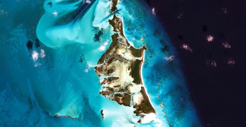
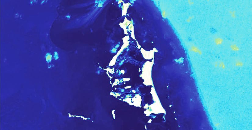
Sentinel-2 also captured these images of The Bahamas. The first image is a natural-color scene, whereas the second image has the Modified Normalized Difference Water Index (MNDWI) applied. MNDWI uses the green and shortwave infrared bands to highlight areas with high water content—displayed here from dark to light blue—while drier surfaces appear in tan to white.
Street-level cameras are often used to capture images and videos at ground level, providing a distinct perspective on the environment. The widespread availability and ease of use of these devices make them ideal for capturing imagery in a variety of contexts, from documenting work to inspecting assets.
Unlocking the Full Potential of Imagery in GIS
ArcGIS provides a comprehensive set of tools to manage, visualize, and analyze imagery, as well as create reality mapping products such as 3D meshes. By combining different types of imagery, you can gain a more comprehensive understanding of your area of interest. You can also access imagery data from ArcGIS Living Atlas of the World and Content Store for ArcGIS, allowing you to make informed decisions without leaving your GIS workflow.