Sunriver, Oregon, has been a popular vacation destination in central Oregon since the 1960s. Nestled in the foothills of the Cascade mountains, the area is known for its natural beauty and snow- and sun-friendly recreation activities.
The main source of fresh water for Sunriver is the Upper Deschutes Basin Aquifer, which supplies three primary wells that are connected to the region’s water distribution system via 81 miles of water main. Sunriver Utilities manages water and wastewater operations in the area, currently serving a steadily growing customer base of 4,700 accounts. The utility has its own wastewater treatment plant that treats an average of 500,000 gallons of wastewater per day. In addition to providing reclaimed water to irrigate an 18-hole golf course, the treatment plant supplies byproducts that are used to create compost that Sunriver Utilities sells to the community.

Six years ago, leaders at Sunriver Utilities realized that, to keep up with growth in the area, their manual, paper-based systems for managing work operations needed to be digitized. They wanted to start tracking work and asset management activities in an electronic system that could leverage the utility’s existing ArcGIS technology, which served as the enterprise-wide system of record for all assets. Leaders also wanted to integrate customer billing workflows into the solution.
To do this, Sunriver Utilities implemented Elements XS, a GIS-centric, web-based asset management app for utilities and government organizations from Esri partner Novotx. Elements XS interacts directly, in real time, with published map services in ArcGIS Enterprise and ArcGIS Online. This allows Sunriver Utilities to manage workflows and assets; track inventory and labor; and generate comprehensive, GIS-based reports all in one place.
In the four years since implementing the system, employees at Sunriver Utilities have gained a better understanding of the utility’s assets. According to Erik Nelson, the GIS manager at Sunriver Utilities, this allows everyone at the organization to make more informed, data-driven decisions.
“Since implementing Elements XS…we not only have increased productivity in daily operations, but [we have also] substantially boosted company revenues,” Nelson said. “The robust platform has allowed us to integrate our enterprise [GIS], asset and work management, inventory, and utility billing into a single, seamless system.”
A Way to Reinvest in Existing Technology
Elements XS is designed specifically for utilities and governments. It is an all-inclusive, web-based app that integrates with the ArcGIS system, as well as billing, financial, and enterprise resource planning (ERP) software—enabling utilities to take full advantage of their existing technology investments.

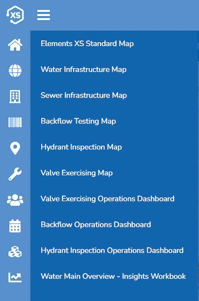
Employees at Sunriver Utilities can access Elements XS from anywhere and on any device, meaning staff in every department can manage assets without having to work in separate modules. Elements XS is built on a live, real-time connection to ArcGIS, so an organization’s geodatabase is the single, authoritative repository for asset data. Employees can seamlessly access ArcGIS Dashboards, ArcGIS Insights, ArcGIS Survey123, ArcGIS Field Maps, and more, from within the Elements XS interface, meaning they don’t have to switch from app to app. They also no longer need to bring paper to the field.
“Field workers can complete their service orders on mobile devices rather than having a stack of papers that could easily become misplaced, wet, and muddy in our line of work,” said Sunriver Utilities water supervisor Steve Yeoman.
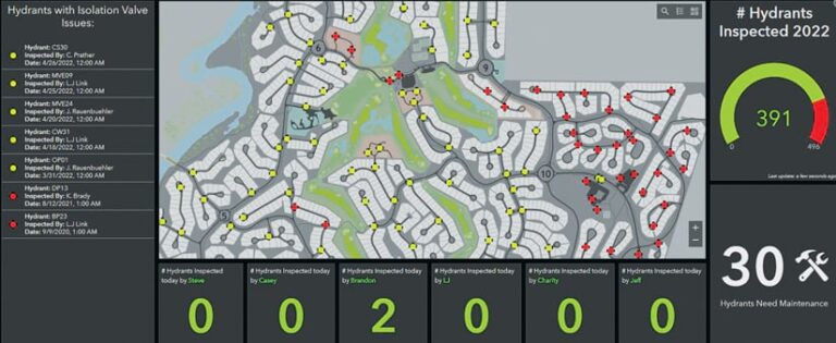
Currently, the utility uses Elements XS for backflow testing (inspections of devices that prevent water from flowing the wrong way), hydrant inspection, valve exercising (the process of physically moving valves to prevent them from corroding), and work order tracking, as well as capital construction projects.
Major Improvements in Backflow Testing
Since Sunriver Utilities deployed Elements XS in 2018, the utility has significantly boosted productivity and revenue in its backflow testing program.

Backflow testing involves sending a crew—from either the utility or a contractor—to test backflow devices that are placed on pipes to prevent water in a customer pipe from flowing back into the water main. For example, when a fire hydrant is turned on, the water should only flow out through the fire hydrant, not backward because it could cause an imbalance in water pressure.
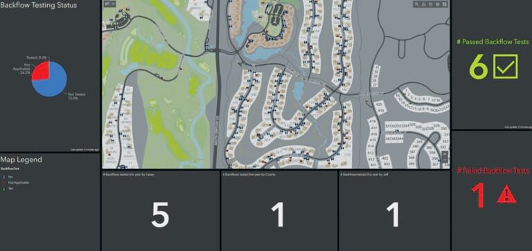
Within Elements XS, employees at Sunriver Utilities now view all installed backflow devices on a map and use a dashboard, built with ArcGIS Dashboards, to see the test results of each device. Mobile crews also use Survey123 and Field Maps within Elements XS to create and fill in test reports; automatically report test failures; request device changes; and, if discrepancies are found between what’s in the GIS and what’s happening on the ground, make or request changes to an asset’s metadata.
This new process has helped Sunriver Utilities increase the number of backflow devices tested each year by 29 percent, to an all-time high. What’s more, the time between Sunriver Utilities finding a defective device and notifying the appropriate party to get the issue resolved has decreased. This has contributed to a 20 percent increase in revenues related to backflow testing.
Managers and Mobile Crews Monitor and Share
Sunriver Utilities now employs a comprehensive map- and analytics-based process for all its water asset inspections.
“Being able to interact with our GIS maps and dashboards within Elements [XS] has been extremely valuable for work management, project tracking, and managing asset life cycles,” said Yeoman.
A dashboard allows mobile crews, managers, and supervisors to track the progress of projects without leaving the Elements XS user interface. It also enables employees to easily share critical data with both internal and external stakeholders.

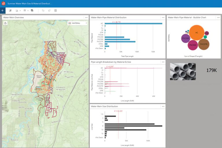
Additionally, the availability of ArcGIS Insights within Elements XS allows everyone from managers to mobile crew members to quickly review and analyze asset data, so they can approach asset life cycle management and maintenance tactically and strategically. Insights workbooks provide valuable information on assets such as water and sewer mains, hydrants, and lift stations. The app’s interactive maps, data cards, charts, and graphs let employees analyze asset conditions, performance levels, maintenance history, and life cycle trends in a holistic way. Employees also use Insights to review data from the utility’s billing database to better understand and manage meter-based activities, including determining customers’ water usage and service needs and when their assets need to be repaired or replaced.
Plans for the Future
Now that leaders at Sunriver Utilities see the benefits of capturing comprehensive water asset data in ArcGIS within the Elements XS interface, they are working on implementing the system for the utility’s wastewater assets and operations as well.
Having all available data about an asset—from its physical condition and maintenance details to where it is located and how much it costs to operate—together in one GIS-centric interface makes it simpler to plan maintenance and repairs; helps staff decide when an asset needs to be serviced, rehabilitated, or replaced; and aids in end-of-life decision-making, such as when to decommission an asset and how to dispose of it.
Looking to the future, Sunriver Utilities plans to add other geospatial details to its asset records—by mapping all the individual components of a pump or wastewater lift station, for example—to make them easier to visualize and interact with on a map. The utility is also exploring how to integrate Oregon’s call-before-you-dig program into the system.


