Two university instructors improved students’ learning experience by moving the labs for a geography course from ArcMap to ArcGIS Online. The move simplified the students’ interaction with the software and made it more accessible. The move also saved the instructors time when writing labs and gave them easy access to diverse and current datasets.
Crystal Bae, a PhD student at the University of California, Santa Barbara, worked closely with faculty member Liz Chrastil to redesign the GIS-based labs for their department’s introductory Urban Geography course. As the course instructor, Chrastil had inherited the Urban Geography course from a faculty member who recently retired. The labs, originally designed in ArcMap, were modeled and adapted from the lab activities presented in the textbook Exploring the Urban Community: A GIS Approach, 2nd Edition, by Richard P. Greene and James B. Pick.
Many lab assignments used data from the 2000 US Decennial Census. Chrastil and Bae worked together to redesign the labs, so they would be easy to update as the US Census Bureau released new demographic data, either from the decennial census or the American Community Survey.
In Bae’s experience as a teaching assistant and instructor for Urban Geography, she found that undergraduate students who were less experienced with file organization and data structures struggled setting up, saving, and retrieving lab files in ArcMap. A significant amount of time was spent explaining and troubleshooting common issues. This detracted from the time that could be spent interpreting the results of spatial analyses or reflecting on possible explanations for the results obtained.
Urban Geography is a topical course rather than one that is primarily methodological, so it often draws students from outside the geography department. Although the department’s series of GIS courses were not a prerequisite for Urban Geography, Chrastil and Bae wanted to introduce students to using GIS with urban geographic datasets and give them hands-on experience performing the analysis.
Both Chrastil and Bae recognized this was an opportunity to redesign the lab assignments and move them to the university’s ArcGIS Online platform. They were motivated to make the move by the simplicity of the ArcGIS Online interface, the ability to access ArcGIS Online from any computer without installing software, and ArcGIS Online’s more intuitive definition of spatial analysis.
Accessibility was important for students who lived further off campus and would not be able to work on their lab assignments outside of class hours. Previously, students had to find time to come to the computer labs in the geography department to use ArcMap if they were not able to complete the assignments during the designated lab section time. Occasionally, students ran into issues when they began an exercise with one version of ArcMap but tried to complete it in another computer lab that had a different version of ArcMap.
Another benefit is the number and diversity of the huge public datasets available as map layers shared on ArcGIS Online. Finding appropriate datasets used to take instructors the majority of the time they spent writing lab assignments. Now many datasets are available in a format that is ready to use in the platform. In a few cases, Chrastil and Bae started with existing lessons they found in the ArcGIS Lesson Gallery and adapted them to the course’s topics.
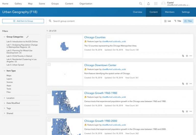
Using the Groups feature of ArcGIS Online allowed them to set up a group for each year’s Urban Geography class and make the appropriate lab files available for each assignment. They shared content by adding the necessary layers to the group and categorizing them by lab assignment. However, when Chrastil and Bae offered the class a second time on ArcGIS Online, they found they had to manually reclassify the datasets associated with each lab after copying the course materials to the new class group.
The Urban Geography course has been taught twice since the lab assignments were moved to ArcGIS Online. The feedback from students and instructors has been very positive. Students spend less time downloading and organizing data and more time running spatial analyses and interpreting the results in relation to the lecture content. Students without prior GIS experience become acquainted with the ArcGIS Online interface quickly and keep up with weekly assignments.
In addition, teaching assistants and instructors find it easier to guide students through the work and spend less time troubleshooting. Students had complained about the “stale” data used in labs that was not updated frequently. Now, it will be much easier to update datasets as they become available—a huge plus.
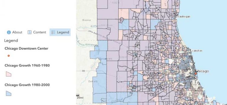
It took Bae only a few months working part time in the summer to adapt the existing ArcMap lab assignments to ArcGIS Online. The first lab assignment was a GIS crash course. It was adapted from an existing tutorial found in the Learn ArcGIS Lesson Gallery. Topics for other lab assignments include population change in metropolitan regions, residential clustering, and the urban core and periphery. These assignments use specific regional or city datasets that are either available through the publicly shared data on ArcGIS Online or from other agency resources.
Although Bae was accustomed to the ArcMap interface and the names of spatial analysis tools were different on ArcGIS Online, she found that overall the organization worked better and was much more intuitive for first-time GIS users. Instructors new to teaching the course who want to adapt labs to their own research interests can do so easily.
Next steps will be creating a gallery of available lab assignments for use by instructors within the organization or geography department. Going forward, labs could be adapted as needed, based on the instructor’s teaching emphasis or the specific interest areas of the students.
For more information, contact Crystal Bae.
About the authors

Crystal Bae