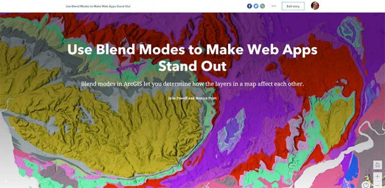
Blend modes in ArcGIS let you determine how the layers in a map affect each other so you can highlight a specific aspect of the data, produce an interesting effect on a layer, or make what seems like a new layer by blending two or more layers in a map.
However, these Adobe Photoshop-like effects create live, interactive maps rather than static images. Blend modes are available through the ArcGIS API for JavaScript and as an option when authoring maps in the new ArcGIS Online Map Viewer.
This story map illustrates some of the most useful Blend modes: multiply, luminosity, saturation, hue, and compositing.
About the author
Julie Powell
Julie Powell is a technical product manager. Her primary focus is the ArcGIS API for JavaScript. She has more than 17 years of experience working with software development, delivering solutions for both enterprise and consumer markets. Powell has worked on a wide range of projects and consulting endeavors, including serving as a technical lead for web mapping solutions for strategic customers. She interfaces with a wide user community to maintain awareness and insight into GIS community needs, meanwhile contributing feedback to development teams to help ensure users can be successful in building state-of-the-art, purposeful solutions using ArcGIS software.
Fill out this form to subscribe to ArcUser, the magazine for people who use Esri’s GIS technology. Its articles provide practical, technical information that will help you employ the most effective strategies for implementing GIS, and better understanding GIS technology.