New foundational courses available from Esri Academy will empower GIS staff to answer complicated questions about the patterns and relationships that exist in the massive quantities of data now currently available for analysis.
Recognition of the value of both data science and spatial data science has grown tremendously in the last several years. Spatial data science employs methodologies and tools to extract nonobvious and useful patterns from data, enabling practitioners to make predictions. However, by incorporating geographic data and spatial analysis methods, spatial data science adds place-based context and greater insight to the practice of data science.
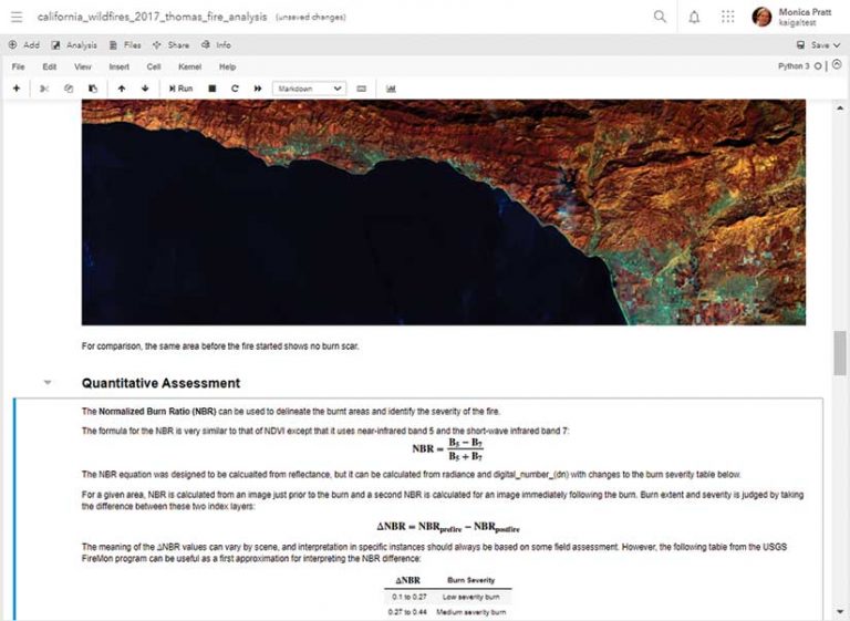
ArcGIS provides tools and workflows to use spatial data science methods to transform massive amounts of spatial data in many formats into actionable information that can improve the processes and decisions of organizations. ArcGIS Notebooks, built on top of the open-source web application Jupyter Notebook, has been implemented across ArcGIS to incorporate spatial data science capabilities and seamless integration with ArcGIS, while creating and sharing documents that contain live Python code, visualizations, and narrative text.
ArcGIS Notebooks is instrumental in performing the vital but formidable tasks required prior to analysis: data wrangling, cleaning, engineering, exploration, and visualization. These tasks transform, correct, and standardize data; devise the mechanisms needed for analyzing and gaining understanding of the data; and use that data for creating charts, plats, graphs, maps, and layouts.
By streamlining processes, making collaboration easier, and providing convenient access to any Python library, ArcGIS Notebooks lets GIS professionals bring far greater resources to bear on challenging problems as well as in automating and sharing work and building reproducible research.
ArcGIS Notebooks Basics and Data Science Workflows Using ArcGIS Notebooks, a pair of new web courses, will help get GIS professionals and data analysts started using ArcGIS Notebooks within ArcGIS Pro. These courses are available from Esri Academy. They provide the foundation needed for taking advantage of the data science tools and workflows in ArcGIS enabled by ArcGIS Notebooks.
ArcGIS Notebooks Basics explains how to use ArcGIS Notebooks in ArcGIS Pro to query features, perform analysis, geocode a location, and perform many other tasks. This course introduces the ArcGIS Notebooks interface and functionality for creating Python notebooks that perform spatial data analysis tasks.
Data Science Workflows Using ArcGIS Notebooks introduces data engineering concepts and the workflows needed to perform data engineering tasks using ArcGIS Notebooks in ArcGIS Pro.
Both courses are available from esri.com/training at no charge to those who are current on maintainence.