A new microcredential program offered by Monroe Community College (MCC) in Rochester, New York, enhances students’ skill sets with specialized training in geospatial data acquisition and management, web mapping, and geospatial programming.
Designed to meet industry trends in modern GIS and emerging workforce needs, the program can be taken on its own, or credits can be applied to a Geospatial Information Science and Technology (GIST) certificate and associate of applied sciences in geography degree with a concentration in GIS. For more than five years, MCC has offered courses in GIS technology, remote sensing, cartography, spatial analysis, and a capstone course as part of an online 24-credit GIST certificate program and the associate degree.
According to 2019 Bureau of Labor Statistics findings, the geospatial job market was projected to grow faster than the average growth for other occupations. In response, MCC launched a nine-credit microcredential program in 2021 to keep pace with modern GIS skill sets.
“When it comes to modern GIS, these courses are touching on what is new in this industry—problems like streamlining GIS workflows, using dashboards, and how to create or modify scripts,” said Nia Beazer, a recent MCC graduate. “We are not going to touch on everything because we only have so much time in these courses. But we’ve dabbled in a little bit of everything, which has prepared me so much for my future in this industry.”
Students can either enroll in three classes to earn the microcredential or use the earned credits toward a GIST certificate or the new associate degree in GIS. Funding for the new degree and microcredential came from the National Science Foundation, which also offered support through its Integrated Geospatial Education and Technology Training (iGETT): Remote Sensing project and the Advanced Technological Education Mentor-Connect Program.
Building a Curriculum That Reflects How GIS Is Used Today
To develop the coursework, Jonathon Little, associate professor of geography and GIS at MCC, sent a survey to geospatial professionals across the state who subscribed to two GIS list servers maintained by the New York State GIS Association and the Geographic Information Sharing Special Interest Group.
“We were really trying to get a feel for our local or state GIS needs, and I think it proved very valuable,” Little said.
The survey asked them to assess topics and skills that were most desired in the workplace. It revealed the specific skills and technological knowledge needed in the workforce. The survey also revealed that professionals who had graduated several years earlier needed to learn new skills such as web mapping or programming with Python.
“Our goal in developing these courses was to bring geospatial awareness to traditional students and upskill incumbent GIST professionals,” said Little. With colleagues Wayne Howard and Heather Pierce from the chemistry and geosciences departments, Little developed three pillar courses that focused on geospatial data acquisition and management, web mapping, and geospatial programming. These topics addressed competency skills that were identified in the survey and were based on feedback from the college’s GIST advisory board.
Additional feedback was given by members of the National GeoTech Center, a National Science Foundation-funded organization that provides GIST educators with curriculum resources and model core competencies that meet workforce needs. The courses at MCC needed to reflect how GIS is used today and ensure that students would be competitive job applicants.
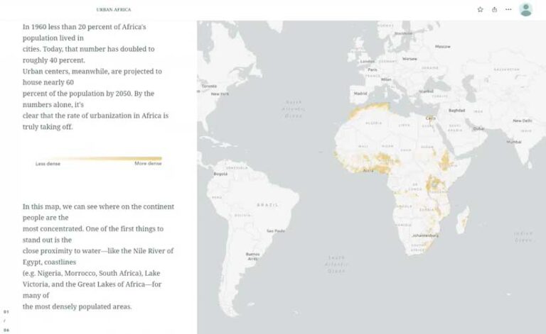
Beazer used ArcGIS StoryMaps to create a series of maps comparing the size of urban populations with the rate of urban population change in Africa.
“In the first year, we have already received feedback from students telling us, ‘This course is why I received the job,’ which is amazing,” said Little. “The program has a lot of interest from professionals across the state.” The program has seen tremendous growth this past year, with 150 new students enrolled in the introduction to GIS course and more than 40 new students enrolled in both the web mapping and remote sensing courses. In 2021, nearly 150 students completed the microcredential interest form for the upcoming year.
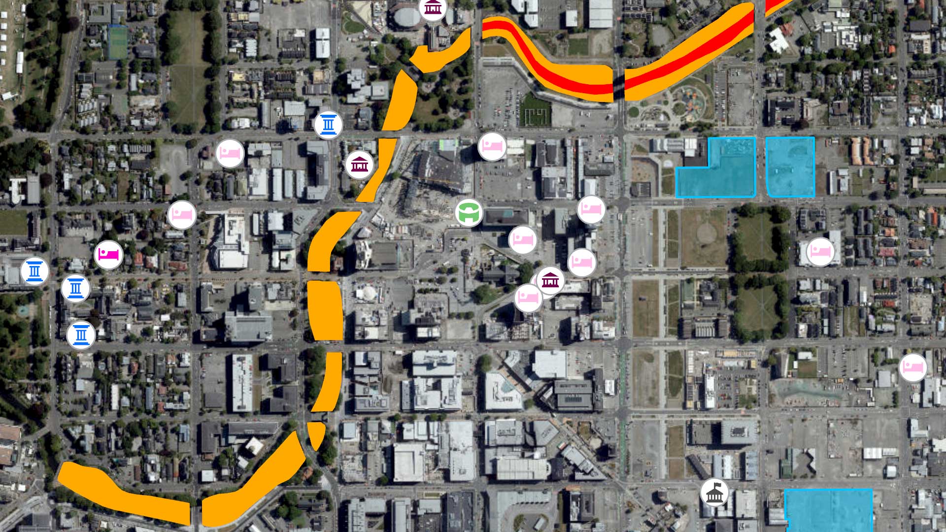
The curriculum includes classroom and lab experiences for students to learn specialized software like ArcGIS Dashboards, ArcGIS Field Maps, ArcGIS Hub, ArcGIS Online, ArcGIS Pro, ArcPy, and ArcGIS Survey123. In addition to the coursework, students are required to create a portfolio using ArcGIS StoryMaps to showcase their best work and sign up for a LinkedIn profile to begin professional networking.
The combination of flexible online courses and detailed preparation for students to enter the workforce is what drew Beazer to MCC’s GIST programs. Beazer decided to change careers in early 2020, just before the pandemic started. “I’ve watched my husband [work in GIS] for years, and I knew I had to do this too. I absolutely love it.”
For one course project, Beazer created four maps representing safety, shelter, donation, and relief efforts conducted during the 2021 La Soufrière volcanic eruption in St. Vincent and the Grenadines (SVG).
As a mother caring for two young children at home during the pandemic, flexibility was a must-have for her associate studies. “When I read about MCC’s fully remote program, I knew it was the one for me,” said Beazer.
Modern GIS Education Is Workforce Preparation
While Beazer pursued the associate of applied sciences in GIS degree, she also earned the GIST certificate and microcredential credits to advance her skills. Some of the advanced GIS topics in her coursework included unmanned aerial system (UAS) data collection and processing, mobile data collection, automation using Python, and the enterprise geodatabase. “We touched on so many things,” said Beazer.
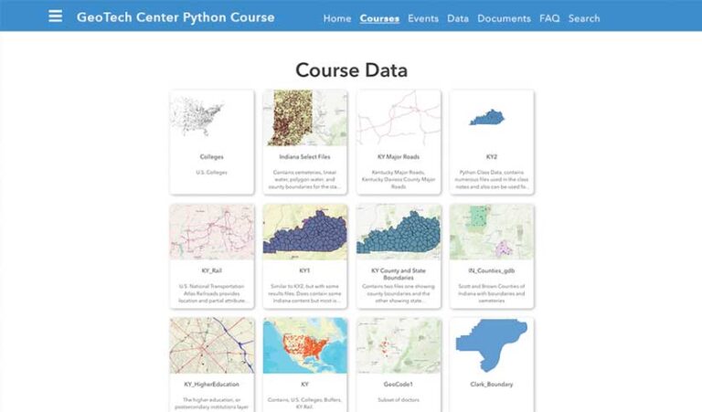
For Beazer, the web mapping course was a favorite because she learned the usefulness of applications, Web GIS tools, Google Earth, Google Maps, ArcGIS Online, and ArcGIS Hub, which proved essential in her internship at the National GeoTech Center. She created a hub site to house all the Python courses and data that other institutions could use for their courses. Beazer also learned to automate the production of a map series using Python in her introduction to programming course.
“This was my first time learning how to customize and automate GIS applications using Python scripting language,” she said, noting that in almost every advertised job she sees, recruiters are looking for applicants with Python experience.
Alumni mentors, led by Catherine DuBreck, work with students to ensure they understand the material and offer career advice as they prepare to enter the geospatial field. For Beazer, having a mentor to work with her through every step in her programming course was key to her final project’s success. “It’s great to be able to communicate with someone who’s been exactly where you are, and they ended up becoming successful in this industry.”
For Little, ensuring students succeed in the workplace was key to the microcredential program. MCC staff will continue to evolve the program to keep pace with GIS advances. The program meets students where they are in their careers. “As technology changes, the courses are going to be changing, and we’ll be modifying them as needed based on feedback from the advisory board,” said Little.
Little also hopes to expand the classroom curriculum to include challenges facing the global community through higher education partners in Kazakhstan, Malawi, Jordan, Colombia, Costa Rica, and Mexico. “I’m working on a grant to support diversity, equity, and inclusion through our partners in a global virtual community,” said Little.
About the author