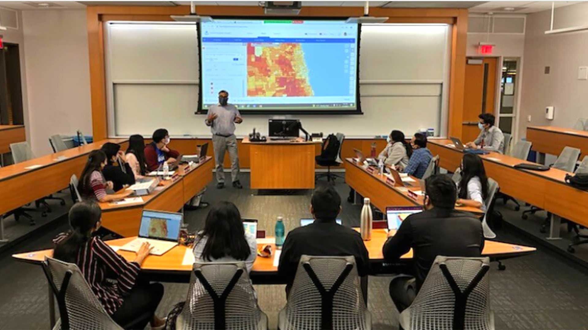
At the University of Pittsburgh, faculty from the department of geology and environmental science help teach modern GIS skills using resources available from Esri.
As GIS technology continues to attract growing interest among students and employers, higher education institutions must find ways to keep curricula on pace with innovations in technology. The university has a long and successful history teaching GIS, supported by its partnership with Esri. Access to comprehensive, advanced resources is giving University of Pittsburgh graduates an advantage upon entering the job market.
Deep learning has emerged as a pivotal function of machine learning and artificial intelligence (AI), enhancing the efficiency and accuracy of data analysis. When applied to GIS and remote sensing technologies, deep learning models can be trained to recognize complex patterns, shapes, and textures at numerous scales within images. This allows data scientists across all industries to analyze and derive meaningful insights from vast amounts of satellite, aerial, and drone imagery.
“When the department switched to ArcGIS Pro, the integrated deep learning toolboxes were a real advantage,” said Daniel Williams, a teaching assistant professor at the University of Pittsburgh. “And when students can go to an employer and show them an understanding of how to use these deep learning toolboxes, that’s something that is going to be vital moving forward.”
Williams first came to the university as a PhD student in 2012. He now teaches GIS, GPS, and Computer Methods, an introductory course in GIS that helps students across departments and disciplines incorporate basic GIS principles into their field of study. His aim is to keep students as close to the cutting edge as possible—which can be challenging in a field that prides itself on rapid innovation.
Keeping Pace along the Cutting Edge
Until recently, Williams considered himself a novice in the realm of AI within GIS. As his colleagues began to apply deep learning to their own research, he knew he needed to gain practical experience of his own.
“Everything is evolving so fast within science and technology,” Williams said. “And we’re always going to be playing catch-up as educators because we’ve got to see these advances and then we’ve got to learn how to do it ourselves.”
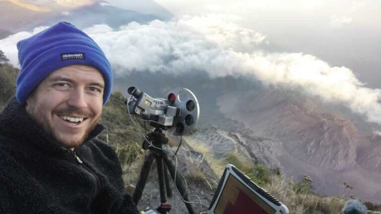
Deep learning already had a place in the GIS curriculum at the University of Pittsburgh. Professor Bill Harbert had been including it in the advanced GIS course. Furthermore, colleagues at the University of Pittsburgh and Istituto Nazionale di Geofisica e Vulcanologia (INGV) in Italy had applied deep learning techniques to their study of volcanic eruptions. They trained the software to identify thermally elevated pixels, or hot areas at the Earth’s surface that might indicate magma rising, which can lead to an eruption.
Williams—a passionate volcanologist—was inspired by their application of the technology. He used Esri resources, such as ArcGIS Labs, available from Esri Academy, to improve his understanding of deep learning. Esri Academy provides learning experiences for anyone using ArcGIS, including instructor-led courses, videos, and self-paced training sessions complete with software exercises.
He also used a simplified deep learning installer for ArcGIS, available from the Esri GitHub site. The installer streamlines the user experience by packaging the necessary dependencies and components for ArcGIS Pro, ArcGIS Server, and ArcGIS API for Python. The installer includes a broad collection of 99 packages with components for frameworks, such as PyTorch, TensorFlow, Fast.ai, and scikit-learn, for performing deep learning and machine learning tasks.
“My education on deep learning came from an Esri exercise finding shipwrecks from ocean bathymetry data,” said Williams. “There is another exercise that I gave to my students, looking for the location of wind turbines in aerial photographs. I understood it better by performing the actions and completing it myself.”
As he worked through the training sessions, Williams was surprised to find how simple the exercises were to navigate. Although he budgeted three hours for one set, he was able to complete the training in half an hour. He advises colleagues at other institutions who may be wary of AI to reach out to Esri for help.
“If you’re worried about how to go about installing and updating all these deep learning toolboxes, but you are already working with Esri, reach out to them. It’s going to benefit you in the future.”
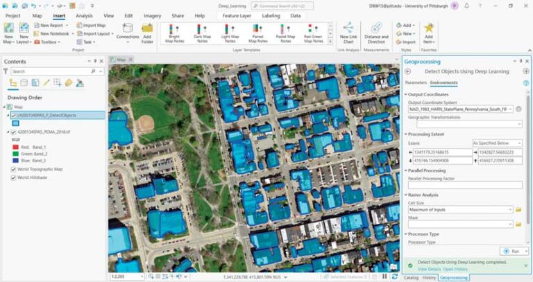
Employers value graduates with exposure to deep learning and ArcGIS Pro. Organizations around the world are now using pretrained deep learning models available from ArcGIS Living Atlas of the World to perform tasks such as feature extraction, classification, redaction, detection, and tracking to derive meaningful insights from large amounts of data. For example, a data scientist can rapidly and accurately extract railway assets from lidar or classify land cover using satellite imagery, making workflows simpler and more efficient.
GIS Gains Traction among Students
According to the marketing research firm Research And Market, the global GIS market is poised to grow significantly through the end of the decade. Businesses rely on geospatial solutions for analysis and decision-making, and students are eager to acquire GIS skills to stand out upon entering the workforce. Higher education institutions that cater to this need will appeal to graduates seeking a solid return on their educational investment.
Since his time as a student at the University of Pittsburgh, Williams has seen the enrollment in GIS courses expand from 70–90 students to more than 200 students per year.
“We’ve got students from so many different departments, different schools within the university, interested in GIS because their studies have some kind of spatial component. And we have a lot of careers available in environmental consulting in western Pennsylvania, which has a very strong GIS requirement,” said Williams.
The University of Pittsburgh also offers a certificate in GIS and remote sensing for eligible undergraduates. As part of the certificate program, students must complete a four-credit independent study course. This is a major project meant to reinforce and polish the students’ GIS or remote sensing skills, culminating in a published report or map that describes the results of their research.
In addition to gaining practical industry experience by completing their own research topic, students can use their GIS certificate to leverage themselves in the job market.
“The certificate is something that’s been appreciated by employers in the area and beyond,” said Williams. Students that take the independent study course after his introductory class already know where to find resources. He makes a point of showing them the vast catalog of datasets and deep learning exercises available through Esri. Students can even get training to start developing their own deep learning models.
Williams has received encouraging feedback from students. “Many of my students—particularly those who started university later—they might have friends already working in some kind of field using GIS. Those students said that they feel that they’ve learned some things that their friends who are already professionals weren’t familiar with.”
Ultimately, Williams strives to give his students a solid foundation in the principles of GIS and a brief window into deep learning to inspire their professional pursuits.
“Graduates have been adding deep learning and AI methods to their CVs and have been picked up by employers who are saying to them, ‘We want this. You’ve done exactly what we would hope you would’ve done.’ And that makes them much more employable in that field. It’s exciting,” said Williams.
About the author