According to global market research and consulting firm MarketsandMarkets, the geospatial analytics market is projected to grow from US$67.4 billion in 2022 to US$119.9 billion by 2027. It reports, “Governments and corporate organizations can now use geospatial data as a critical information source to make decisions about risk assessment and mitigation, disaster management, and urban development as well.”
GIS has always been the premier technology for bringing data from many sources into a geospatial framework and applying the geographic approach to understanding the world on many levels. Through modeling, analyzing, and interpreting data, GIS can yield a deeper understanding of the world that supports better decisions and real-world action.
With the integration of rapidly expanding technologies—machine learning, imagery analysis, cloud computing, 3D visualization, and predictive modeling—the expanding capabilities of GIS are being applied to better understand how the world is, how it could be, and how it should be. Articles in this issue highlight examples of these robust applications of GIS.
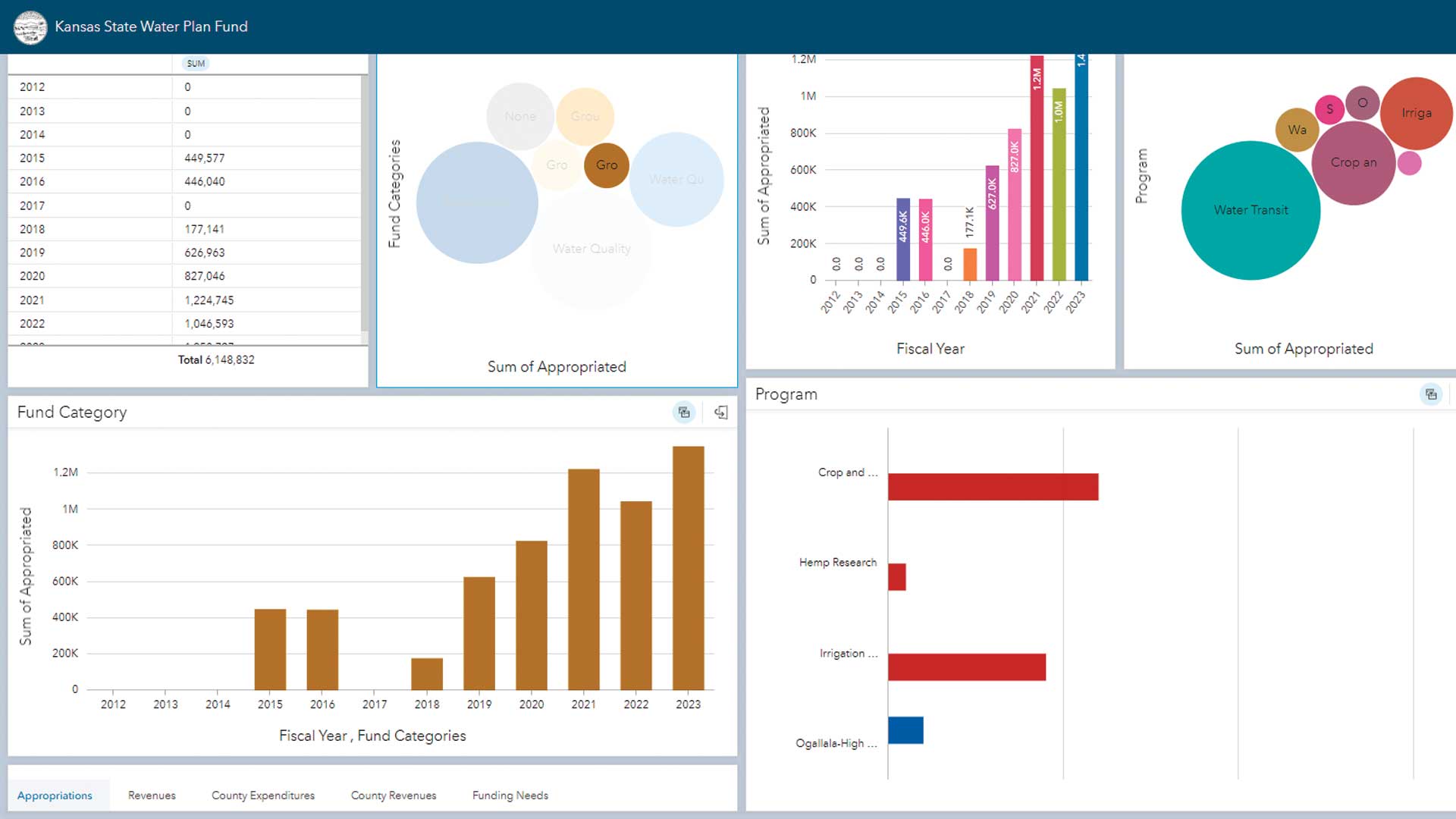
Using ArcGIS Knowledge, the Kansas Water Office (KWO) integrates large amounts of nonspatial and spatial data and applies spatial and graph analytics. With the information produced, KWO communicates more effectively with stakeholders through interactive charts and graphs so that they can make more informed decisions.
The visualization tools in GIS not only reveal the current situation but can also model the future. Built using GIS, digital twins are more than 3D visualizations. They can contain a wealth of information on buildings, neighborhoods, and cities that can be queried. Digital twins can be used to develop, model, and test proposed solutions in the context of existing conditions. The City of Prague in the Czech Republic is employing its digital twin not only to optimize city operations but also to design solutions to connectivity problems within the city’s infrastructure.
Missing Maps, which provides free mapping services to humanitarian organizations, is working to aid at-risk populations in Sudan. It analyzes data on hazards such as drought, flooding, and areas of conflict and social stressors such as food insecurity and the displacement of populations. Using results of this analysis with predictive models, Missing Maps can anticipate where aid will be needed and proactively stage resources to speed response.
As ArcGIS continues to expand the analytical capabilities in GIS and incorporate information technologies such as cloud computing, its scalability will aid in tackling challenges such as the effects of climate change, declining biodiversity, and the need for sustainable urban design.
About the author