Lehigh University has a long history of using geospatial technology, including GIS, to prepare future K–12 educators to teach their students analytical thinking and problem-solving skills. The private research university located in Bethlehem, Pennsylvania, first introduced a dedicated geospatial technology course for science and environmental educators in 2008.
“For 15 years we have taught versions of that class for educators across disciplines,” said Tom Hammond, associate professor of instructional technology and teacher education at Lehigh University.
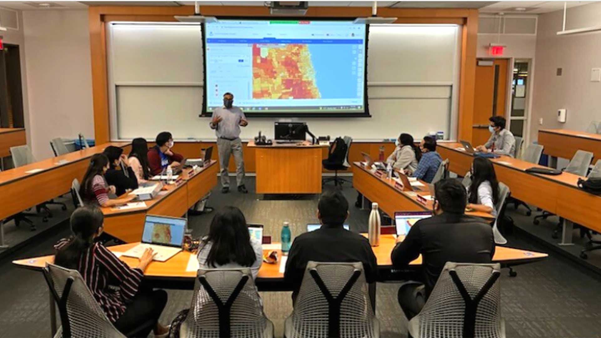
Currently, the Lehigh University College of Education offers the Teaching, Learning, and Technology Program, which focuses on teaching future educators how to align technology with standard curricula to create an innovative learning environment. The university also offers a shortened version of the program within its two graduate certificate programs.
The program is designed to meet educators where they are in their learning journey. Through a combination of coursework and field studies, it empowers them to teach with technologies such as GIS in the context of their expertise, Hammond explained.
“Whether it is understanding global issues like climate change or local issues like fast food [restaurant] density and redlining policies over time, geospatial tools are an incredibly powerful tool for understanding these complex issues,” said Hammond. “We include GIS in our teacher education programs to help educators learn the technology and give them the skills to incorporate a geospatial component in their curriculum.”
Aligning GIS with K–12 Curricula in the Community
It’s that commitment to providing teacher education and bringing technological tools into more K–12 classrooms that led Lehigh faculty and others to start the Environmental Literacy and Inquiry Working Group (eli.lehigh.edu). Funded through the National Science Foundation, this collaborative organization brings together Lehigh faculty and students from the university’s college of education and college of arts and sciences to educate local K–12 teachers on how to improve their classroom with technologies like immersive virtual reality (VR) and GIS.
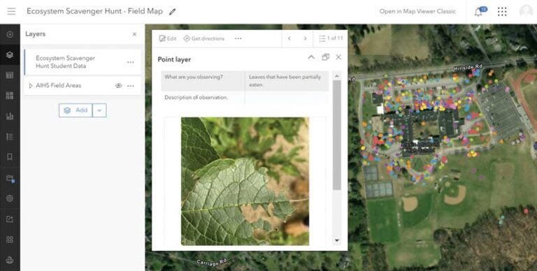
This program has brought these technologies to seven high schools to teach subjects that include robotics, computer science, physics, and social studies. The curriculum is built on inquiry-based learning activities that use dynamic interactive mapping applications to analyze data patterns and relationships. The various topics include climate change, energy, land-use change, tectonics, and socioenvironmental science investigations. Students are encouraged to collect data in their community by using ArcGIS Field Maps and then later manage, query, and analyze the data using ArcGIS Online.
For example, in one participating biology class, students took what they learned about macromolecules (proteins, fats, and carbohydrates) and used GIS to explore a public health issue. They identified local fast-food restaurants where people could be consuming those macromolecules and compared those locations with places where they could burn them off, like gyms. The research added a real-world context to their studies. They mapped their data to find trends and make suggestions to the community, including where to offer fresh food or places to exercise.
“Spatial thinking isn’t a part of standard curriculums but is an essential skill set that is cross-disciplinary and helps someone really understand something, especially if it is meaningful or if it’s something that they are invested in and can get excited about,” said Hammond.
Lehigh’s Teaching, Learning, and Technology Program and the Environmental Literacy and Inquiry Working Group received an Esri Special Achievement in GIS Award in 2020 for their innovative use of mapping and analytics technology as well as thought leadership in the field of GIS education.
Helping Expand the Use of Geospatial Technologies Across the Nation
The success of previous projects allowed the Lehigh University College of Education not only continue pursuing other research grant opportunities but also expand its education programs to enhance high school students’ geospatial skills and boost their science, technology, engineering, and mathematics (STEM) knowledge.
In April 2020, the National Science Foundation awarded $2.85 million to Lehigh’s College of Education and two other universities for geospatial technology research-practice partnerships across three regions of the United States. For the past three years, project leaders worked with teachers at two high schools in each region to develop socioenvironmental investigations that fit within the students’ curriculum.
Doug Leeson, a former English teacher and now a doctoral candidate at Lehigh University, worked with the grant team and designed the research studies around GIS in K–12 classrooms. He said the work highlighted the value of honing spatial thinking in formal education. A student project is used to propose changes to the school’s campus to make it more ecologically sustainable.
“Spatial literacy has so much value because it helps students grasp the context of what is happening outside of a textbook. When you present a lesson using maps, they can see the patterns and relationships and understand how these systems work in a digestible way,” Leeson said.
”
As part of his doctoral work, Leeson helps high school teachers develop their understanding of GIS and fit it into their classrooms. In one case, Leeson helped incorporate geospatial technology into an exercise testing soil properties as part of the lab work in a chemistry class. He had students take their samples from different areas around campus and use ArcGIS Field Maps to track their location.
“It was great because the students checked the box of what they needed to do for the curriculum by learning how to test for pH, phosphorous, nitrogen, and potassium. But then they analyzed that information with the maps and could see correlations like, ‘OK, we have high levels of this here because of runoff from cars or from trash,’ and use geospatial reasoning to answer why there are differences in the samples,” said Leeson.
In another instance, Leeson worked with a social studies teacher to study historical redlining boundaries around Philadelphia and see the changes and trends in neighborhoods over time. “No matter the context or academic level, we have found there is a place for GIS to be used,” said Leeson. Some students have expressed an interest in pursuing environmental engineering or going to college to study GIS because they were exposed to GIS.
Although Lehigh’s grant funding ends in 2024, Leeson is optimistic about GIS in K–12 curricula expanding as well as the plans to empower participating teachers to involve their colleagues. Leeson noted that anyone with the ArcGIS for Schools Bundle can incorporate GIS in their classroom.
“You don’t need a professional or university team of researchers to come into your classroom to teach you about it. You just need that initial introduction and just a little spark of curiosity, and I think from there, [anyone can] figure it out,” said Leeson.
While there are constraints to incorporating GIS in the classroom, the key to successfully bridging these gaps is meeting educators where they are and within the context of their needs.
“The key to incorporating GIS in our classrooms is ensuring it serves the curriculum and meaningfully enhances it.