Create a Space-Time Cube Layer
In this tutorial, learn how to analyze spatiotemporal data by visualizing changing homeownership rates over time throughout Florida.
In this tutorial, learn how to analyze spatiotemporal data by visualizing changing homeownership rates over time throughout Florida.
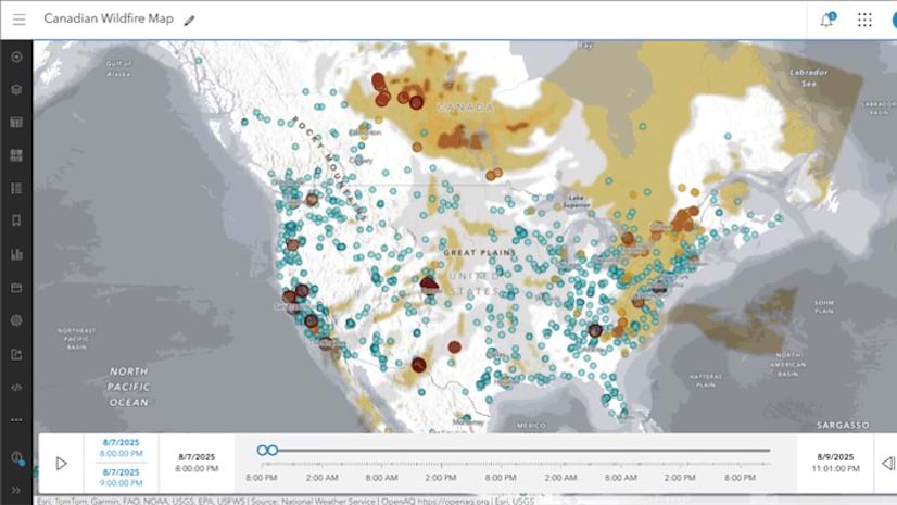
Use data from ArcGIS Living Atlas of the World to make a Canadian smoke and fire map that explores current smoke conditions and air quality.
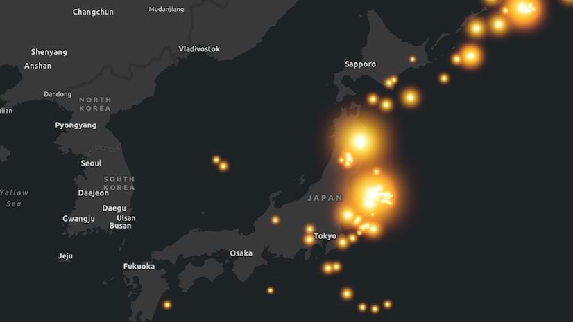
In this tutorial, learn how to use ArcGIS Pro to create a short animation of earthquakes in Japan.
A series of short videos shows examples and provides advice for choosing colors and color schemes for maps.
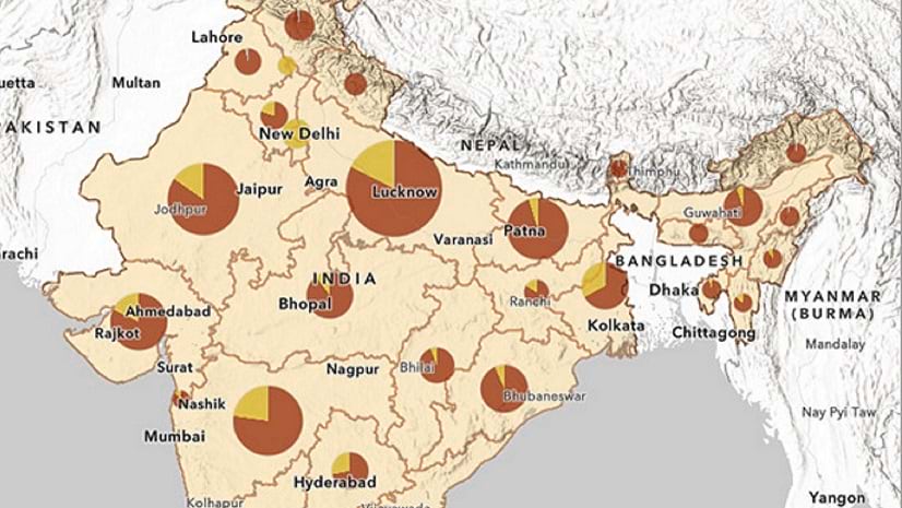
In this tip, learn how to add a .csv file to a map in ArcGIS Online and join it to a feature layer.
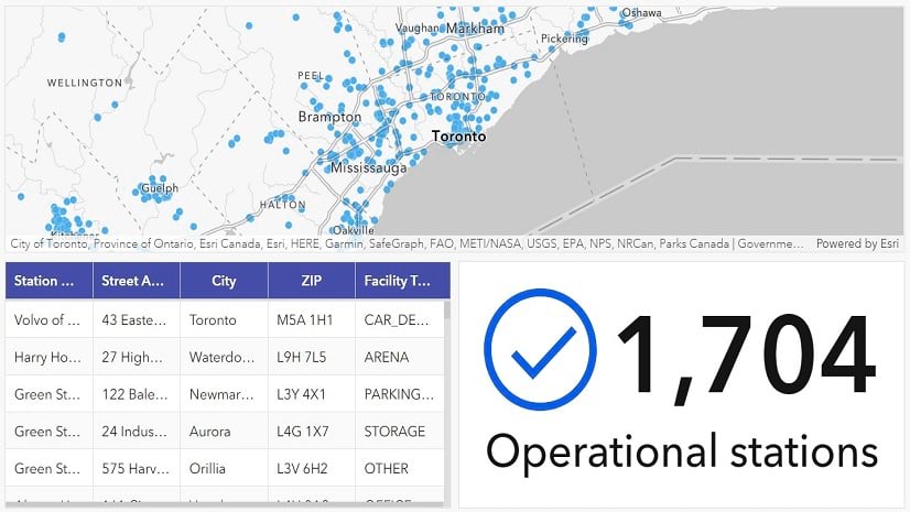
In this lesson, you'll use ArcGIS Dashboards to create a dashboard that allows users to find charging stations for electric vehicles.
Learn how to make a map with a glowing double ring effect using smart mapping in ArcGIS Online.
Web map pop-ups can be configured to send email back to you or your organization.
Use the Elevation Profile app template to make a web map that shows the difficulty of hiking trails.
Learn to import and prepare data for applications, create and style maps and layers, as well as develop a mapping application...
This tip just might end up being one of your all-time favorites. The release of ArcGIS Pro 2.0 in June 2017 gave you the ability to save and ...
ArcGIS Online provides a variety of ways to organize content you frequently use, including using favorites...