
GIS professionals from across the globe gathered in San Diego, California, July 13–17 for the 2026 Esri User Conference (Esri UC). Centered on the theme “GIS—Creating a more intelligent world,” the event brought together thousands of GIS practitioners, experts, and thought leaders as well as virtual attendees to discover the latest advances in GIS technology, connect with colleagues, and get hands-on experience with Esri products.
Artificial intelligence (AI) was a popular topic, and one message was clear: AI needs GIS. Speakers on the opening day of the conference emphasized that AI models require authoritative geospatial data to deliver accurate results, noting that AI is only as good as the data behind it. Geospatial AI integrates the power of GIS and AI across organizations and workflows.
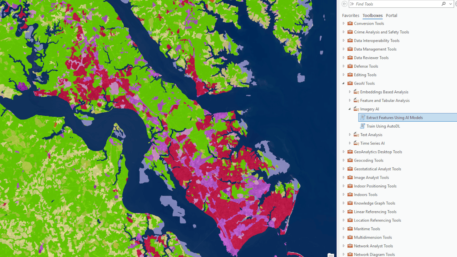
At Esri, three pillars comprise the geospatial AI capabilities available in ArcGIS: AI assistants enhance user experience, AI tools and models advance the science of GIS, and agentic AI expands the impact of GIS across organizations. With these new AI-driven capabilities, users can extract information at scale, quickly understand patterns and relationships, automate workflows, and ultimately make GIS easier to use.
“AI is already transforming GIS,” says Ismael Chivite, Esri product manager for geospatial AI. “It’s making it easier through the assistants. It’s making it more powerful with new AI tools and models. And we are making GIS more impactful than ever before through agentic mapping applications that are easy to use.”
A User-Centered Approach
The new AI-powered assistants, agents, and tools from Esri are designed with users in mind. They are first released in beta so users can provide feedback on how they’re working and suggest additional functionality. This helps Esri build a product based on what people need.
“We really listen to user feedback and want to make sure users are involved when it comes to the development of new capabilities like AI,” says Jett Legacion, associate product marketing manager for geospatial AI at Esri.
The team also focuses on equipping external AI agents with geospatial tools, enabling interoperability. AI that is grounded in geographic context helps deliver strong location insights for better decision-making, says Chivite.
AI Assistants for Your Everyday Tasks
The latest assistants available in ArcGIS help users navigate workflows and easily carry out tasks like coding and creating metadata. They are included with user types and are available to use in ArcGIS Online and ArcGIS Pro, with ArcGIS Enterprise coming soon.
Here’s how each assistant can help you do your work and boost your productivity.
AI in ArcGIS Pro
The ArcGIS Pro assistant, designed for anyone who uses ArcGIS Pro daily, helps you build charts, run analysis, and change symbology using natural language prompts.
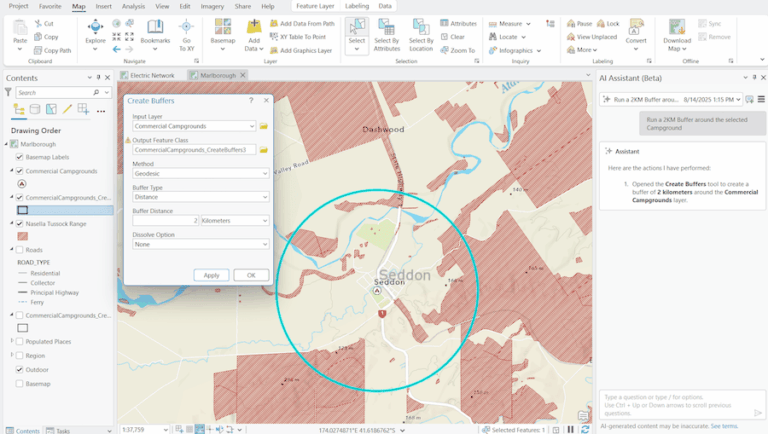
Structured Query Language (SQL) is a programming language used to retrieve, filter, and manipulate data stored in rows and columns inside a database. With the ArcGIS Pro assistant, users can query their data more efficiently using SQL and answer questions about documentation for ArcGIS.
“The answers can help you better understand ArcGIS and save time by retrieving relevant information when you need it,” says Legacion. “For example, you can submit a question about how to do a particular workflow and ask for suggestions on how to complete it, all within ArcGIS Pro.”
Coding Support in ArcGIS Notebooks
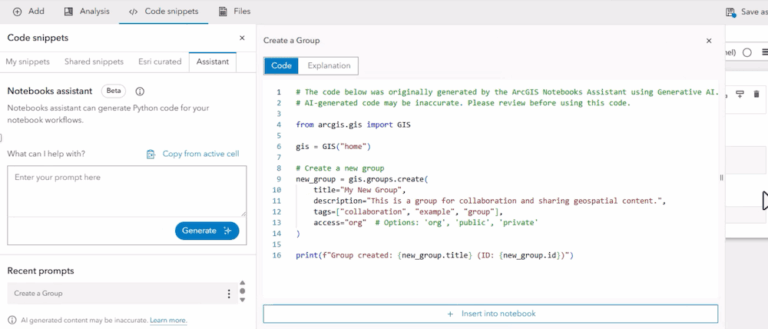
ArcGIS Notebooks provides an integrated Jupyter Notebook environment inside the ArcGIS ecosystem that runs, documents, and shares Python code for spatial analysis and data science. The ArcGIS Notebooks assistant helps you write, explain, and learn code faster using natural language prompts—without leaving the notebook.
The assistant also helps you troubleshoot and fix coding errors, which is a significant pain point for developers, those just beginning to code, or anyone learning programming languages.
Metadata Creation
Currently in beta, the Item Details assistant is a tool for creating effective metadata. Good metadata makes your content easier for both people and AI to find, understand, and use, so anyone who owns and creates content like maps and layers in ArcGIS can benefit from using this tool.
Metadata is also key in map production. When you bring data into applications such as Map Viewer, accurate metadata for feature layers and descriptions helps the map and any pop-ups look their best by conveying clear information.
“It helps AI discover your items, and it’s able to understand and use them more effectively,” says Legacion. “If an AI agent has access to poorly described data, it may struggle to answer questions accurately. Good metadata provides the context it needs to better understand the data and deliver higher-quality answers.”
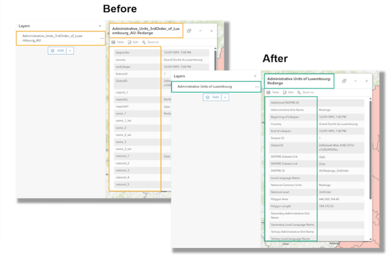
The Suggest button for fields automatically creates improved display names, descriptions, and value types. This feature also reads your layer and drafts the metadata for you, returning the suggested text so you can review, approve, and save it in seconds. This tool is available now in ArcGIS Online and ArcGIS Enterprise 12.0 and is coming soon to ArcGIS Enterprise 12.2.
Agentic AI
Agentic AI aims to expand the reach of GIS in two ways. First, it powers agentic mapping apps to make geospatial workflows more accessible and intuitive for users. Second, it makes geospatial knowledge and tools available to third-party AI agents through Model Context Protocol (MCP), an open-source standard that connects AI apps to external systems. MCP support is available now as a beta for ArcGIS Location Platform and ArcGIS Enterprise, with ArcGIS Online coming soon.
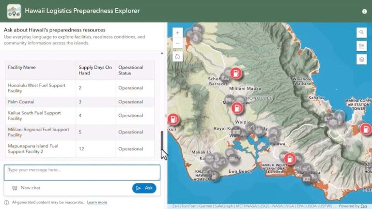
Newer GIS users who may not be familiar with workflows like querying data, as well as experienced users in search of help or suggestions, can now use natural language to get assistance. Users can ask questions in a chat for a conversational experience. The built-in agents provide answers and show the results on a map so users can better see patterns and trends.
“The powerful insights gained from GIS can now be made easily accessible thanks to the conversational experiences,” says Legacion.
While ArcGIS includes ready-to-use geospatial agents for data exploration and navigation, users can also create their own. The AI components for the ArcGIS Maps SDK for JavaScript, available in beta, allow users to interact with a web map using natural language. Additionally, the AI components in the JavaScript Maps SDK—including the Navigation Agent, Data Exploration Agent, and Help Agent—let users explore web maps via natural language interactions.
The ArcGIS Instant Apps Data Explorer template is a new way to create agentic mapping apps for map and data exploration. You can now interact with your map using an AI-powered chat interface. This no-code solution is currently in beta for ArcGIS Online and will be released in beta in ArcGIS Enterprise 12.2.
AI Solutions for Your Work
Chivite encourages organizations to adopt AI tools and solutions at their own pace. He says that Esri’s focus is on building useful applications for AI that people can use whenever they choose to.
“We don’t rush AI tools to our users, and we don’t want our users to rush in adopting them either,” he says. “When they’re ready, they can reach out to Esri for help identifying where these tools can help them in their business workflows.”
Legacion believes that the new AI-driven tools, models, and assistants will enable users to work faster and even complete tasks they may not have been able to do before.
“These tools make GIS more accessible to users across the world and to people who may have no idea what GIS is,” she says. “I think that’s the most exciting part.”
Helpful Resources
AI Needs Geography—and You
https://www.esri.com/about/newsroom/arcnews/ai-needs-geography-and-you
The Next Era of AI and ArcGIS
https://www.esri.com/about/newsroom/arcnews/the-next-era-of-ai-and-arcgis
Trusted AI in ArcGIS
https://trust.arcgis.com/en/trusted-ai/trusted-ai.htm
Esri’s Approach to Responsible AI
https://www.esri.com/arcgis-blog/products/arcgis/geoai/esris-approach-responsible-ai-enterprise