Tornado Season
A devastating storm struck Douglas County in April 2024. Learn how GIS helped the county respond to and recover from the disaster.
August 2024

A devastating storm struck Douglas County in April 2024. Learn how GIS helped the county respond to and recover from the disaster.

Learn to make a hurricane map in a minute using ArcGIS Online and ArcGIS Living Atlas of the World.
The Coast Community College District in Orange County is using geospatial tools to give students a road map to career success.
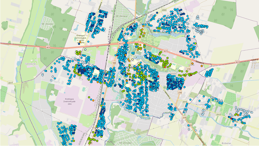
ArcGIS has become an essential tool at Kretinga Waters in optimizing operations and making informed decisions.
Jay Theodore, Esri Chief Technology Officer, explains why organizations are combining AI and the geospatial thinking to make better decisions.
This forthcoming title from Esri Press takes you into the depths of Challenger Deep, showcasing the perseverance needed for ocean exploration.
Learn about the new community maps based transit initiative launched at Esri.
Introducing ArcGIS Flight, a mobile application that revolutionizes the way drone flights are planned and executed.
Learn about new and custom themes in ArcGIS Dashboards and how to apply them in your own work.
You can now recover items that were accidentally deleted in ArcGIS Online. Learn how.
Make changes to your layer schema directly within Map Viewer using the new add and delete field experience.
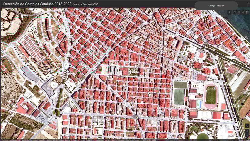
Explore how models in ArcGIS Living Atlas of the World can streamline change detection for mapping agencies.
Jeff Opperman, Global Freshwater Lead Scientist with World Wildlife Fund, explains how the WWF protects the economically vital Mekong Delta.
Through firm and project management, collaboration, field safety, and drone use, learn how surveyors can leverage GIS to optimize workflows.
Over four weeks, learn how to use modern, no-code technologies to build useful and engaging geo apps.
In this course, you will get familiar with ArcGIS Arcade scripting environments and build expressions.
The new ArcGIS Maps SDK for JavaScript Associate 2024 Technical Certification tests your experience developing and deploying apps for JavaScript.