
Despite the upheaval and changes to our lives caused by the worldwide coronavirus disease 2019 (COVID-19) pandemic, GIS is still here. In fact, GIS is more important than ever. The pandemic has raised global awareness of the relevance of GIS as a decision-making technology that gives people the ability to build healthy communities, resilient cities, and a more sustainable planet.
Therefore, the global GIS community can celebrate with gusto this year, embracing this essential technology for applying geography and spatial thinking to decision-making. Because of COVID-19, however, you will likely need to make your celebration a virtual one. To support your online event, Esri offers many resources, which will be outlined below. But first, let us address the when and why of GIS Day.
The event will be observed officially on November 18, 2020, although you can certainly choose another day to celebrate what your organization is doing with GIS. The first GIS Day was held in 1999, and since then, it has served to help others learn about geography and the real-world applications of GIS that are making a difference in our society. It’s a chance for you to share your accomplishments and inspire others to discover and use GIS.

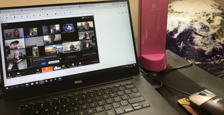
Many GIS Day events will occur online this year. How can your government agency, school, university, company, or nonprofit organization host such an event? You can use Zoom, Skype, Facebook, a YouTube livestream, Google Hangouts, Adobe Connect, GoToWebinar, or another type of web-conferencing method.
If the high attendance figures for online GIS-based conferences over the last seven months are any indication, your audience this year for GIS Day could be much larger than the ones at face-to-face events in the past. Use this opportunity to go big! Think creatively about how to highlight the good people in your organization; the ways you use GIS; and the positive difference it is making to your community, hence why GIS will matter to your audience.
Here are several ideas to consider for your virtual event:
Experiment with engaging GIS technology!
Try using ArcGIS Hub, ArcGIS Experience Builder, or an ArcGIS StoryMaps collection to showcase your virtual event.
Teach a hands-on workshop! Focus on a tool that you are excited about, or perhaps a dataset that your organization is proud to have created. Need additional ideas? Consult this GIS Day interactive map.
During the workshop, you can show your audience some of your favorite maps in ArcGIS Living Atlas of the World.
Check out the Mapping Hour series—hour-long videos that you could use to get instructional guidelines as well as ideas on tools and teaching approaches. Also, GeoInquiries and Learn ArcGIS lessons can provide you with additional content.
If you need further inspiration, read this story about how organizations such as the government of Upper Austria and Weld County, Colorado, celebrated GIS Day in 2019. This second story showcases several other GIS Day events that typify the 1,500 celebrations held worldwide and aptly demonstrate what people have done to make the day extra special and spatial.
Make your celebration interactive! Create a map-based quiz or use existing ones such as Name That Place, Sounds of Planet Earth, or Weird Earth, or choose from among this collection of treasure hunts. You could even use Kahoot! or another fun online quiz format in conjunction with maps and images.
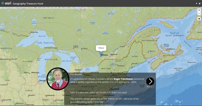
Showcase the new quiz Geography Treasure Hunt: Pioneers of Geography and GIS Edition. Quiz participants will find the answers to a series of 20 questions. Each question is focused on a geography or GIS pioneer and provides a hint about a location somewhere in the world, where the pioneer either was born or had worked. To answer the question, find the location and frame it within the viewfinder by using the map’s pan/zoom functions.
GIS Day celebrants can also put their GIS skills to the test with this new, GIS-themed crossword puzzle. Use it in your event as a contest, awarding kudos to the person or team to get the most answers in, say, five minutes.

The Resources page on the GIS Day site provides additional lessons, posters, videos, and other items you can use.
Need more inspiration? Here’s a roundup of 101 ways to participate in GIS Day, including sending a thank-you note to a GIS or geography teacher and producing a GIS Day song.
Once you’ve gathered your team and planned what you will do, register your event. It will appear on a GIS Day map. With your registration, you will receive a software donation (five ArcGIS for Personal Use licenses go to each GIS Day host for them to give away as they see fit) and event support (help with any questions or resources).
If you are unable to host an event, no problem! Use this web map to find an event of interest to you, then join that event!
Stay tuned, follow GIS Day on Twitter, and visit the GIS Day website often to learn more about how you can join the global GIS community and Esri to celebrate virtually this year.
P.S. Watch your email and stay tuned for more information about special virtual celebration content coming closer to GIS Day.