William Shuart, a geographer with the United States Army Corps of Engineers, came to Virginia Commonwealth University (VCU) in Richmond in the late 1990s as a student and graduated with bachelor of social science and master of science degrees in environmental studies.
Today, in addition to his job with the corps, he is an assistant professor at VCU and the environmental technology coordinator at the university’s Rice Rivers Center, an environmental research and teaching facility located on the tidal James River. The university and its center leverage GIS and remote sensing technologies for environmental life science research and courses.
The school’s mission, as stated on VCU’s website is to “develop young scholars to be the next generation of environmental professionals.”
Shuart takes that mission to heart. He uses drones and the latest in Esri technology, such as ArcGIS Drone2Map, to help students bolster their in-demand job skills for their future careers. Since the beginning of his career, he has applied the latest Esri technologies in both his research and his classroom instruction. The goal: empower students with a foundational understanding of GIS that they can use as part of their technical and soft skills in the workplace.
“We are equipping students not [only] to understand the GIS software that Esri provides—we [also] want them to become expert users of those tools to give them a foundation to apply the software in any situation after they graduate,” Shuart said. “It is an unknown box where they are going to go after graduation, so it is my job to help them become quality employees when they graduate.”

Tools to Empower Students for Big-Picture Thinking and Workforce Application
Shuart teaches two courses, Environmental Remote Sensing and Application of Drone Technology, to undergraduate and graduate students. In his 25-year academic career, Shuart has utilized the latest GIS and drone software available, most recently teaching with ArcGIS Drone2Map, Site Scan for ArcGIS, and ArcGIS Pro. For Shuart, the challenge has been to evolve his approach to best fit technological advances and the needs of the students. He researches the latest uses of GIS in the real world and incorporates the most recent technology and software releases into his classes.
Twenty-five years ago, a GIS professional had to focus on being an information technology, network, database, and server person, according to Shuart. “Students had to understand the hardware, software, and data analysis to put it all together,” he said.
Today, because the GIS infrastructure is now in place, students can focus on programming, bringing disparate data together, and doing more with the technology—for example, using a different kind of camera on a drone, according to Shuart. “They’re really on the cutting edge in terms of GIS and remote sensing,” he said.
Shuart ‘s teaching philosophy focuses on bringing value to the students by correlating GIS and drone technologies and their best practices with the skills, knowledge, and abilities necessary for jobs postgraduation.
“Whether they are planning [drone] flights; bringing Excel data into CSV [files], GIS or GPS, and remote sensing; or showcasing data in a PowerPoint or in Site Scan, they are learning valuable skills in the process, like project management, effective communication, and visualization,” he said.
Both course structures use Shuart’s T-shaped philosophy. The horizontal line of the T represents the wide variety of skills a student needs in a workplace—communication, collaboration, the ability to pitch an idea or proposal, statistics, web app development, time management, and project coordination. The vertical line of the T represents the depth of knowledge the student has in a particular area, including software, drone concepts, subject matter, and the application of the technologies.
“The width of your skills helps get you an interview, but the depth of those skills provides the ability to truly compete for the job. But you have to be willing to shift the depth of your knowledge every few years,” Shuart said.
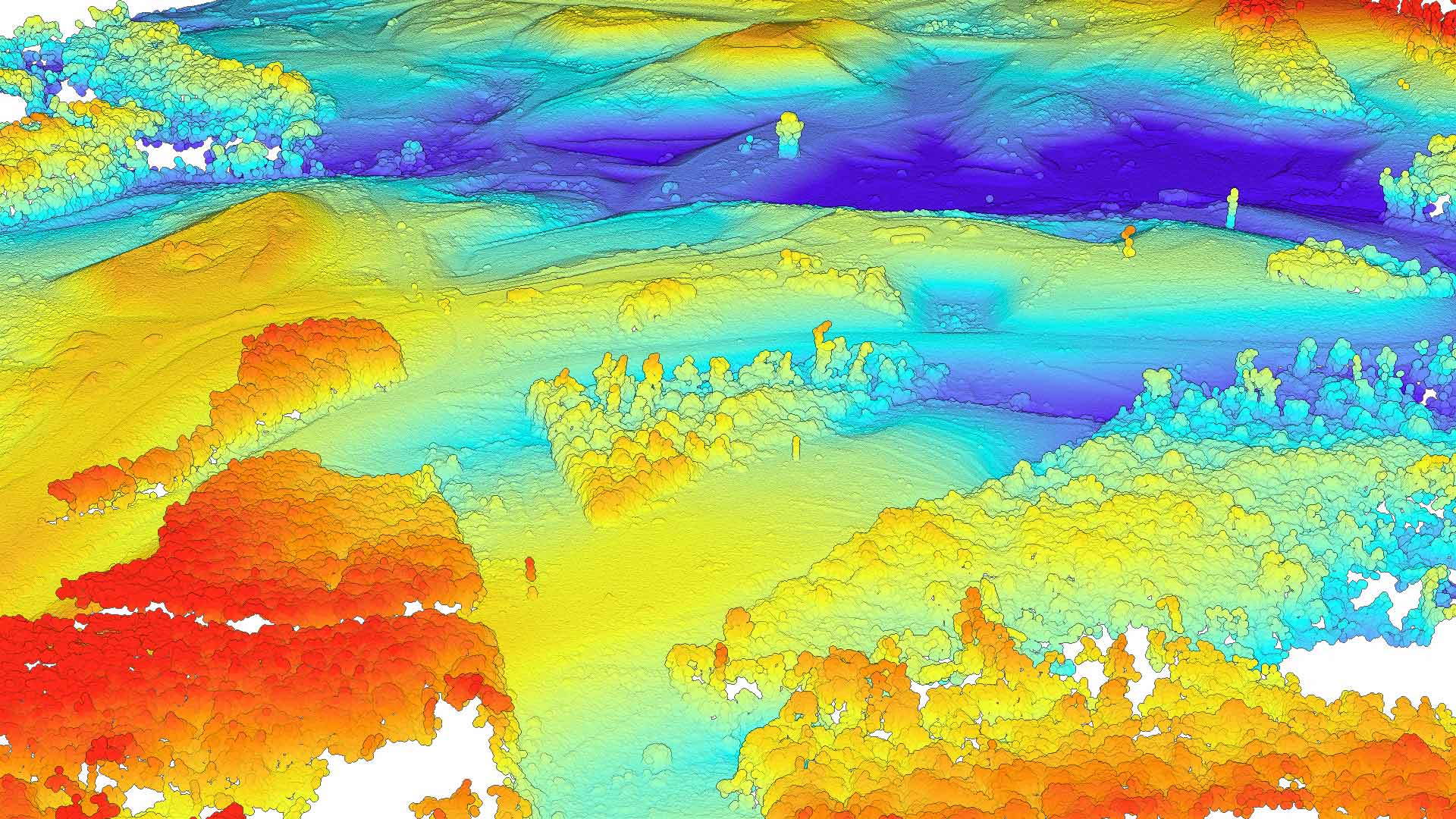
In his remote sensing class, one week students may focus on the synthetic aperture radar, while another week they’ll use forestry lidar for a biomass assessment.
Students can then work with the software between classes, play with data and get to know the semantics, according to Shuart. “But on the other hand, this teaches them to be consistent and to deliver in the end,” he said. “That’s the way jobs are set up: you have long-term deliverables, but you also have to show up and do the daily work.”
A final project both helps students develop workplace job skills and enhances students’ understanding of the technology. They apply the technology to solve a problem that is meaningful to them. Students then collect the data, complete research, draft a write-up, and present their project for 10 minutes to their peers—and the faculty.
“One thing that I disliked when I was a student was, the professor got to decide what was on two tests and my grade was based on that—a midterm and a final, right? Nobody ever liked that,” Shuart said. Now, his students at VCU can choose a class project, which counts for 35 percent of their final grade.
The students also are learning how to use the technology to solve a real-world problem and gaining transferable skills. For one project, high-resolution digital elevation models of Mars were generated using Mars Reconnaissance Orbiter datasets. Another project involved studying salinity in streams caused by street deicing in the winter.
A Student’s Success: Connecting the Tools to the Problems That Need to Be Solved
Angela Armstrong, a former student and teaching assistant at VCU, said she gained many of her skills and an understanding of ArcGIS technologies from the projects she completed during Shuart’s courses. She now works as a GIS analyst at Ørsted, a sustainable-energy company. Armstrong took several courses of Shuart’s that emphasized project work. Armstrong collaborated with the Virginia Department of Environmental Quality (DEQ) on its salt management strategy program.
The DEQ investigates chloride levels that are rising in water bodies in northern Virginia due to water runoff from where salt is used to deice the roads during winter storms. Armstrong conducted a large spatial analysis project to quantify impervious land surfaces, classified by land category, within northern Virginia cities and counties. The goal was to have a visual representation of where the majority of the runoff occurred. Armstrong shared the results in a presentation to approximately 150 stakeholders. She went a step further, creating a plan for potential education and outreach activities that DEQ could use to inform residents, since residential neighborhoods had the highest amount of runoff. The project is ongoing for DEQ.
These courses are geared mainly toward learning why GIS is useful rather than how to use the software and expose students to all the different possibilities that exist to solve real-world problems,” according to Armstrong.
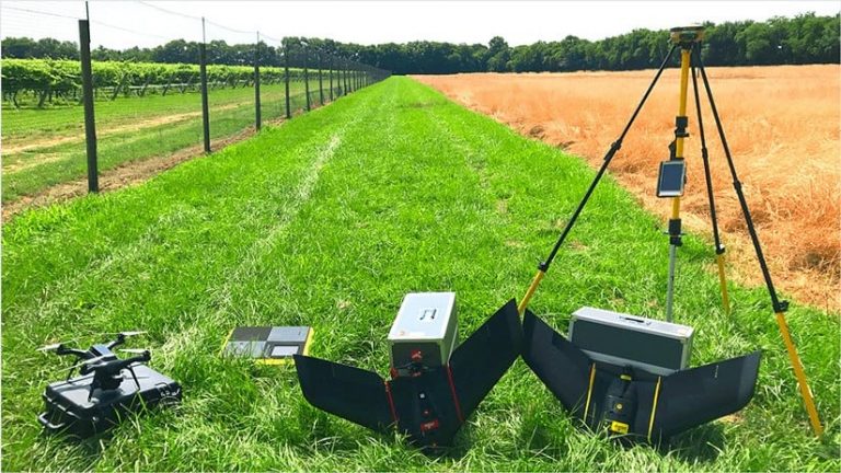
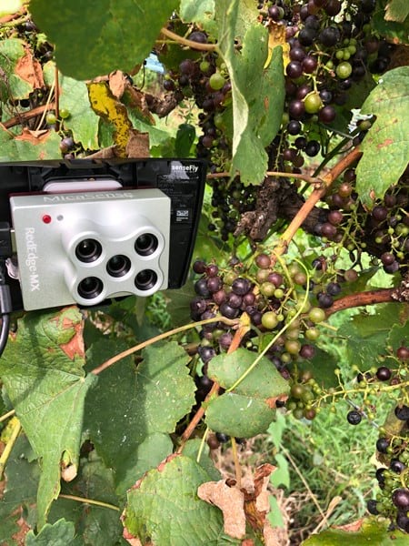
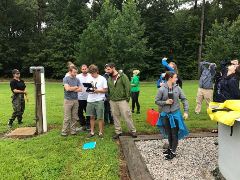
In addition to the projects and weekly assignments, the classes encourage hands-on learning. In the Application of Drone Technology course, students prepare by surveying the land and making a flight plan for a real-world location, thus learning how to run the flight paths from start to finish. In the field, students do the surveying, ensure ground control accuracy (both relative and absolute), and occasionally fly the drone. Students then run the collected data through workflows using ArcGIS Drone2Map and Site Scan for ArcGIS.
The class also invites guest speakers—including environmental quality agents, engineers, insurers, government employees, Esri staff, GIS consultants, and analysts—to discuss their wide-ranging careers. “Finding out from others how different sectors use the same technology in different ways was very helpful in understanding what parts of GIS students should focus on, for what career paths they are interested in,” Armstrong said.
Armstrong hopes to see more educators ground their lessons in real-world problems. “You you can truly teach anyone to use GIS as a technical skill,” she said. “However, teaching them how to leverage it so that it connects to problems that need to be solved—that is the most important part.”
An Innovative Future for GIS and Drone Technologies in Higher Education
Shuart’s teaching philosophy embraces a community approach. He encourages students to explore the overlap of disciplines and connect with other GIS experts in places such as Esri Young Professionals Network.
“I tell my students to get involved with other young professionals so that they are not siloed to their specific field,” Shuart said. “And I hope that when they graduate, they can collaborate with other subject matter experts to work through challenges together.”
Shuart expects GIS technology in the future to be even more integrated into daily operations for municipalities, businesses, and educational institutes. “The things that are siloed are going to become more interdisciplinary,” Shuart said, adding that with GIS, systems become more accessible for collaboration.
Read more about Shuart’s work with drones in the article “Flight Safety: VCU Researchers Use Drone to Map Campus for Intelligence and Emergency Planning Efforts.”