

The historic corridors of ETH Zurich, a prestigious public university in Switzerland, often present a maze-like challenge for students and visitors. Founded in 1855, the institution has grown from a single building with 36 students into a global leader in science and technology with around 27,000 students and more than 500 professors across more than 230 buildings.
While the university’s heritage is a point of pride, its complex architecture—including the 158-year-old main building—has historically made the campus difficult to navigate, especially for individuals with disabilities.
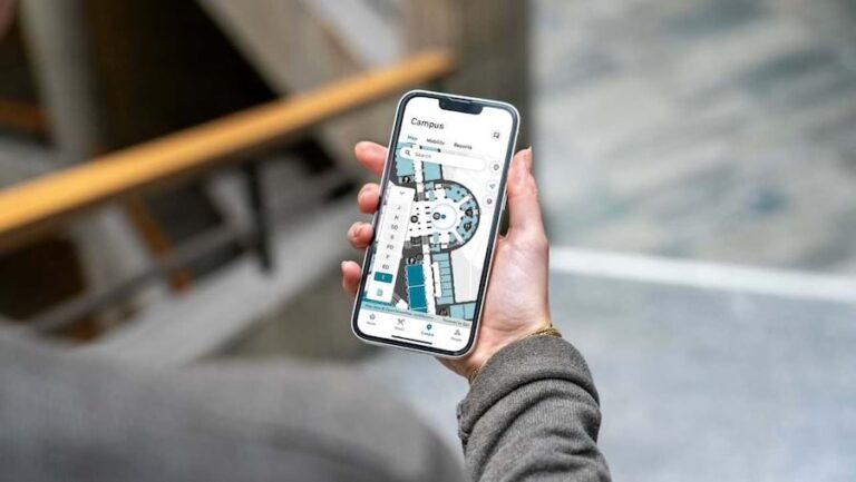
To address these needs, the university recently launched a smart campus initiative powered by ArcGIS Indoors and Esri’s indoor positioning tools. The existing ETH campus mobile app, which offers information like school news and dining options, now includes building and floor-aware maps with real-time indoor positioning. This helps ensure that people of all abilities can traverse the sprawling facilities with confidence.
Prioritizing Barrier-Free Access
The primary driver for the project was a commitment to helping people get around and improving accessibility with a wayfinding solution. According to Ricardo Roch, a GIS specialist in the department of engineering and systems at ETH Zurich, many campus buildings feature winding halls and have historic preservation restrictions that limit physical modifications—including installing new ramps and additional signage that provides directions or building information.
Previously, navigating the campus could be challenging for those needing barrier-free routes. In many older buildings, reaching a specific room might require a long detour that was not always obvious on static maps.
“The most important factor and [driving] part of our project when we started was the topic of accessibility,” Roch says.
The project evolved from a pilot program into a core component of the university’s digital ecosystem. The mapping capabilities that were added to the school’s web app provide digital routing that calculates the most efficient and accessible path from one place to another. For users with mobility challenges, the app maps out barrier-free routes that utilize ramps and elevators rather than stairs. The indoor wayfinding capability is particularly vital for a younger, tech-savvy generation that expects to have the same user experience indoors as outdoors.
Building the Technical Foundation
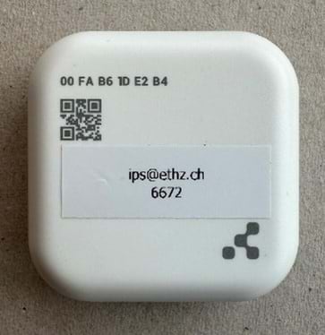
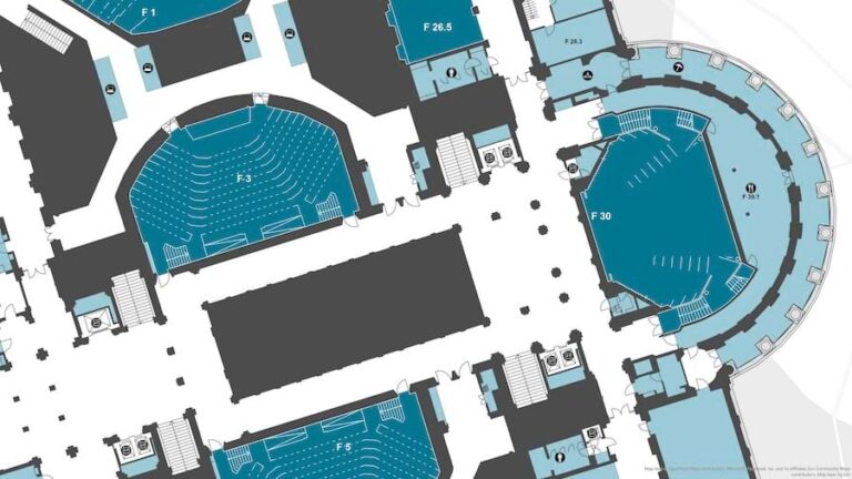
Implementing a campus-wide indoor map with navigation was a comprehensive undertaking that spanned more than three years and relied on a suite of ArcGIS technology. With the system hosted on ArcGIS Enterprise, the team used ArcGIS Pro to process the data needed to map building interiors, including floor-specific CAD files and spreadsheets with room numbers and security levels. The team used ArcGIS Indoors to structure the university’s CAD files in a standardized indoor information model, creating the floor-aware maps and the routable network of pathways. To enable the live “blue dot” positioning on those maps, was paired with thousands of installed Bluetooth beacons.
These beacons are hardware transmitters that broadcast their unique identifiers to a compatible app, which can be used to track visitors in real time or determine the device’s location. The ETH mobile app picks up these signals and converts them into precise location information. This is done by measuring the signal strength from multiple nearby beacons and cross-referencing that data with smartphones’ built-in motion sensors.
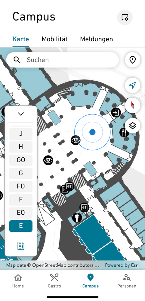
These indoor GIS capabilities were integrated into the ETH mobile app rather than a separate wayfinding app. Now, students can use the app they’re already familiar with to search for a room number or the cafeteria and see their live position on the map as they move toward their destination.
The beacon and mapping deployment currently covers 44 buildings with about 405 floors. It includes roughly 33,000 points of interest such as lecture halls, libraries, and even the famous student locker used by Albert Einstein. Managing this volume of data required integrating various sources, including CAD files and departmental databases. Roch used Python scripting to create data pipelines—automated workflows that connect different systems and migrate their information into the central GIS.
When it came to publishing floor-specific data, the team faced a unique security challenge. Because the school stores sensitive research and prioritizes campus safety, administrators could not simply release detailed architectural floor plans that showed exact wall thicknesses, window placements, or the locations of critical laboratories. To resolve this, Roch developed an algorithm to generalize these features for the public version of the app.
User Adoption and Smart Campus Success
For the ETH Zurich community, the ability to find places via a mobile phone or a web app has transformed the daily campus experience. Now, this complex environment is a more accessible and inclusive space for everyone. Since the launch of the new mapping functionality in September 2025, the indoor map data has been downloaded more than 18,000 times. Usage spikes during exams and when a new semester starts, as students seek out unfamiliar lecture halls.
Beyond general navigation, the system has fostered greater independence for users with mobility challenges. Roch notes that while the indoor GIS technology cannot fix physical barriers, it provides a better solution for people with disabilities.
“They can do it on their own now,” he says, emphasizing that users no longer need to rely on others for guidance.
Beyond simple navigation, the system helps streamline daily operations. Roch notes that users—including himself—are discovering better ways to get to and from locations they visit daily.
“Many people found out that their usual route to a location isn’t the most efficient,” Roch says. “I actually found out my [past] way to my office wasn’t the fastest way to go.”
The initiative also balances sophisticated GIS technology with a familiar user interface. The design follows common mapping standards found in popular commercial apps, making it intuitive for users who are not GIS professionals. For those needing additional help, the university provides video tutorials and information on a dedicated web page for PolyMaps, the web-based version of the system.
The success of the indoor GIS project aligns with ETH Zurich’s broader plan to create a digital twin of its entire campus. Integrating GIS technology into existing workflows helps the university maintain its buildings more efficiently by enhancing operational insights. For instance, staff can now see the exact geolocation of safety assets such as automated external defibrillators, rather than just viewing them as text entries in a database.
For other organizations considering a similar path, Roch suggests they start with a clear understanding of what they want to achieve and ensure that their intended use cases fit with the available technology. He also emphasizes the importance of keeping floor plans updated. For example, at ETH Zurich, the real estate department provides new CAD plans following construction work. This data is then imported into the GIS regularly to keep the system current.
“Wayfinding and positioning on a complex campus increases efficiency,” Roch says. “I think this results in a better mood for the employees and the students. If they can save time searching for their destination, it can improve their campus experience.”
For more information, contact Ricardo Roch at ricardo.roch@ethz.ch.