June 1, 2026 |
Christian Carlson | Urban Planning
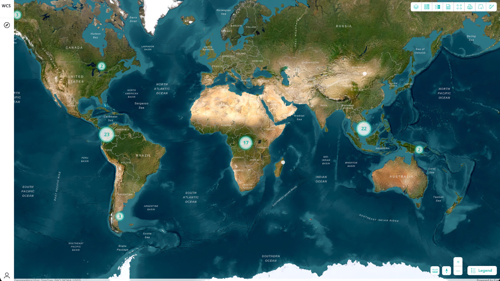
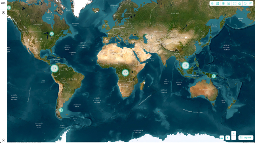
Urban Planners Harness Data for Smart Growth and Community Impact
Communities use GIS to model land use; engage residents; and form smart growth strategies that support equity, sustainability and infrastructure.