displaying 998 results

To bridge the digital divide in GIS, we need to democratize access to advanced cyberinfrastructure and high-performance computing resources.

Eva Reid emboldens women in tech to pursue challenges and try new things—advice she has recently taken herself.

Esri technology evangelist Bern Szukalski walks you through how to create your first dashboard using ArcGIS Dashboards.
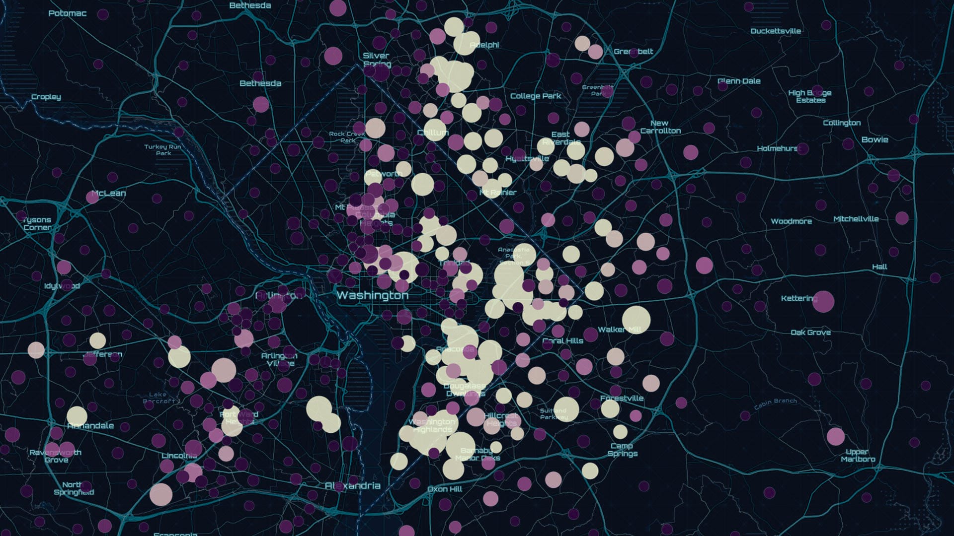
The preauthored maps in the new Esri Maps for Public Policy app foster collaboration and drive fact-based decision-making.

The new Maps for Public Policy web app from Esri provides free access to preauthored policy maps, allowing anyone to explore community issues.
It’s daunting to think how much time and effort it would take to do a manual inventory of all the trees on the more than 500 acres…
Lacking a legislative mandate that would afford reliable funding, the Georgia Geologic Survey was abolished in 2004 after serving the state...

Researchers use ArcGIS to evaluate the impact of on-site social programs on affordable housing residents.

In its law enforcement efforts, the City of Baltimore uses mapping and spatial analysis as a fundamental tool for making decisions...
The US Census Bureau projects that by 2050, there will be 88.5 million Americans age 65 and older...
Bradley Shore, from Inland Empire Health Plan (IEHP), a health insurer in Southern California, explains in an interview how his organization...
Epidemiologist Amy Hockett led the location intelligence efforts to address COVID-19 in Linn County, Iowa, helping people from all walks of life.