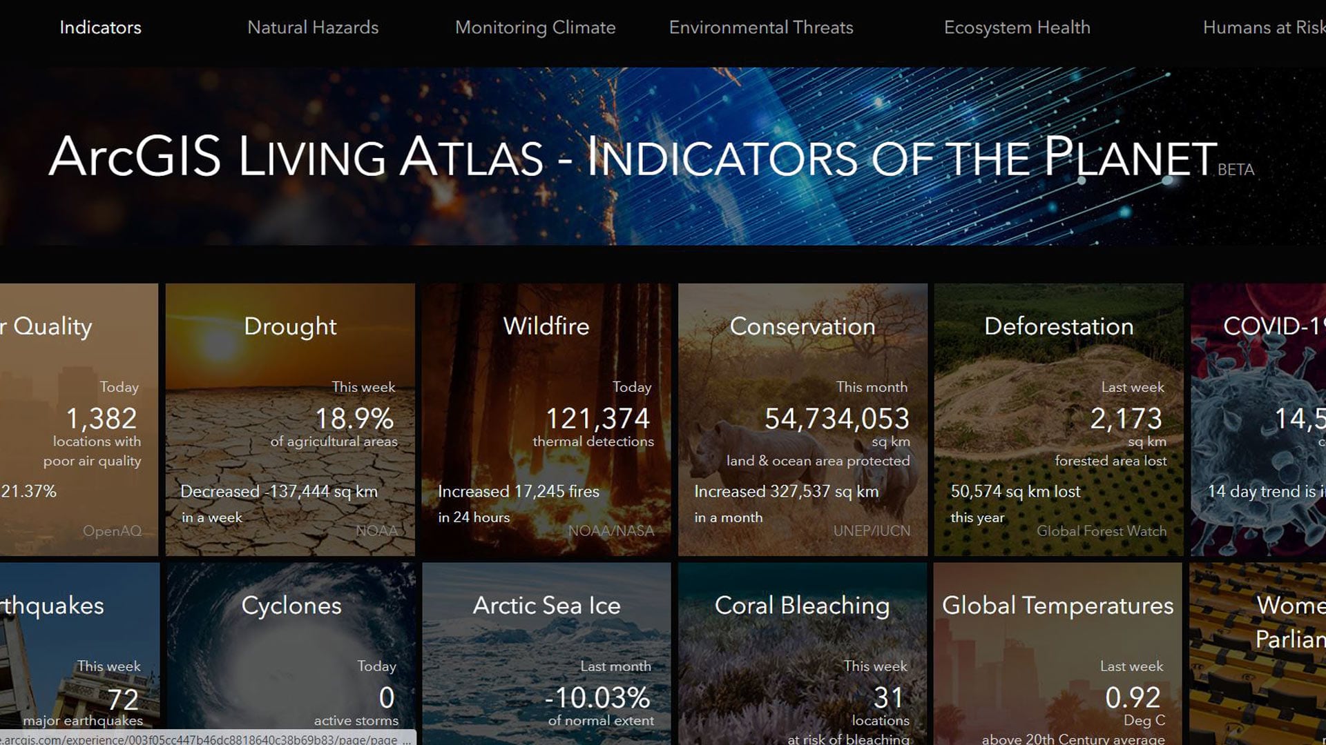
displaying 396 results
Esri technology evangelist Bern Szukalski uses content from the Living Atlas to show you how you can make your own flood map in a minute.
The National Geographic Society and Esri are teaming up to create new digital experiences that leverage geography and GIS.

Science is part of Esri’s DNA, and what the world needs now is the power of deep, integrative geographic science.
Create maps that represent individuals, houses, or anything else you can count, with the dot density mapping style in the Map Viewer beta.
The National Science and Technology Center for Disaster Reduction used 3D GIS to put together a war game simulation for flooding.
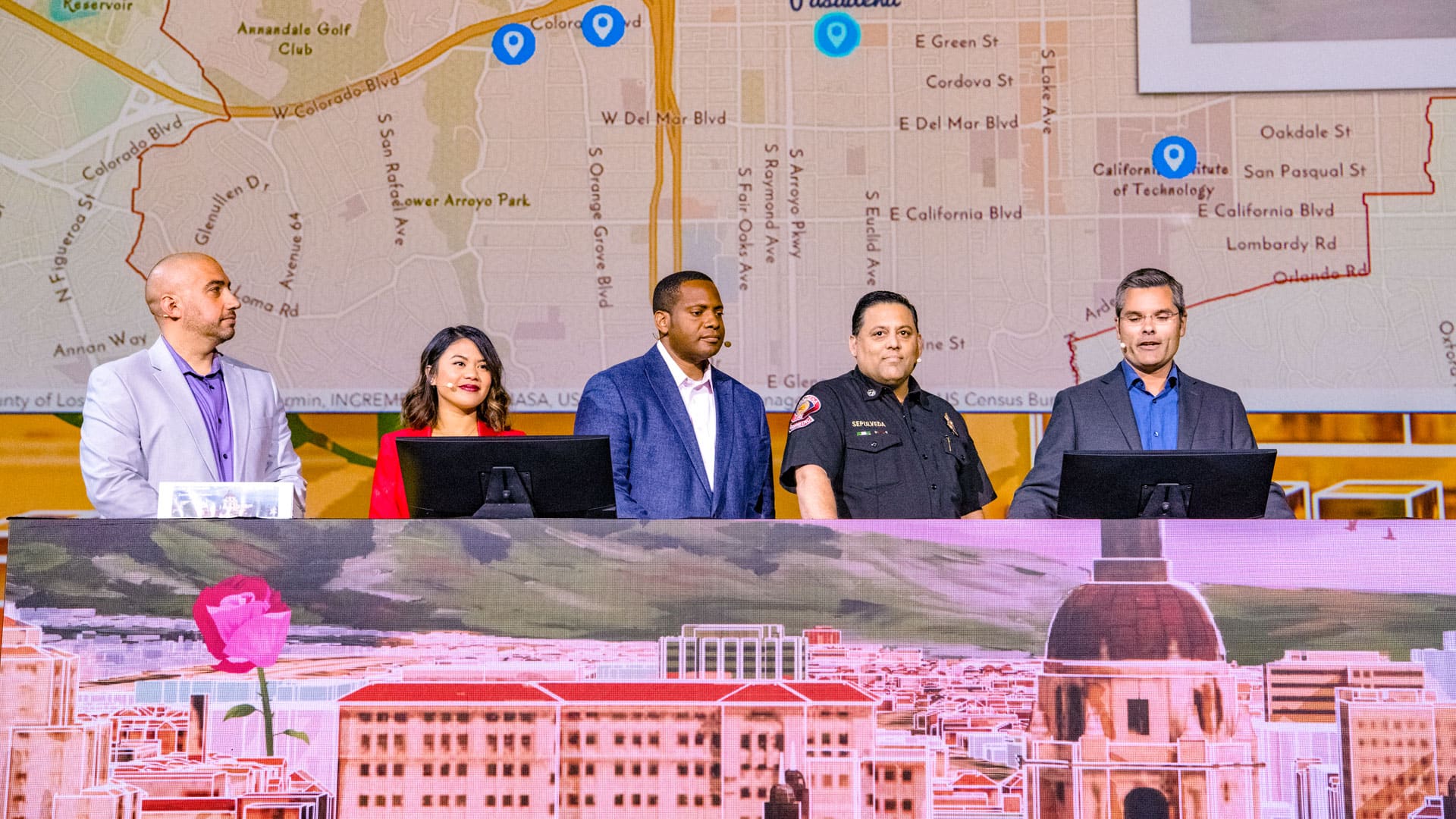
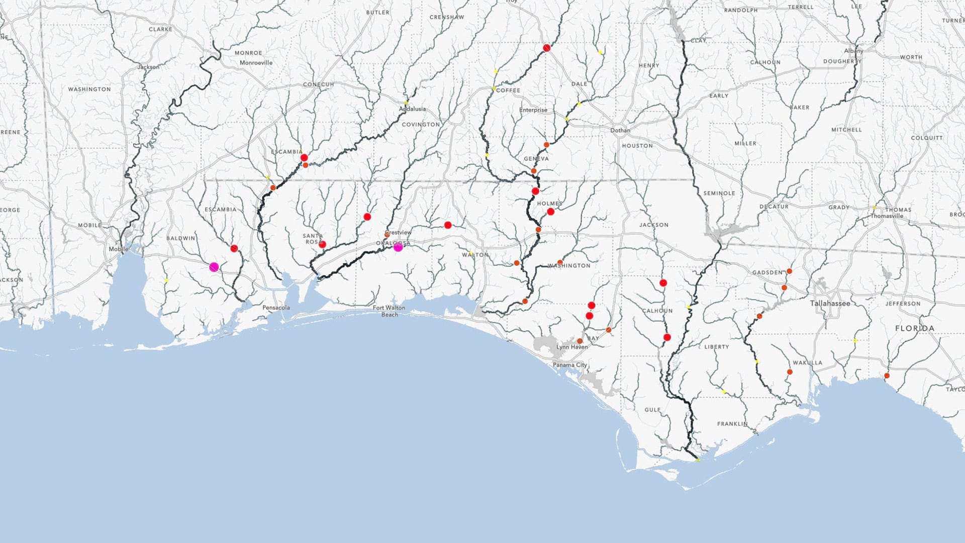
The City of Pasadena, NatureServe, the US Census Bureau, and other organizations show how GIS helps them see what others can't see.

When a presenter positions a world map locally, how do attendees from other regions experience the map and the information it exhibits?
I like to think of geodesign as a perfect marriage of art and science. In geodesign, a GIS platform is used to support both the creative act...

Esri’s new tagline, The Science of Where, captures the company’s long history, values, and mission, as well as the essence of future endeavor.
The 2017 International Cartographic Conference will be held in Washington, DC, June 2-7—one week before the Esri User Conference in San Diego, CA

Acquisition of Airbus' WorldDEM4Ortho Means Esri Provides Most Accurate Global Satellite-Based Elevation Data Available
