displaying 884 results

ArcGIS Analytics for IoT can help organizations use the big, real-time data generated by IoT devices to gain spatial insight and awareness.

A GIS platform that combines desktop, web, and mobile GIS apps is helping students across Singapore develop their spatial thinking skills.
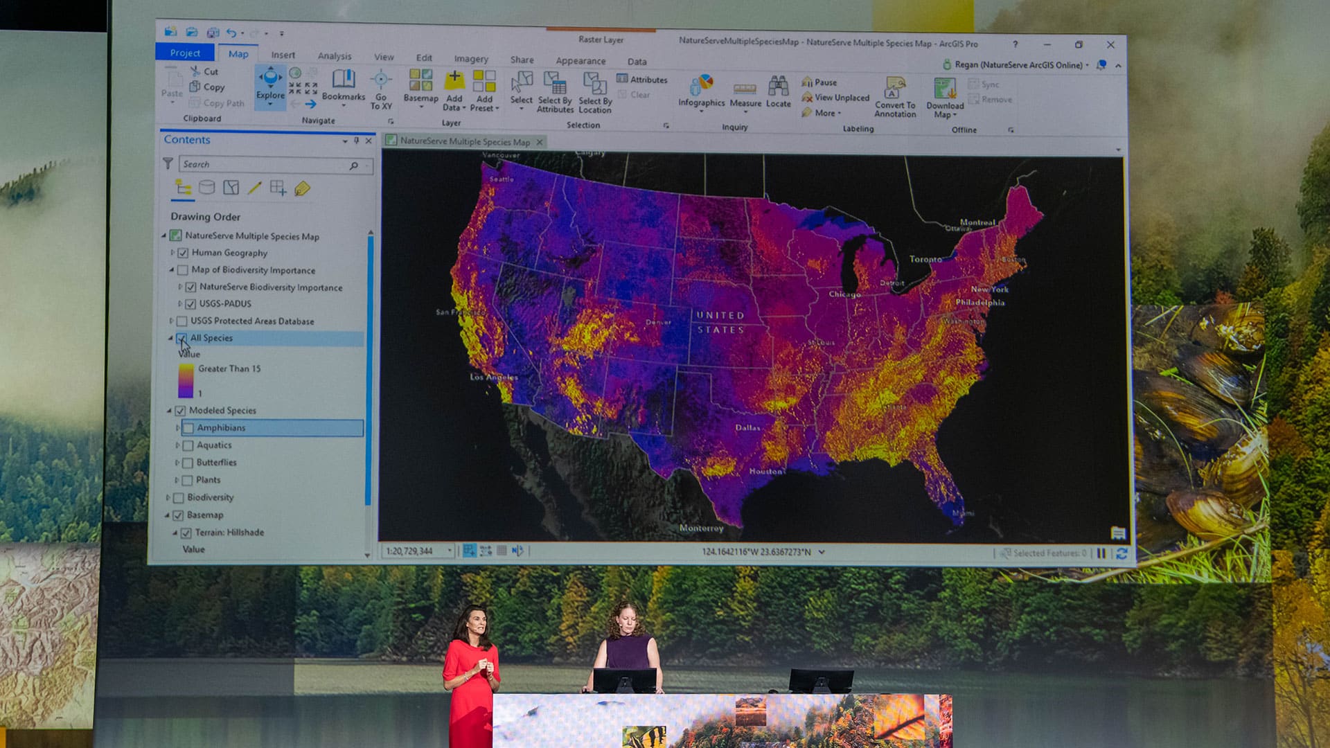
At the 2019 Esri User Conference, a range of users demonstrated how their GIS implementations work as an intelligent nervous system.

At the 2019 Esri Partner Conference, Esri recognized partners in 13 award categories for their expertise and superb ArcGIS implementations.
What was the big technology buzz at the 2015 Esri Developer Summit (DevSummit)?

To save lives, the New Zealand Transportation Agency models curve risks on rural roads.
Esri is hiring people with all levels of experience for positions at its headquarters, regional offices, and R&D Centers.
Technology and People Need to Work in Sync to Create Resilient Communities

Utility Network for ArcGIS is the next generation of network management for utility, pipeline, and telecommunications companies.
Users Showcased Incredible GIS Work at the 2017 Esri User Conference.

New green infrastructure tools from Esri and the National Geographic Society will help communities design a better future in their own backyards

Esri’s new Real-Time GIS can handle any organization’s big data needs and keep pace with the Internet of Things.