displaying 2991 results
Esri vector basemaps are optimized to quickly generate and update maps and apps.

The new Storyteller user type lets anyone in your organization make ArcGIS StoryMap apps.

Counties across the United States are relying on GIS to adapt voting practices to the realities brought on by the (COVID-19 pandemic.

he most inspiring part of today’s planning environment is that planners don’t also have to be GIS professionals.

The city has unconventional setback requirements. To better maintain this data, it incorporated ArcGIS Desktop and Geocortex Essentials.

Esri Globe is a quick and painless way to keep up with the trends that affect your organization’s GIS.
With Data Appliance for ArcGIS, Esri users can protect their internal proprietary data by keeping it local—on their organization’s network.

Esri World Elevation Layers for South America, Western Europe, Central America, and the Caribbean Islands have been enhanced with detailed,...

Insight without immediate action is not enough. Iterative policy making—addressing issues in real time—is the next shift we need to make.
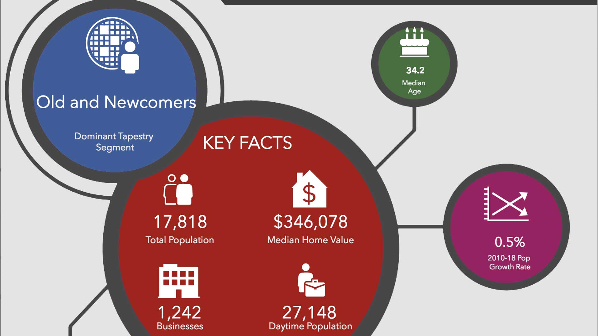
ArcGIS Community Analyst's library of professional infographics improve the way you tell your community's story.
Scientific data that's spatially analyzed produces highly useful information for academics, scientists, and other researchers.