displaying 820 results
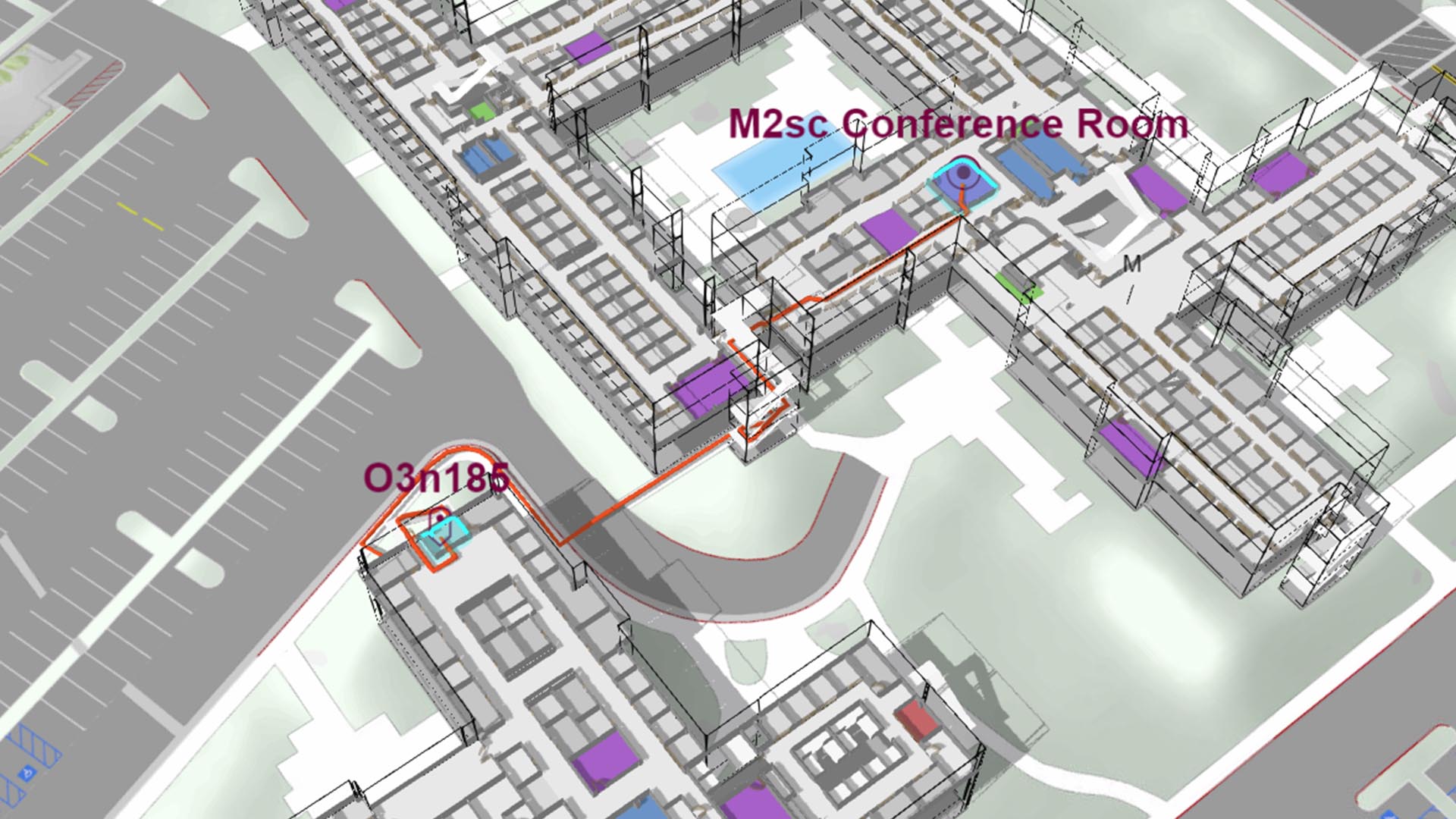
Advanced technologies are delivering convenience to employees of smart workplaces—and bottom-line benefits to their employers.
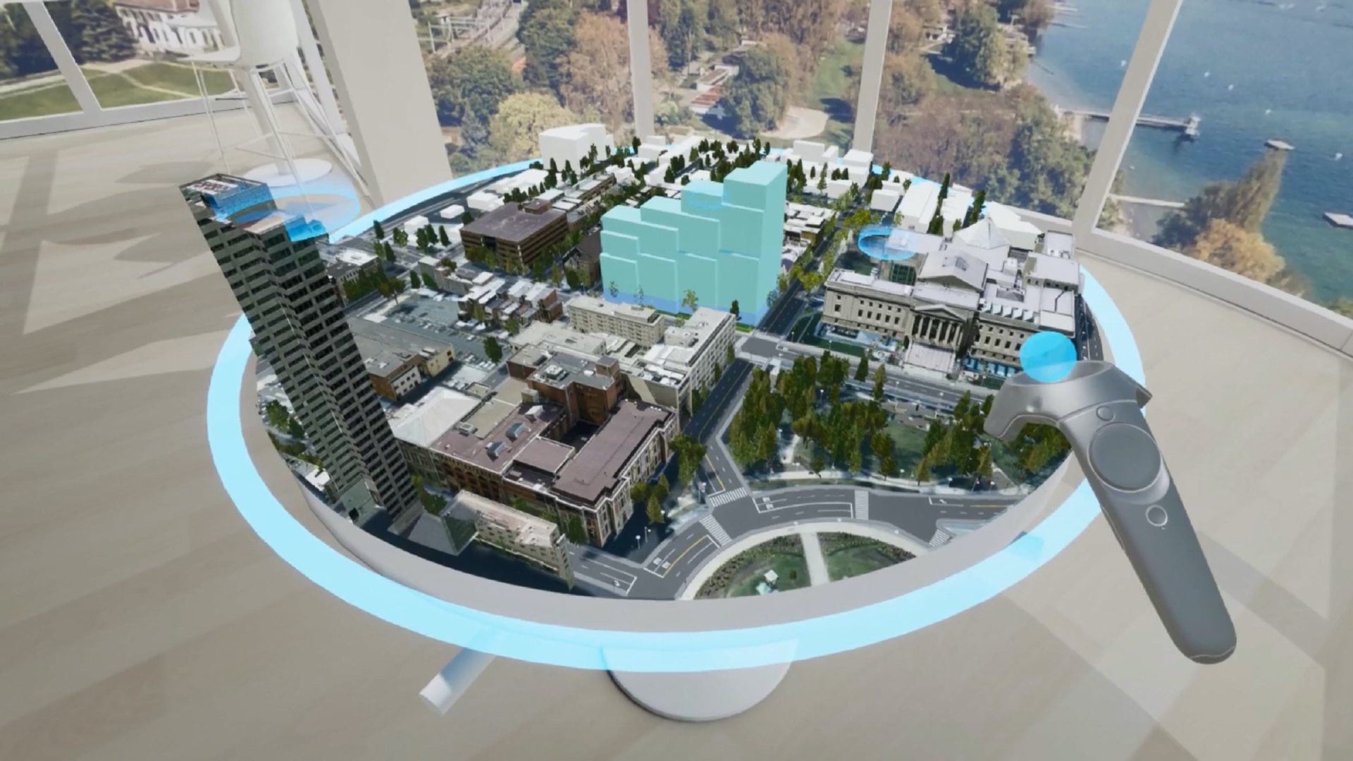
Leaders use realistic cityscapes to make decisions, collaborate, and improve quality of life.

For a team of archaeologists, GIS offers an effective way to collect data and quickly disseminate project findings in compelling formats.

With its impressive 2D and 3D mapping capabilities, ArcGIS Pro 2.0 is technologically ahead of everything else on the market.
Underground Visualization of Utilities at Green Square Complex in Raleigh, North Carolina
3D GIS capabilities in Esri ArcGIS software, users can create a highly realistic representation of geographic information in three dimensions.

"Geodesign is both an ancient idea and a new idea supported by new and advancing technology," said Esri president Jack Dangermond, as he welcomed
With 3D tech, location intelligence, and data-fueled insight, Cushman & Wakefield stays on the cutting edge—and helps clients see what's next.

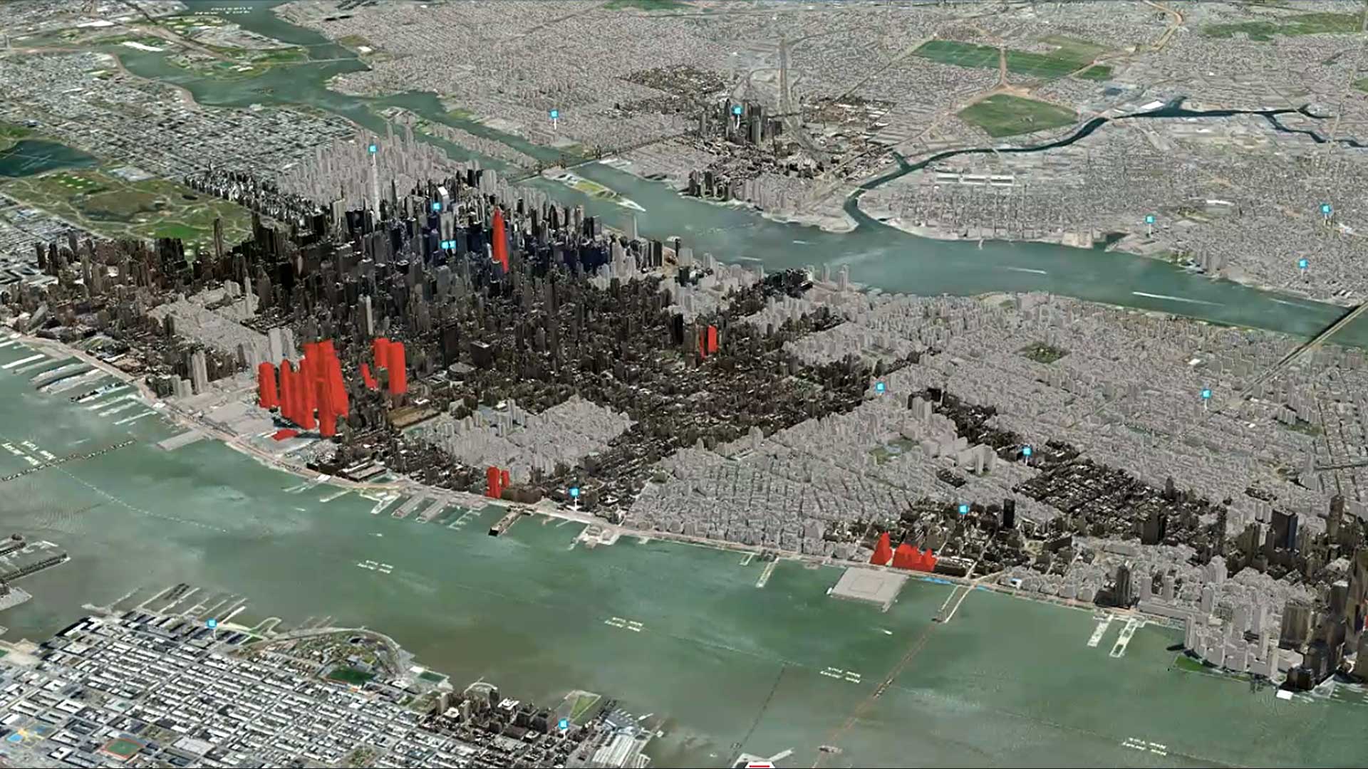
Boston’s digital twin, a 3D GIS model of the city, helps city planners, developers, and citizens to evaluate proposed development.

To continue training employees through the COVID-19 pandemic, Singapore’s Urban Redevelopment Authority digitally transformed its courses.

A combination of 3D technologies gives planners a view of the future that can preempt cost overruns down the road.