displaying 822 results
ArcGIS 10.4 introduces many new tools for visualizing, analyzing, and effectively communicating in both 3D and 2D.
Presenters at the 2015 Geodesign Summit showed how geodesign technologies are moving into areas such as transportation, economic planning, and...

With ArcGIS Pro, analysts at University Lands can easily view the extent of leased land plus the depth of mineral deposits.
Iraq has had a rough ride in recent times, and many of its cities are showing the scars of years of neglect and warfare.

3D artist Romain Janil uses Esri CityEngine to make helicopter flight simulation programs that are as realistic as possible.
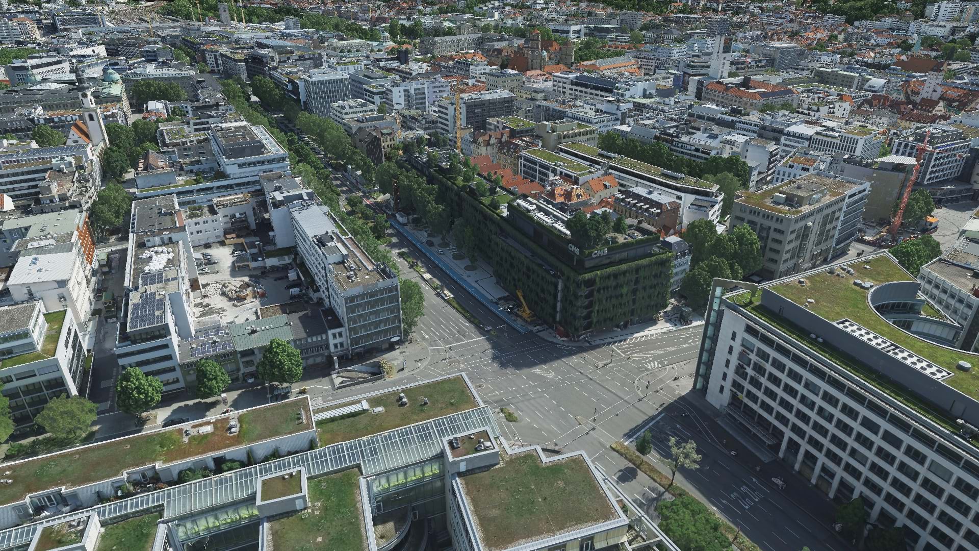
With aerial data and reality mapping, GeoFly helped create a 3D model of the City of Stuttgart to build an even smarter city.
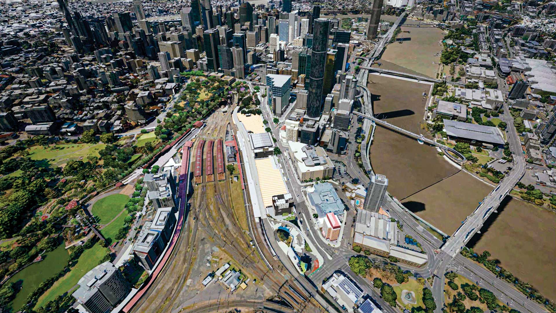
A digital twin and virtual reality program are guiding the construction of an underground railway in Brisbane, Australia.

Esri Provides Free App for Visualization of GIS and KML Data
ArcGIS Maps SDK for Unity and ArcGIS Maps SDK for Unreal Engine enable direct access to ArcGIS data and operations within a game engine.
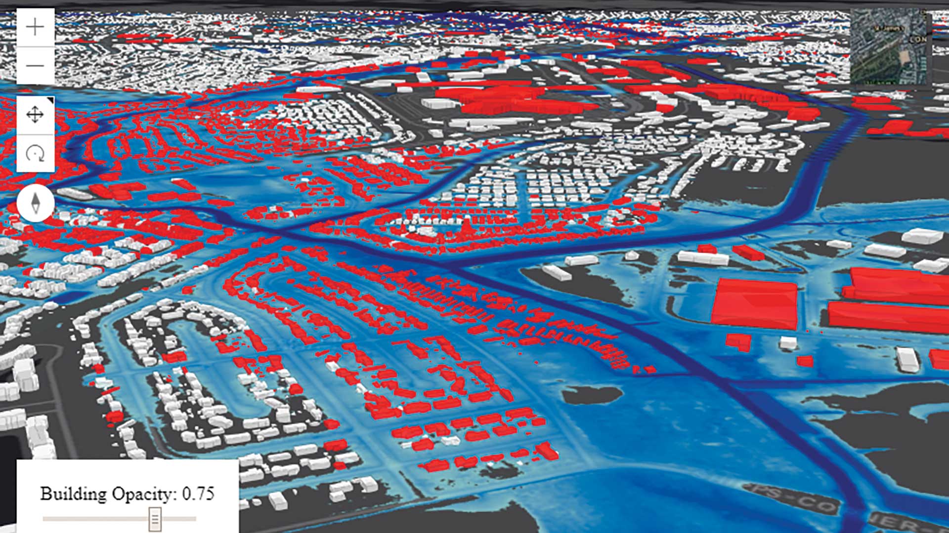
The StormSense project uses ArcGIS to visualize water level sensors data and model in in 3D.

Drone2Map for ArcGIS helps re-create a historic Native American site in Wisconsin.