displaying 218 results
Drones. Imagery. Video. Sensors. Real-time data. Focused mobile 3D applications. Big data. The cloud. The Internet of Things (IoT).
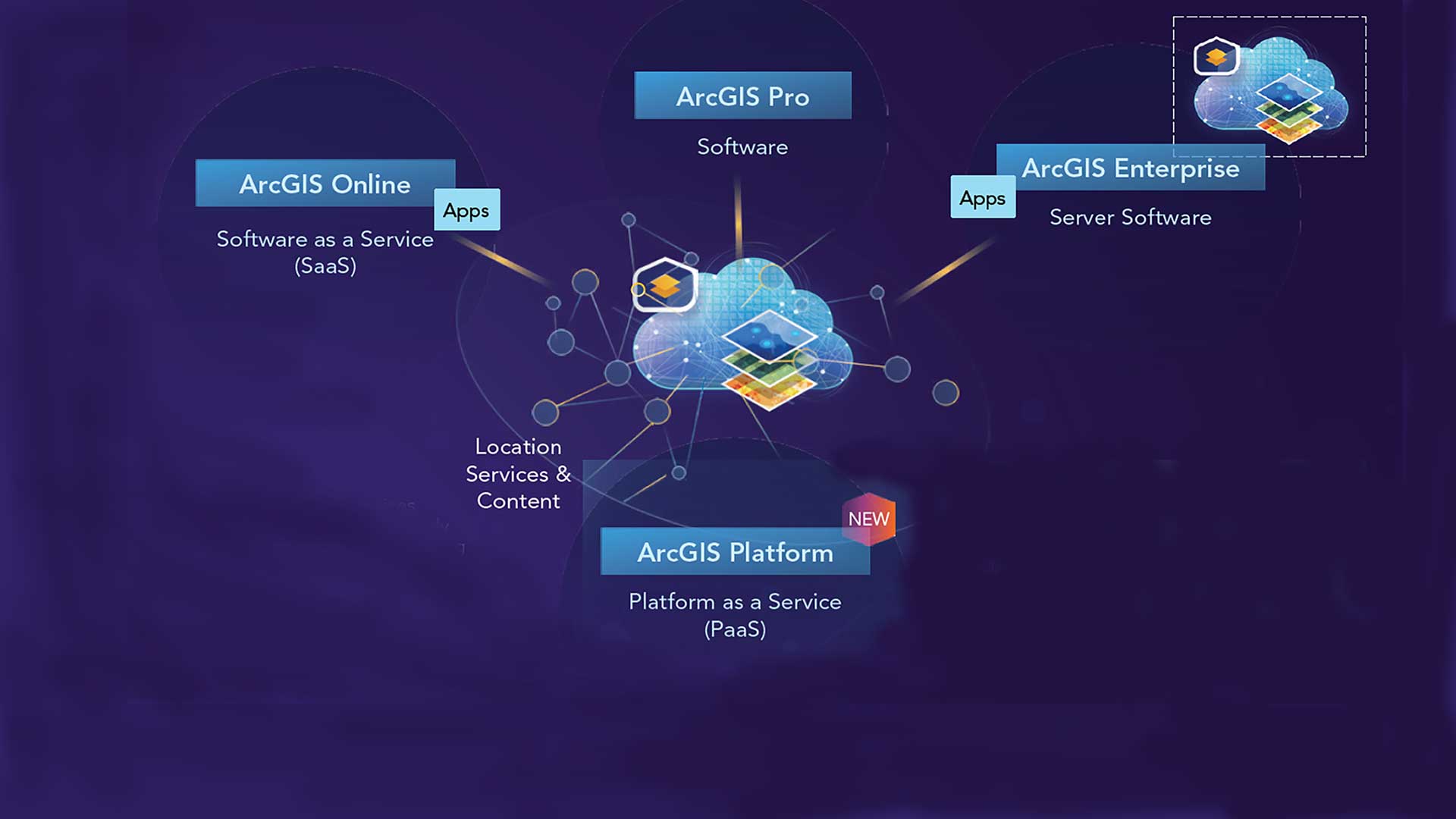
ArcGIS Platform provides developers access to ArcGIS location services and geospatial content through this location platform as a service.
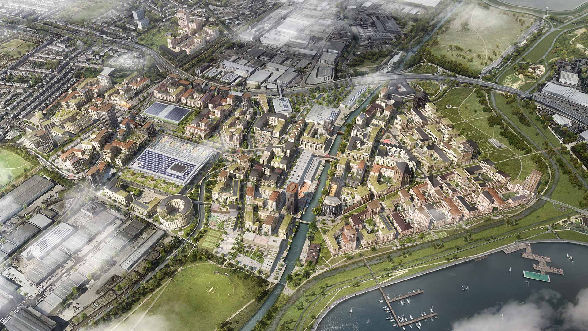
The Geodesign Summit highlighted sustainable projects such as the multi-billion dollar Meridian Water housing and jobs development in London.
Geodesign methods and supporting technologies will be needed more than ever as the population increases.
Data feeds for your GIS go real time. Maps in your tablets and smartphones go offline.
What was the big technology buzz at the 2015 Esri Developer Summit (DevSummit)?
Overview of the 2013 Esri International User Conference.
David Cardella, product manager for developer technologies at Esri, lists his top 10 takeaways from this year's Esri Developer Summit.

One way to cope with climate change on a global scale is by continuous, near real-time mapping and monitoring of the face of the Earth.
Former director of software development Scott Morehouse is now leading small research teams focused on civic engagement and urban design.