displaying 998 results

The City of Seattle created a Web GIS app that maps eateries offering takeout, curbside, and delivery services during the COVID-19 pandemic.

A cycling organization accurately maps mountain biking trails in Québec, Canada, using ArcGIS QuickCapture and high-accuracy GNSS receivers.

You can find authoritative geospatial data on North Carolina at NC OneMap, a portal created using ArcGIS Hub.
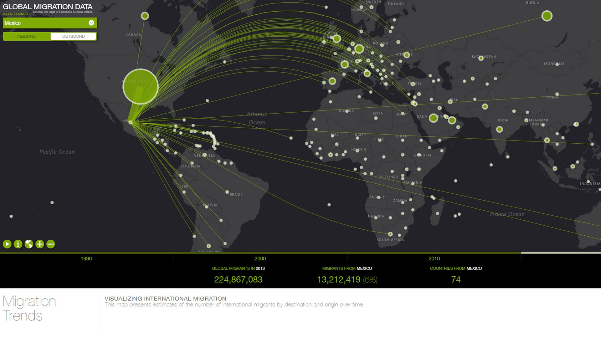
ArcGIS Online and ArcGIS Living Atlas of the World provide cloud-based tools and content that make it easy to analyze spatial demographic data.

The Pacific Ocean Accounting Portal brings attention to this body of water in ways that decision-makers can quickly understand.
With ArcGIS Enterprise, Naftna Industrija Srbije has made many of its business processes easier and more efficient.

A cycling organization in Québec, Canada, maps mountain bike trails using ArcGIS QuickCapture and GNSS receivers from Eos Positioning Systems.
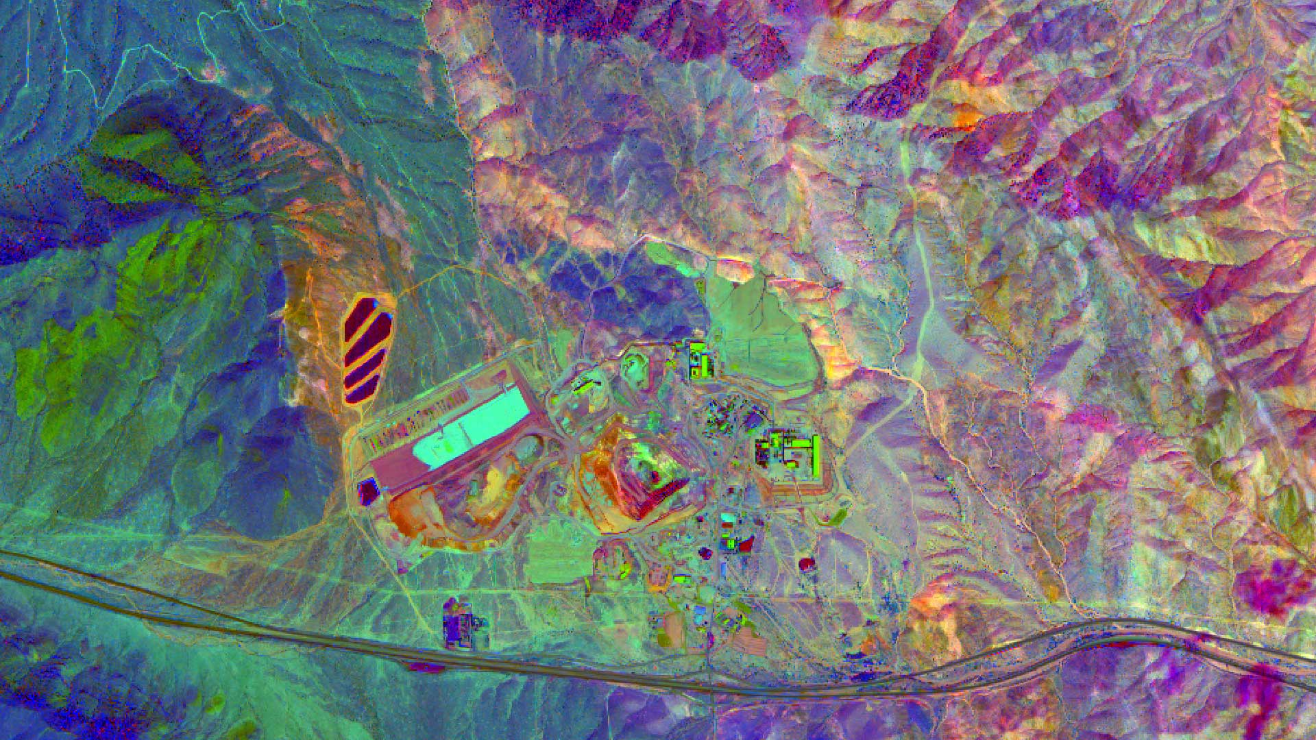
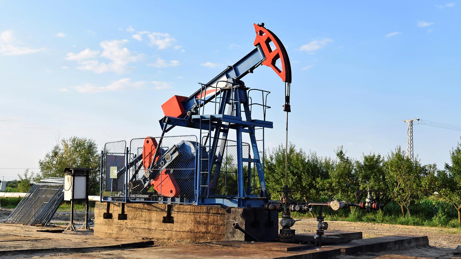
High quality imagery helps in finding mineral and petroleum deposits and Esri ArcGIS can be used to process, enhance, and analyze those images.
Collecting imagery in Michigan is difficult. A cross-governmental, cloud-hosted approach helps the state and counties keep imagery fresh.

Jane Goodall, DBE, and renowned biologist Edward O. Wilson brought their perspectives on biodiversity conservation to the Esri User Conference.

The City of Pasadena, NatureServe, the US Census Bureau, and other organizations show how GIS helps them see what others can't see.

The South Coast AQMD app gives users location-based air quality information for greater Los Angeles, California.